
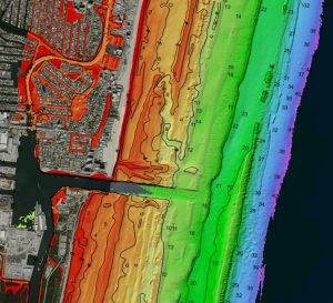
Woolpert collected high-altitude bathymetric lidar data from 3,048 meters, or 10,000 feet, over Fort Lauderdale, Fla., in 2021 via newly patented technology incorporated into the BULLDOG sensor. The data measured depths in excess of 55 meters. This image…
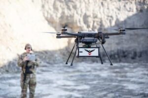
RedTail LiDAR Systems Unveils Innovative LiDAR System for Small Drones
Fairmont, WV - RedTail LiDAR Systems, a leader in microelectromechanical systems (MEMS) mirror-based LiDAR technology, today unveiled the market…

Dewberry To Lead Lidar Project Covering Six Areas in Northern California
Dewberry has been selected by the U.S. Geological Survey (USGS) and the Federal Emergency Management Agency (FEMA) to facilitate, acquire, and process…
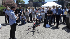
What Happened at LiDAR for Drone 2017 – YellowScan User Conference
LiDAR for Drone 2017 – YellowScan International User Conference was held on the 29th and 30th of June, in the Château de Flaugergues, Montpellier. For this special event, YellowScan had put together a diverse and exciting agenda, proving the broad usage…
Engineered Solutions: Topographic LiDAR Data Employed to Map, Preserve U.S. History
By Michael Meiser and Daniel Ngoroi In August 2015, the National Park Service (NPS) contracted Woolpert for the Little Bighorn National Monument Mapping Project to record the locations of thousands of headstone markers at the Custer National Cemetery as well…
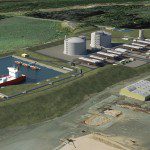
Oregon Preparing for Export: Assessing the Seismic Challenges of a Liquified Natural Gas Plant
In the international port of Coos Bay, Ore., construction will begin in late 2016 on a liquefied natural gas (LNG) export terminal that will be the largest private construction project in the state’s history. The bay is separated from the ocean by a tongue…

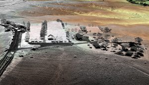
Infrastructure Outlook: What’s New in Reality Capture?
New reality-capture technologies are gaining ground as firms realize that the flexibility offered by new tools can improve designs, reduce clashes and eliminate expensive site rework. Construction companies now use reality capture to monitor building projects…
Mobile LiDAR Proves Cost Effective for Pavement Mapping
The Pennsylvania Department of Transportation (PennDOT) has used low-altitude mapping photography (LAMP), typically flown at 300 feet above mean terrain (AMT) via a helicopter, as a base for photogrammetry projects requiring high-accuracy pavement mapping…
Mapping the Maya: Technology Integration Captures Cultural Heritage
To set the stage of this essay I would ask each reader to think back to a time in their life when they were asked “what do I want to do when I grow up?” This simple but powerful question has been recurrent for centuries with varying answers, to the demise…
Hitting the Point: A Simple Guideline for Contracting 3D Mapping Professionals
Recently, a few technologically specific themes have surfaced in the contemporary business world that all of us can relate to. Whether you are a surveyor, engineer, analyst, or somewhere in gray the topics of “the cloud”, “big data”, and “data mining”…
