/ Category / mobile

TomTom Traffic to Be Used within IFS Mobile Workforce Management Solution

IFS (STO:IFSB), the global enterprise applications company, in collaboration with TomTom , the global navigation and mapping company, announces a major feature enhancement to the IFS Mobile Workforce Management solution. With this launch, IFS is enhancing…

Rutgers Launches World’s First Accelerated Testing Facility for Bridges

November 18, 2015 - in Bridges, Corporate, Design/Engineering

Rutgers is launching the world’s first outdoor laboratory capable of simulating deterioration that occurs on bridges by inflicting and intensifying…

Bridging the Gap Between Inspections and Decisions

August 27, 2015 - in Bridges, Feature, Featured

Bridge safety hasn’t always been top of mind for legislators in the United States. The impetus for creating standards and collecting information on…

CourthouseUSA Markets Hexagon Geospatial’s Mobile Alert for Crowdsourcing Property Data

August 25, 2015 - in Corporate, Surveying/Mapping

NORCROSS, Ga, Aug. 25, 2015—Hexagon Geospatial is pleased to announce that CourthouseUSA, a leading provider of authoritative U.S. property data and property related mobile apps, is marketing Mobile Alert for the crowdsourcing of property appraisal data.…

Color Reference System Offered On Subscription

July 9, 2015 - in Design/Engineering, Products, Sensors

CHATTANOOGA, Tenn., July 9, 2015—The subscription-based business model adopted by giants like Adobe, Audible and Birchbox has finally reached the interior design and architecture fields thanks to a new offering by color technology and mobile application…

CartoPac and EDM Implement Transmission Line Inspection Software Solution for Western Area Power Administration

Fort Collins, Colo., May 7, 2015—CartoPac International (www.cartopac.com) and EDM International (www.edmlink.com) announced the implementation of a new Transmission Line inspection solution based on the CartoPac Software platform for the Western Area Power…

Mobile LiDAR Proves Cost Effective for Pavement Mapping

April 4, 2015 - in Feature

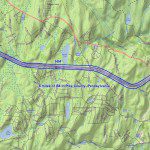
The Pennsylvania Department of Transportation (PennDOT) has used low-altitude mapping photography (LAMP), typically flown at 300 feet above mean terrain (AMT) via a helicopter, as a base for photogrammetry projects requiring high-accuracy pavement mapping…

GRAPHISOFT BIMcloud Extends Workflow Integration to Mobile Devices with Newest, Free Update

October 29, 2014 - in Design/Engineering, Modeling, Products

BUDAPEST, October 28, 2014 – GRAPHISOFT, the leading Building Information Modeling (BIM) architectural software developer, has announced a strategic update to its recently released BIMcloud solution, offering integrated team messaging for mobile devices…

Gruntify: Real-Time Incident Capture and Reporting

October 16, 2014 - in Maintenance, Products, Sensors

BRISBANE – 14 October 2014 – Asset management and defect remediation is estimated to cause over $3 billion in damages per year to Australia Government-owned assets alone. Graffiti, litter, damaged street furniture – just to name a few – are problems…

SAP to Deliver New Workforce Mobile Apps Running on SAP Mobile Platform

October 15, 2014 - in Products, Sensors

LEIPZIG, Germany, Oct. 14, 2014 — SAP SE today announced plans to release new versions of the SAP Enterprise Asset Management (SAP EAM) solution and SAP Field Service mobile app leveraging the Maximo back end, to help workforce customers simplify their…