The world today invests some $2.5 trillion a year on transportation, power, water, and telecommunications systems. Yet it’s not enough—and needs are only growing steeper. In a follow-up to its comprehensive 2013 report Infrastructure productivity: How…

Reality Modeling for Everyone
Highly Accurate Context from Simple Photography Before beginning any infrastructure project, a project team needs to survey existing conditions in order…

Looking to Sustainable Cities as Key to Smart Future
The world is entering an age of urbanization. Every year more people relocate to cities, creating new challenges around affordable housing, transport…

Hansa Luftbild Provides Addis Ababa with a Modern Land Information System
A member of the Bentley Developer Network, the Hansa Luftbild Group, Muenster, Germany, offers public- and private-sector clients expertise in the areas of geoinformation and geospatial problem-solving. The City of Addis Ababa, Ethiopia, retained Hansa Luftbild…

Geodesign Summit Europe Comes Into Focus
What better place to be in September than the historic city of Delft, the Netherlands? Famous for its canals and blue pottery, Delft is also a place steeped in the study of technology and engineering, as it is home to universities that specialize in those…

Cultivating Community Potential through Economic Gardening
With the global financial crisis, many local communities struggle to stay afloat. Despite the many ongoing conversations about the nation’s economy and what needs to be done to fix it. Detroit is the latest casualty of this unsustainable economic climate,…
A Mobile App Aids City Planners with Details for Cycling and Walking
It has been notoriously difficult for city officials to really learn how residents move around major cities, particularly when taking into account the routes of joggers, walkers and cyclists. They take unique paths to get to work or their homes, and many of…

Designing with Data: Shaping Our Future Cities
With the dawn of a ‘smart’ era the world is undergoing a transformation not seen since the industrial revolution. As more and more of us take to twitter, use the internet to influence governance or map our daily activities, policy makers and business are…
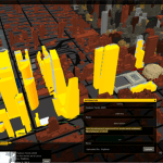
The Future of Urban Planning: Interactive 3-D Visualization
In many cases, the software used by urban planners and architects is nearly as complex as urban planning itself—especially for owners and operators of the project, who may not have design backgrounds. However, unlike the old, manual method of sorting though…
Location-enabled Smart Planning and Community Development
The economic downturn impacted many nations around the world including the US. In particular, decreasing home values left many Americans underwater on their mortgages and many companies and organizations struggling to survive. Companies downsized or went out…


