EarthCam Premieres Live Camera Integration with Esri ArcGIS Online
Live streams have many important geospatial use-cases - climate change, crime, active construction and more
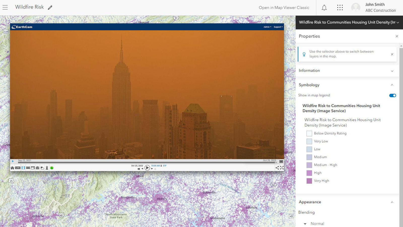
Live views enable visual verification within Geographical Information Systems (GIS)
LAS VEGAS – EarthCam, the leader in live camera technology, content and services, today announced its integration with Esri® ArcGIS Online®, the popular Geographical Information Systems (GIS) platform, at Autodesk University. EarthCam’s live camera views deliver a new level of location intelligence direct to GIS maps. With EarthCam’s integration, users can immediately access high-quality, live-streaming views of mapped locations together with many layers of contextual data, making real-time collaboration easy.
EarthCam’s camera streams are now easily mapped to each precise location in ArcGIS, providing a richer perspective of the surrounding environment. Live cameras have many important geospatial use-cases to visualize data layers, such as active construction, climate change, crime and many more. Real-time video powerfully augments GIS for governmental projects, virtual tourism, ecological studies and scientific research.
“Adding live video to GIS metadata revolutionizes perspectives within interactive maps,” said Bill Sharp, SVP Product Development & Strategy. “This combination of geography with up-to-the-minute visual data delivers unique insights utilizing EarthCam’s gigapixel panoramas, 8K imagery and epic time-lapse capabilities.”
EarthCam continues to advance its leadership in live camera technology, content and services with SaaS solutions and AI-powered visual data. EarthCam deploys solar-powered, 4G camera rentals, professional installation and reality capture services to make project management more efficient with powerful visual data. To learn more about EarthCam’s innovative webcam technology, visit EarthCam.net. To explore the world with EarthCam’s live streaming webcam network, visit EarthCam.com. To learn more about EarthCam’s software, camera technology, and the Esri integration, visit EarthCam.net/esri
Connect with EarthCam!
Facebook: http://www.facebook.com/earthcaminc
Twitter: http://www.twitter.com/earthcam
Instagram: @EarthCam
YouTube: http://www.youtube.com/earthcam
LinkedIn: https://www.linkedin.com/company/earthcam-inc-
ABOUT EARTHCAM
EarthCam® is the global leader in providing live camera technology, content and services. Founded in 1996, EarthCam provides live streaming video, time-lapse construction cameras, 3D/4D BIM model integrations and security solutions for corporate and government clients.
EarthCam leads the industry with the highest resolution imagery available, including the world’s first outdoor gigapixel panorama camera system. This patented technology delivers superior multi-billion pixel clarity for monitoring and archiving important projects and events. EarthCam has documented over a trillion dollars of construction projects around the world. The company is headquartered on a 10-acre campus in northern New Jersey.
Projects documented by EarthCam include: One Vanderbilt in Manhattan, St. Regis Chicago, Hudson Yards, UBS Arena, SoFi Stadium, Allegiant Stadium, Mercedes-Benz Stadium, LAX Airport, Moynihan Station, San Francisco Oakland Bay Bridge, Panama Canal Expansion, The Red Sea Project, The Jeddah Tower, Academy Museum of Motion Pictures, Whitney Museum of American Art, Louvre Abu Dhabi, Smithsonian National Museum of African American History and Culture, One World Trade Center, Statue of Liberty Museum and the Smithsonian Air & Space Museum.
Learn more about EarthCam’s innovative solutions at EarthCam.net.
Author

Parul Dubey
Video: Crashes Drop Measurably After Rural Road Safety Improvement Project on US 521 in Lancaster County

Redevelopment of Horseshoe Bay Terminal

June Issue 2026
.jpg?width=225)