Sponsored by
A Brief History
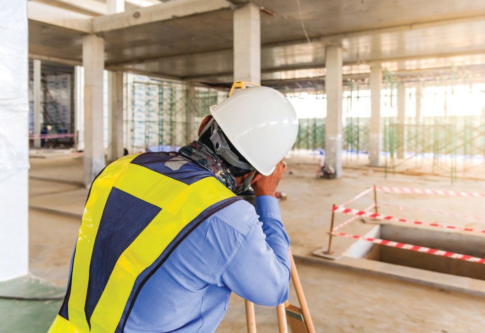
Laser scanning—the digital capture of objects using a line of laser light to produce a surface—has been around for decades and came to prominence in the survey, engineering and construction space in the 1990s.
The deliverable: a point cloud of highly accurate, measurable as-built conditions. Yet industry professionals are still reluctant to invest in the technology. The perception is that it’s an expense that can’t be justified when a tape measure and camera can suffice.
In today’s fast-track construction space, efficiency is essential to success, and profit margins are tight. Laser scanning reduces costly in-field disconnects, material overages, and miscommunications among team members and clients.
The Evolution
3D laser scanners today are vastly different than they were even three years ago. One advantage of 3D scanners in construction is the ability to capture full-detail digital 3D models with extremely low error—in some cases less than 1 millimeter—within minutes.
The Leica RTC360 laser scanner with advanced HDR imaging system has a measuring rate of up to 2 million points per second, with a range of 130 meters, and can gather colored 3D point clouds in less than 2 minutes. The 12-pound scanner also incorporates cloud-to-cloud in-field registration. With its industrial-grade 256GB USB, operators can quickly transfer data back to the office.
The integrated Visual Inertial System (VIS) technology—with its five cameras—automatically tracks the position and movement of the scanner from station to station, coordinating the scanner relative to the previous setup, making postprocessing extremely fast.
Onsite, operators can capture, register and examine scan and image data from a tablet using the Leica Cyclone FIELD 360 app for iPads. The user-friendly interface combines easy handling of complex calculations with a graphical user guidance. Voice recordings, video, images, text or documents can be tagged to each scan and positioned accurately in the point cloud. No more sifting project directory folders for photos of “the mechanical room in building 3” to still find no clarity about what area of the room is shown. With Cyclone FIELD 360’s geo tagging, site visit data is always easily located.
The Leica RTC360’s even smaller and lighter little brother, the BLK360, is a 3D scanner with an integrated spherical imaging and thermography panorama sensor system. It measures only 6.5 inches tall, weighs only 2.2 pounds and captures 360,000 points per second with a range of 60 meters. The BLK360 takes less than 3 minutes to complete a full-dome scan (in standard resolution) and 150MP spherical image generation. Also, with the Leica Cyclone FIELD 360 mobile-device app, users link the scan data in-field and wirelessly transfer the scan data to Leica Cyclone or REGISTER 360 to finalize and export to multiple formats.
Point Cloud Post-Processing
Historically, data management and point clouds were too large to use in a conventional CAD solution. Today, point cloud files are easily brought into engineering software such as Autodesk Navisworks or AutoCAD Civil 3D. All of the data—billions of points—are available to use for new design or quality checks.
Another benefit of the point cloud data is the ability to virtually tour any given space through the point cloud data at any time. Quickly measure distances and assess areas of concern virtually.

Laser Scanning at Work
Differences between conventional practices and laser scanning are clear by way of increased productivity, decreased labor costs and time savings in project turnarounds. A customer recently asked for a proof-of-concept and ROI of laser scanning vs. conventional data gathering. The project required as-built measurements of a plant in preparation for an upgrade.
Scenario 1: Two engineers and two assistants go onsite for five days to gather necessary data. That’s five days of travel expenses and five days they are not in the office. At the end of that five days, they had a lot of notes, SD cards full of photos and some hand sketches.
Scenario 2: One person laser scanned the entire plant in less than one day (nearly 100 scans) and took thousands of photos. With little post-processing, the project team back at the office virtually navigates the site with full 300- by 360-degree domed photos and measures visual objects without site revisits or getting on a ladder or renting a lift.
It was clear to the customer that not only did they need a scanner, they needed one for each of their offices. It’s been proven that laser scanning is fast, accurate and valuable in ways beyond the initial as-built visual. Today’s scanners and associated software offer high performance, improved workflows and more portability for less cost.
Bottom line: Drop the tape measure, pencil and digital camera, and start scanning.
About U.S. CAD
U.S. CAD is a leading provider of architecture, engineering and construction (AEC) technology and consulting services. Find out more at uscad.com

Todd Danielson
Todd Danielson has been in trade technology media for more than 20 years, now the editorial director for V1 Media and all of its publications: Informed Infrastructure, Earth Imaging Journal, Sensors & Systems and Asian Surveying & Mapping.
Video: New Roundabout Under Construction at McIver and Old Florence Roads in Darlington County

Bridge Replacement at Amsterdam Centraal Station

June Issue 2026
.jpg?width=225)