
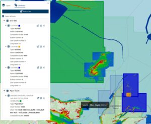
Fredericton, NB, CANADA: Teledyne Geospatial, a Teledyne Technologies company, is pleased to announce the release of three new applications on its CARIS Cloud platform—the CARIS Bathy Data Service, S-57 ENC Service, and Chart Data Service. The robust…
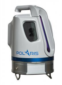
Introducing Polaris — Next-Generation Terrestrial Laser Scanner
Teledyne Optech is pleased to announce the release of its Polaris Terrestrial Laser Scanner at the SPAR 3D Conference and Expo, April 3-5, in Houston,…
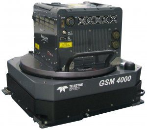
Teledyne Optech Announces the New ALTM Galaxy T1000 with Dramatic Operating Cost Reduction and Performance Increases
Teledyne Optech is pleased to announce the latest addition to its innovative line of airborne laser terrain mappers, the ALTM™ Galaxy T1000. This new…
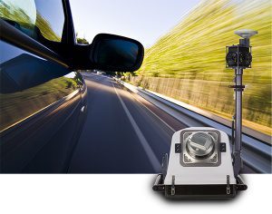
Teledyne Optech Doubles Scanner Speed with Lynx HS-600 Mobile Surveying Solution
Teledyne Optech is happy to announce the release of the Optech Lynx HS-600 mobile lidar scanner. Available in single- and dual-sensor configurations, the HS-600 is a major step forward for collecting uniform lidar data from high-speed platforms. The HS-600…
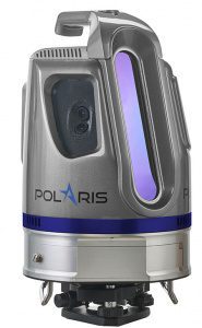
Brand-New Optech Polaris Terrestrial Laser Scanner Launches at INTERGEO 2016
Teledyne Optech is pleased to announce the release of its new Optech Polaris TLS Series of tripod-mounted laser scanners, which bridge the gap between small short-range scanners and heavier long-range scanners. Over three years in development, the Polaris…
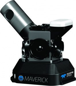
Teledyne Optech Unveils the Ultra-light Maverick for Mobile Asset Mapping
Teledyne Optech is excited to announce the release of its Maverick mobile mapping system. Light enough to be worn on a backpack, the Maverick sets a high bar for size, portability and versatility in mobile asset mapping. Weighing in at less than 9 kg, the…
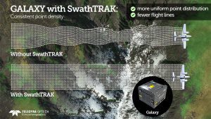
Teledyne Optech Announces New Efficiency Enhancement for ALTM Galaxy Wide-Area Lidar Mapping Sensor
Teledyne Optech is pleased to announce a high-performance scanner update to its innovative line of airborne laser terrain mappers, the Optech Galaxy ALTM™. The Galaxy’s scan efficiency has been engineered to deliver an additional 30% boost to its class-leading…
