The recently announced Leica BLK ARC and the Leica BLK2FLY — the latest additions to the iconic, award-winning BLK series — will make their first public appearance at the conference. The Leica BLK ARC, an autonomous laser scanning…

Hexagon revolutionises autonomous reality capture with the launch of the Leica BLK ARC and Leica BLK2FLY
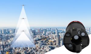
NACKA STRAND, Sweden - Hexagon AB, a global leader in digital reality solutions, today announced the introduction of the Leica BLK ARC and the Leica BLK2FLY,…

Hexagon announces Luciad 2021
Latest release enhances developer experience and delivers geospatial data faster (HUNTSVILLE, Ala.) - Hexagon’s Safety, Infrastructure & Geospatial…

Hexagon supports new centre for digital planning and construction
Hexagon supports new centre for digital planning and construction (Heerbrugg, Switzerland, 27 May 2021) Hexagon’s Geosystems division participates in a new centre at ETH Zurich (Swiss Federal Institute of Technology) as a strategic partner with a…

IDS GeoRadar announces IQMaps enhancement
New functionalities in the updated version of IQMaps improve the visualisation of radar data (Pisa, Italy) IDS GeoRadar, part of Hexagon, today announces that it has enhanced IQMaps, its post-processing software application for advanced GPR…

GeoMax introduces new X-PAD 365 service platform
GeoMax connects its entire X-PAD software portfolio, offers integrated applications and services that are accessible anytime, anywhere (Widnau, Switzerland) – GeoMax Positioning, part of Hexagon, introduces the new X-PAD 365 web-based cloud platform…

HxGN Content Program to Collect New Single-Season Aerial Data of 14 U.S. States This Year
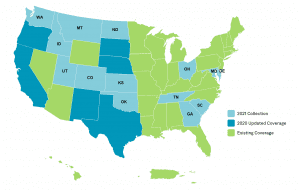
HxGN Content Program to collect new single-season aerial data of 14 U.S. states this year 888,035 square miles of high-resolution aerial imagery and digital elevation data will be captured in 2021 as part of Hexagon’s third refresh of the United States (Washington,…

Leica Geosystems Announces BLK3D Update
Leica BLK3D - the in-picture measurement solution (HEERBRUGG, SWITZERLAND, 18 March 2021) – Leica Geosystems, part of Hexagon, today announced the Leica BLK3D update. The new handheld imager has doubled its operating range and in-picture measurement…

New Leica CityMapper-2L configuration enables digital twin creation of cities in complex weather and congested flight operation areas
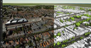
With a new focal length combination for ultra-high resolution projects or operations when low flying altitude is required, the Leica CityMapper-2 now offers a full product portfolio covering all flying parameters and GSD’s (HEERBRUGG, SWITZERLAND) – Leica…

South Carolina Department of Transportation selects Hexagon for safety management system
(Norcross, Ga.) — South Carolina Department of Transportation (SCDOT) has selected Hexagon’s Geospatial division to implement a transportation safety management system that will support the state’s roadway safety programs and federal reporting requirements.…


