
DJI and Datumate Launch Designated Site Survey Solution Bundles for Field Construction, Surveying and Infrastructure
DJI and Datumate launch an upgraded Site Survey Solution bundles with industry specific capabilities for field construction, surveying and cellular infrastructure companies worldwide. The new bundles feature DJI's new Phantom 4 Pro drone, Datumate's DatuFly™ mission planning app for drones, as well as one of Datumate software solutions: DatuSurvey™ Enterprise, DatuSurvey™ Professional and DatuSite™ - tailored to address the range of professional needs. The DJI's new Phantom 4 Pro features a...

Topcon GNSS Modular Receiver Integrates with a Wide-Range of Applications
LIVERMORE, Calif., USA/ CAPELLE A/D IJSSEL, The Netherlands – Topcon Positioning Group announces a new modular GNSS receiver system — the MR-2. The system combines all current and planned constellation tracking with a comprehensive set of communication interfaces to service any precision application requiring high performance RTK (real-time kinematic) positioning and heading determination. The MR-2 can perform as a mobile RTK base station, marine navigation receiver, mobile mapping device and...
FINLEY Updates Software Platform to SOFiSTiK and Autodesk
FINLEY continually reviews and upgrades it’s technology to enhances problem solving at every stage of the project delivery process, from planning, preliminary and detailed design, construction engineering simulations and analysis. SOFiSTiK has created a seamless BIM workflow for structural engineering. It is a breakthrough in construction planning. For the first time, all necessary steps from modeling through to generating reinforcement sheets for civil and structural engineering project...

Two New Releases of Automated Utility Design Available
San Diego, CA – Spatial Business Systems (SBS) announces the availability of two new releases of their Automated Utility Design™ (AUD) product at the DistribuTECH Conference in San Diego. AUD is a new SBS offering based on the strategic alliance between SBS and Autodesk that was announced October 3, 2016. Through the alliance, SBS is now responsible for future development, support and licensing of the AutoCAD Utility Design software. AUD now has a new naming convention. Previous relea...

Jacobs Unveils Connected Enterprise Framework to Enable Digital Transformation
DALLAS - Jacobs Engineering Group Inc. (NYSE:JEC) today unveiled its Connected Enterprise, a suite of integrated capabilities and solutions to enable digital transformation. Jacobs Connected Enterprise (JCE) provides clients the capability to connect, protect and analyze operational systems and data. JCE spans several core functional categories, including the Industrial Internet of Things (IIoT), information technology (IT) and network infrastructure, cloud solutions, data analytics and cyber se...

Kespry Announces Drone 2 with Increased Performance for Construction
MENLO PARK, Calif. - Kespry, the leading aerial intelligence platform provider, today announced that it has enhanced the Kespry Drone 2 with higher performance features that deliver significantly greater accuracy and reliability. These enhancements make Kespry Drone 2 even more ideal for a wide range of industrial applications, including those requiring survey-grade precision, such as in mining and the architecture, engineering and construction (A/E/C) markets. The new Drone 2 now achieves fo...

Topcon Announces New ES Series Total Station with Advanced Data Transfer Functionality
LIVERMORE, Calif. – Topcon Positioning Group announces the release of the latest addition to its ES total station series in the Americas, the ES-60. Featuring advanced reflectorless capabilities and an upgraded data transfer functionality — the new ES-60 is designed to provide an entry-level total station option with a fast and powerful EDM. “The ES-60 is an excellent solution for customers looking for the dependability and accuracy of the ES series in an entry-level package,” said Ray Kerwi...
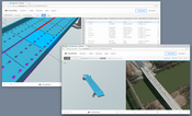
New CloudCities Brings IFC Support and Password Protected Scenes
San Francisco/Zurich — CloudCities today announced an update to the platform bringing IFC support and private scenes. The new CloudCities is now available at cloudcities.io . CloudCities is an online platform for visualizing, editing, and publishing interactive 3D city models. It dramatically simplifies creating 3D plans and combining data with it. With the new version, users can configure the privacy of their scenes and even add a password to restrict access. CloudCities now also embraces...

BOXX Introduces the World's Fastest Computer Workstation
AUSTIN, TX - BOXX Technologies, the leading innovator of high-performance computer workstations and rendering systems, today introduced APEXX 2 2403, the world's fastest workstation, featuring a 7th generation (Kaby Lake) Intel® Core™ i7 processor overclocked to 4.8GHz. The latest Intel processors offer a significant performance increase over previous Intel technology and BOXX is the only workstation manufacturer offering the new micro architecture safely overclocked and backed by a three-year w...

Great Water Tech Offers Solution to National Lead Contamination Crisis
St. Paul, MN (1/24/17) – America’s failing water infrastructure has reached a tipping point with over 5,000 water systems across the country currently in violation of federal EPA lead contamination regulations. Great Water Tech, a Twin Cities-based water technology start-up, has commercialized a solution to widespread lead contamination with their German-engineered Folmar™ Pipe Protection product. Folmar™ Pipe Protection is a proprietary silicate-based formulation that creates a very thin gla...
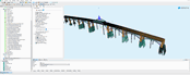
Video: New Roundabout Under Construction at McIver and Old Florence Roads in Darlington County

Promenade at The Point

June Issue 2026
.jpg?width=225)