
MALA MIRA HDR - 3D GPR AT ITS BEST
MALA GPR Australia is proud to present MALÅ MIRA HDR, the new GPR array system. It’s the professional choice for large scale 3D GPR mapping and will help customers around the world to create detailed 3D maps of the subsurface with the highest resolution on the market. MALA GPR Australia launches all new MALÅ MIRA HDR, a large area 3D GPR mapping solution with the highest data quality and resolution on the market, highway speed survey capability, improved mechanical design and new user-friendl...

Next Generation of Drone Surveying System Features Now Available from Microdrones
Rome, NY- Fresh off the heels of releasing a new Microdrones as a Service (mdaaS) business model that makes drone surveying and LiDAR accessible to geomatics companies of all sizes, Microdrones announces additional developments that demonstrate a constant commitment to customers. According to Microdrones CEO Vivien Heriard-Dubreuil, “By and large, surveying professionals are still out there getting work done amidst the shutdowns; that’s why we continue to make improvements to our complete system...

CYPE develops software to design, calculate and implement safety measures in spaces in response to COVID-19
The Open BIM COVID-19 program facilitates the adoption and validation of preventive measure to minimise infections and optimise the occupancy of space, both in buildings and open spaces, taking into account aspects such as interpersonal safety distance or furniture The software is translated into 6 languages and can be adapted to the national safety regulations against COVID-19 of any country in the world and at any phase to optimise the distribution of people and prevent the spread of the vi...

Curb Roller Manufacturing Brings Portability and Operator Comfort with the Eel Screed 6100
FAIRVIEW, Kan. – Curb Roller Manufacturing, the world leader in shaped concrete roller screeds, introduces the Eel Screed 6100, a corded roller screed designed for operator comfort and easy transportation. The innovative design of the Eel Screed 6100 allows contractors, rental customers and other operators to finish concrete screeding faster and more comfortably than alternate methods. The Eel Screed features a direct drive system, eliminating troublesome pulleys and linkage belts and adding...
“Connected Highway” Demonstrator Shows How Easy It Can Be to Federate IoT Data in Infrastructure Digital Twins
Bentley Integrates iTwins with Azure Digital Twins for Single Pane of Glass IoT Application The concept of digital twins is finding new applications in the way that we interact with our critical infrastructure like roads and highways, improving reliability and safety, increasing the movement of people and goods, and creating better value for every dollar spent. For the Microsoft Build 2020 developer conference, a team from Bentley Systems and Microsoft explained to software engineers a...
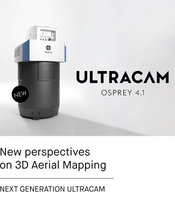
Broaden your perspective with the new UltraCam Osprey 4.1
Graz, Austria- Vexcel Imaging is announcing the release of the next generation UltraCam Osprey 4.1, a highly versatile large-format aerial camera for the simultaneous collection of photogrammetric-grade nadir imagery (PAN, RGB and NIR) and oblique images (RGB). Frequent updates of sharp, noise-free and highly accurate digital representations of the world are essential for modern city planning. Enabling unprecedented flight collection efficiency at superior radiometric and geometric quality, the...
PHIL Offers SSAB Hardox® HiTemp Steels for Hot Slag Applications
PEORIA, Ill. — Philippi-Hagenbuch Inc., a global leader in off-highway truck customization, announces the use of new SSAB Hardox® HiTemp steel in its customized Hot Slag Bodies — part of their lineup of specialty HiVol® Truck Bodies. The new steel is specially designed to withstand extreme temperature environments. As part of PHIL’s Hot Slag Bodies, it reduces necessary plate thickness while maintaining the product’s service life for increased productivity in processing applications. “As a tr...

SPH Engineering announces a bathymetric drone solution
Riga, Latvia - SPH Engineering announces the launch of a new product to make bathymetric surveys of inland and coastal water. An Unmanned Aerial Vehicle (UAV) drone integrated with an Echo Sounder is time- & cost-efficient and suitable for mapping, measuring and inspecting tasks as well as environmental monitoring. A UAV drone equipped with an Echo Sounder allows to collect data with high accuracy faster due to easy transportation and fast deployment and it is 2 times more cost-efficient com...

ASCENT Reveals 2021 Autodesk Courseware Roadmap
Over 50 New Titles to be released for Autodesk 2021 Software Including Self-Paced eLearning Courses Baltimore, MD — ASCENT recently released learning materials for core Autodesk 2021 software titles including AutoCAD, Autodesk Civil 3D, Autodesk Inventor, Autodesk Revit for Architecture and Autodesk Revit for MEP. The newly released titles follow the release of the Autodesk 2021 software. “Each year, our learning content development team begins reviewing Beta software months ahead of...

New in Skyward: Risk Assessment for Safer Drone Operations
Every aviation operation wants to maintain a low risk profile, and corporate drone programs are no exception. But tracking and recording risk across distributed teams flying dozens of missions is a big challenge. That’s where Skyward’s Aviation Management Platform comes in. We help you manage all your drone flights, personnel, aircraft, and more. And with our brand new risk assessment tool, we’re helping drone program managers proactively identify and document critical risks to an operation....
Video: Crashes Drop Measurably After Rural Road Safety Improvement Project on US 521 in Lancaster County

AdventHealth Weaverville Hospital

June Issue 2026
.jpg?width=225)