

New, instant-on ProjectWise 365 cloud services enable any size design team, project, or firm to leverage digital workflows and Microsoft Teams integration, to accelerate information sharing, design reviews, and contractual exchanges. Image courtesy of Bentley…

Hexagon Launches Power Portfolio 2020
Hexagon’s Geospatial division, a world leader in location intelligence solutions, has launched Power Portfolio 2020, the latest version of its leading…

The Wild for Autodesk’s BIM 360® Allows AEC Teams to Collaborate on BIM Content in VR/AR from Anywhere
Portland, OR – October 22, 2019 – VR/AR collaboration platform The Wild released an integration with Autodesk BIM 360®, which will allow architecture,…
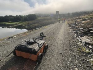
GSSI Announces the GS Series GPR Product Line for Geophysical and Environmental Surveys
GSSI, the world’s leading manufacturer of ground penetrating radar (GPR) equipment, introduces the new 200 MHz (200 HS) antenna, the first of the next-generation high-performance GS Series, designed for applications that require deeper depth penetration.…

Contech’s Cascade Separator Receives New Jersey Department of Environmental Protection Certification
West Chester, OH – Contech® Engineered Solutions announced today that the Cascade Separator has received New Jersey Department of Environmental Protection (NJDEP) Certification as an approved stormwater treatment device. The certification was awarded after…

Bluefin Technology Partners Develops Fluent with Walchem
Worcester Tech Company Builds Remote Monitoring System for Water Testing Devices Worcester, MA – Bluefin Technology Partners, one of Massachusetts’ most innovative digital product developers, today announced their partnership with the water treatment…

FLIR Launches Industry-First Deep Learning-Enabled Machine Vision Camera: Firefly DL
ARLINGTON, Va. – FLIR Systems, Inc. (NASDAQ: FLIR) today announced the launch of the FLIR Firefly® DL, the industry’s first deep learning, inference-enabled machine vision camera with FLIR Neuro technology. With its small size, low weight, minimal power…

Microdesk Launches ARID™, the First Cloud-based Asset Registry and Information Database Application for Enhanced Asset Data Management
New York, NY - Global AECO consulting firm Microdesk, announced today its launch of ARID™, a Cloud- based Asset Registry and Information Database application that leverages machine learning (ML) and artificial intelligence (AI) for enhanced asset data…

Concept3D’s New 3D Panorama Feature Simplifies Space Planning
Concept3D, a leader in creating immersive online experiences with 3D modeling, interactive maps and virtual tour software, today announced the launch of its new 3D Panorama feature, which integrates into the Concept3D interactive map and virtual tour platform.…
Wingtra Launches Corridor Mapping with its 1.10 Release
The new corridor mapping feature in the latest (1.10) Wingtra software release enables fast, efficient coverage of long, narrow stretches with either of WingtraOne’s RX1R II or QX1 payloads. With the touch of a few buttons, customers can now enjoy the broad…
