
Woolpert Awarded $13M Contract to Collect Bathymetric Lidar Data for Florida Seafloor Mapping Initiative
The Florida Department of Environmental Protection data will be used to help evaluate the performance of restoration projects and support coastal resilience efforts.
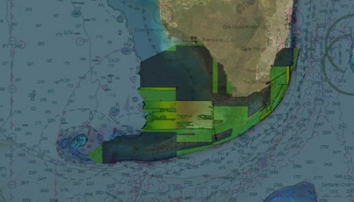
KEY WEST, Fla. — The Florida Department of Environmental Protection has tasked Woolpert with acquiring bathymetric survey data using lidar technologies to support the Florida Seafloor Mapping Initiative (FSMI) and its mission to produce a comprehensive, publicly available, high-resolution seafloor surface model of Florida’s coastal waters by 2026.
FSMI builds on the efforts of the Florida Coastal Mapping Program (FCMaP), an initiative led by federal and Florida state agencies and other community stakeholders to facilitate the collection of approximately 171,780 square kilometers of high-resolution coastal seafloor data from Florida’s shoreline to the continental shelf.
Once completed, the FSMI dataset is expected to be merged with existing terrestrial lidar. The data will be used by federal and Florida state agencies to help better understand the state’s coastal vulnerability and hurricane impacts, evaluate the performance of restoration projects, and support ongoing coastal resilience efforts and flood risk mapping.
Under this task order, Woolpert will collect 23,418 square kilometers of bathymetric lidar data off Florida’s southern coast, including the Florida Keys and extending southwest to Dry Tortugas National Park.
Woolpert Program Director Rick Householder said FSMI will acquire the data in two phases. Phase I will include the aircraft acquisition of topographic and bathymetric lidar data up to 20 meters of depth. Phase II will include the acquisition of data beyond 20 meters in depth up to 200 meters using marine vessels equipped with multibeam sonar.
“The scale and impact of this project is extraordinary. From helping assess the health of Florida’s marine habitats to improving disaster response and resiliency, the amount of information gained through this initiative will have an exponential impact across the state for decades to come,” Householder said. “Not only is this data crucial for the future of protecting Florida’s coastal communities, but this initiative has the potential to provide a blueprint on the benefits of seafloor mapping for all the continental U.S.”
Householder said that the full set of data is expected to be acquired by May of next year and delivered in summer 2024. The contract is currently underway.
About Woolpert
Woolpert is the premier architecture, engineering, geospatial (AEG), and strategic consulting firm, with a vision to become one of the best companies in the world. We innovate within and across markets to effectively serve public, private, and government clients worldwide. Woolpert is a Global Top 100 Geospatial Company, a Top 100 ENR Global Design firm, has earned seven Great Place to Work certifications, and actively nurtures a culture of growth, inclusion, diversity, and respect. Founded in 1911 in Dayton, Ohio, Woolpert has been America’s fastest-growing AEG firm since 2015. Woolpert has over 2,000 employees and more than 60 offices on five continents. For more, visit woolpert.com
