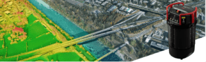
The new airborne mapping system provides maximum application flexibility by offering an adjustable field of view up to 60 degrees and three scan patterns. Heerbrugg, Switzerland, 29.02.2024) - Leica Geosystems, part of Hexagon, introduces the Leica TerrainMapper-3…

