
Revit Live 1.8 Release Announced - Revit Live Service Now Available to Revit LT 2018 Users
Make your Autodesk Revit model immersive in one click with the Autodesk Revit Live service. From Revit, send your model to the Revit Live cloud and in just a few minutes, you will have a file that is ready to be opened, explored, and edited in the Autodesk Live Editor. You can shape your audience’s experience by customizing the navigation points, the render style, and time of day. When you are done refining the interactive visualization, you can present or share your design ideas with...
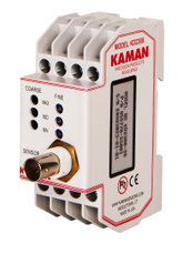
Kaman Measuring Announces KD-2306 Non-Contact Displacement Sensing System
Middletown, CT – The Measuring Division of Kaman Precision Products, Inc., a world leader in the design and manufacture of high-performance, precision non-contact position measuring systems, announces the availability of its KD-2306 single-channel multi-purpose non-contact displacement sensing system. When paired with any of the supported dual and single coil sensors, the KD-2306 becomes an easy-to-use, high precision static and dynamic measuring system. Its DIN rail mount interface makes it ide...
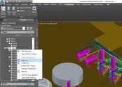
AutoCAD Plant 3D 2018 –Simplified Design from Design Creation, 3D Modeling to Collaboration
This past year has been exciting for the AutoCAD Plant 3D development team. We have added features that further simplify the design process by helping customers easily produce P&IDs, integrate them into a 3D plant design model, and collaborative effectively – all within Plant 3D. This release also paves the way to help customer’s move to the Autodesk Cloud and to BIM solutions. What’s New in Plant 3D 2018 Cloud Based Collaboration This year, we are introducing a new collab...
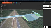
InfraWorks and AutoCAD Civil 3D 2018: They’re Here!
April 13, 2018. The latest Autodesk InfraWorks and Autodesk AutoCAD Civil 3D 2018 are officially released today. Throughout the year many of you have met with our product managers and development teams; and, many, many more of you have shared your Ideas for product feature enhancements. Your involvement in the development of our solutions is invaluable, helping us bring you the tools you need to conceive, design and construct road, highway, bridge, land, and other infrastructure projects in w...

Procore Users Can Print Plans Faster and Smarter for Much Less
Having printed sets of plans readily available for review is a necessity at building sites and in many other architecture, engineering and construction situations. Often, having plans on paper makes it easier for the project management team to see at a glance both the big picture and granular details in relation to the full project scheme. While tablets and other devices are fantastic in many situations, many industry professionals prefer to view schematics and read text on sharp, crisp printed...

DroneDeploy Integrates with agX to Streamline Planning of Drone Mapping Flights
Stillwater, Okla.- STILLWATER, OK – DroneDeploy, the leading cloud software platform for commercial drones today announced an integration with agX® to help growers more easily capture field maps and analyze aerial data. agX users can now share field boundaries saved in agX with DroneDeploy to simplify the planning of drone mapping flights. Over time, agX and DroneDeploy plan to integrate further to allow seamless sharing of drone images from DroneDeploy to agX. “This integration will provide...
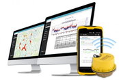
Trimble Unity Smart Water Management Software Adds Wireless Monitoring to Streamline Utility Operations
SUNNYVALE, Calif. — Trimble (NASDAQ: TRMB) announced today the latest version of its smart water management software—Trimble® Unity 3.8. Trimble Unity is a cloud-based, GIS-centric Software-as-a-Service (SaaS) solution that offers a suite of applications and tools for the water, wastewater, storm water and environmental water industry. Trimble Unity enables customers to monitor real-time operations, deploy smart meters, assess the condition of assets, reduce leakage and non-revenue water (NRW),...
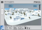
New Atkins Digital Tool Will Enable Collaborative Sustainable Urban Development Planning
A new digital tool to help stakeholders collaborate on sustainable urban growth is being developed by an Atkins team in Stockholm, Sweden. The project is funded by the Swedish Environmental Protection Agency as a part of a four-year €7 million government program to support innovations in city planning. By using the Planning Information Modelling (PIM) tool, urban planners will have a single platform to easily engage with stakeholders such as politicians, government departments, consultants an...
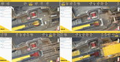
6 Major Construction Companies Adopt New Pix4D BIM Monitoring Solution
Construction professionals understand that daily visualization of a jobsite helps minimize construction delays, prevent clashes between as-built and as-design, eliminate the need for rework, facilitate stakeholder communication and align schedules. But how can they achieve this? Within one complete solution combining hardware and software, the Pix4D Crane Camera enables BIM and Project Managers to tackle some of the most complex and lingering challenges in construction. Designed to mo...

Going Digital: Bentley Systems Advances Reality Modeling to Extend the Scope of Engineering and Surveying Value
A 3D engineering-ready reality mesh created in ContextCapture comparing (left to right) photogrammetry, LiDAR, and a hybrid input. (Image courtesy of Bentley Systems and City of Strasbourg) Houston, TX – SPAR 3D Expo & Conference – Bentley Systems, Incorporated, a leading global provider of comprehensive software solutions for advancing infrastructure, demonstrated at SPAR 3D Expo & Conference (SPAR) new ContextCapture offerings for reality modeling that increase joint opportunities in survey...
Video: New Roundabout Under Construction at McIver and Old Florence Roads in Darlington County

Promenade at The Point

June Issue 2026
.jpg?width=225)