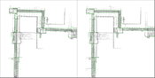
NavVis Sets New Standard in SLAM Precision
MUNICH, Germany – NavVis, a global leader in mobile indoor mapping, visualization, and navigation, announces new mapping software that significantly improves the accuracy of simultaneous localization and mapping (SLAM) technology in indoor environments, such as long corridors. The software update will be available for users of the NavVis M3 Trolley and will significantly improve the accuracy of the resulting maps and point clouds. NavVis’ mobile mapping system, the M3 Trolley, builds upon SLA...

Pettibone Introduces Next Gen T944X Telehandler With Industry-Exclusive Traversing Boom
BARAGA, Mich. — The new Pettibone Traverse T944X is the industry’s only new telehandler with an extendable, traversing boom that moves loads by traveling horizontally. Up to 70 inches of horizontal boom transfer allows users to precisely and safely place loads at full lift height through tight openings without having to coordinate multiple boom functions. With the Traverse, the specified lift height of 44 feet, 6 inches is nearly identical to the 44-foot landing height. This stands in co...
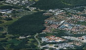
Leica Geosystems Introduces Latest in Linear Mode LiDAR
Heerbrugg, Switzerland – Leica Geosystems, industry leader in measurement technology, announced today the launch of TerrainMapper, its next generation linear mode LiDAR system. As part of the RealTerrain airborne LiDAR mapping solution, the new sensor builds on Leica Geosystems sensor technology and is supported by the HxMap unified multi-sensor post-processing workflow. TerrainMapper enables users to increase point accuracy, deliver even point density across the swath, and accommodates more...
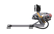
Trimble Announces New MX9 Mobile Mapping System for Surveying, Engineering and Geospatial Professionals
SUNNYVALE, Calif —Trimble (NASDAQ: TRMB) announced today the release of the Trimble® MX9 mobile mapping solution. The Trimble MX9 combines a vehicle-mounted mobile lidar system, multi-camera imaging and field software for efficient, precise and high-volume data capture for a broad range of mobile mapping applications such as road surveys, topographic mapping, 3D-modeling and asset management. The Trimble MX9 captures dense point cloud data along with 360 degree immersive georeferenced im...

Leica Geosystems Multipurpose Mobile Mapping Platform Increases Smart City Applications
Heerbrugg, Switzerland – Leica Geosystems, industry leader of measurement technology, released today the new Leica Pegasus:Two Ultimate, an upgrade to its current mobile mapping platform bringing higher quality digital reality capture to the market. Users can service new market segments, including Smart City applications by digitising road and rail infrastructures while expanding into new markets in support of autonomous vehicles, with seamless 360 and higher resolution imagery, and increas...
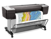
HP Launches the World’s Most Secure Large Format Printers for GIS mapping
PALO ALTO, Calif. — HP Inc. today introduced HP DesignJet T1700 printers, next-generation 44-inch solutions for CAD and geographic information system (GIS) workgroups to produce highly accurate documents and maps with powerful processing and a new level of security. New added features on the HP DesignJet T1700 make it the most secure large format workgroup printer available today1. The improved security is designed to help enterprises print CAD and GIS applications while protecting prin...
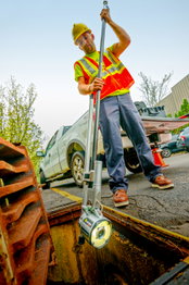
Envirosight Releases New Quickview airHD+ Sewer Assessment Camera
RANDOLPH, NJ— Zoom assessment cameras are used to help determine sewer condition, and the Quickview brand revolutionized the sewer inspection industry by providing rapid, affordable visual assessment capabilities in sewer lines, stormwater lines, catch basins and manholes. The new Quickview airHD+ makes assessment even easier and more detailed. It has all the features of its predecessor: wireless tablet-based control, HD video, remote height and tilt adjustment, and hands-free operation. In a...

Woolpert Updates SmartView Connect to Publish Mapping Data at Unprecedented Speeds
DAYTON, Ohio — Woolpert has launched the SmartView Connect (SVC) Version 5, a streamlined quality assurance/quality control (QA/QC) tracking application to review preliminary imagery, elevation and remote sensing data sets. SVC is an open geospatial consortium (OGC), compliant raster and vector service that allows internet and web map service (WMS) viewing access to project deliverables while a project is underway. “Over the last seven years, we have published more than 500 data sets spannin...

Trimble Expands Mixed-Reality Portfolio for Field Workers
SUNNYVALE, Calif., Jan. 25, 2018-Trimble (NASDAQ: TRMB) announced today Trimble Connect™ for HoloLens and a new hard hat solution for Microsoft HoloLens that improves the utility of mixed reality for practical field applications. The announcement was made at World of Concrete and Air-Conditioning, Heating, Refrigerating (AHR) Expo 2018. "With the rise in acceptance for mixed-reality solutions in business today, the need for 3D visualization outside the office is driving this next wave of T...
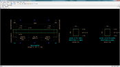
Bentley Systems Expands Concrete Building Design and Documentation Offerings through Acquisition of S-Cube Futuretech
EXTON, Pa. — Bentley Systems, Incorporated, a leading global provider of comprehensive software solutions for advancing infrastructure, today announced the acquisition of Mumbai-based concrete building design and documentation software company S-Cube Futuretech Pvt. Ltd. The addition of S-Cube Futuretech’s applications expands Bentley’s offerings specific to the needs of concrete engineering design and documentation software users in India, South East Asia, and the Middle East. Concrete colu...
Video: New Roundabout Under Construction at McIver and Old Florence Roads in Darlington County

Promenade at The Point

June Issue 2026
.jpg?width=225)