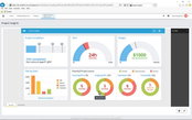
Going Digital: Bentley Announces Microsoft Azure-based Cloud Services Extending ProjectWise CONNECT Edition for Comprehensive Project Delivery
SINGAPORE — The Year in Infrastructure 2017 Conference — Today, Bentley Systems announced new ProjectWise CONNECT Edition cloud services, powered by Microsoft Azure. The Azure-based services complement ProjectWise Design Integration service, the proven workhorse for work-sharing across collaborating engineering teams—which can be deployed on-premises, as a cloud service, or in any hybrid combination. By virtue of the shared Azure platform, project delivery organizations using both ProjectWise C...

Going Digital: Bentley Systems’ New OpenRail is First to Advance BIM for the Full Rail and Transit Lifecycle – Systems Engineering from Planning Through Performance
SINGAPORE — The Year in Infrastructure Conference — 10 October 2017 — Today, Bentley Systems’ CEO Greg Bentley introduced the OpenRail solution, comprising applications and services for the comprehensive planning, engineering, project delivery, and operations of rail and transit infrastructure. OpenRail’s foundation is Bentley’s connected data environment (CDE), shared by ProjectWise collaboration services and AssetWise operations services, and which for OpenRail now brings together digital comp...
Bentley’s New CONNECTservices Bring Comprehensive Learning, Mobility, and Collaboration Benefits to Bentley Application Subscribers
Going Digital: New Azure-based Services Accelerate Users’ Applications Mastery, and Empower Staying Connected Across Devices and Projects SINGAPORE – The Year in Infrastructure 2017 Conference – 9 October 2017 – Bentley Systems, Incorporated, a leading global provider of comprehensive software solutions for advancing infrastructure, today announced the introduction of SELECT CONNECTservices, new Azure-based services that deliver comprehensive learning, mobility, and collaboration benefits to...
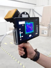
GeoSLAM and Bentley Systems Join Forces to Take Mobile Reality Modelling Indoors
BENTLEY YII 2017, SINGAPORE - GeoSLAM - the experts in “go anywhere” 3D mobile mapping technology, and Bentley Systems, a leading global provider of comprehensive software solutions for advancing infrastructure, today announced a partnership to enable the simple and fast production of hybrid reality models in any environment. Mark Reid, VP of Product Management, GeoSLAM said, “GeoSLAM has already disrupted the reality capture industry by changing the economics of 3D laser scanning enabling b...
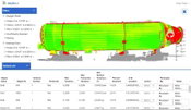
SKUR Launches Assisted Model Alignment and Integrated Workflow to Turn Design Deviation Insights into Actions
OAKLAND, California – October 5, 2017 – SKUR, the pioneer in providing as-built construction insights, today announced the launch of industry-leading innovations to make deviation detection much more streamlined and actionable. Assisted Alignment, which overcomes the need for Ground Control Points (GCPs) when aligning design and point-cloud models, and the integrated Approval Workflow, which drives accountability for deviations, are available to all SKUR customer tiers. SKUR bridges the physi...
GRM FieldForms Connects Intelligent Data Collection in the Field to the Cloud
JERSEY CITY, NJ – GRM Information Management, a leader in enterprise content management and records management, has introduced FieldForms. FieldForms is the latest advancement in GRM’s SaaS-based Intelligent Forms technology that incorporates intelligence behind distinct data fields in order to deliver higher quality and more efficient data collection. The new offline version of GRM’s cloud-based forms solution, FieldForms, delivers the same benefits without requiring internet connectivity durin...

GeoMax Releases All-In-One Office Software for Topographical Data
Widnau, SWITZERLAND: GeoMax, professional surveying and construction product provider, announced today the X-PAD Office Fusion, the all-in-one office software combining data from multiple sensors into one easy-to-use interface X-PAD Office Fusion software manages, combines and processes data from GNSS receivers, total stations, laser scanners and other sensors in one single environment whether from GeoMax or any other provider in the market. There is no need to export the data from one progra...

RIEGL Announces Significant Product News at Intergeo 2017
RIEGL launches their newest, innovative Waveform-LiDAR sensors and systems at Intergeo 2017 in Berlin. For terrestrial laser scanning, RIEGL introduced the NEW RIEGL VZ-2000i 3D Laser Scanner. This long range, very high-speed 3D laser scanner captures up to 1.2 million measurements per second, and covers ranges up to 2,500 m, with 5 mm accuracy and 3 mm precision. RIEGL’s unique Waveform-LiDAR technology enables high speed, long range, high accuracy measurements even in poor visibility a...
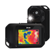
FLIR Announces C3 Thermal Camera
WILSONVILLE, Ore. – FLIR announced today that the FLIR C3 thermal camera for contractors is now available for purchase. Unveiled earlier this year at the Consumer Electronics Show (CES), the FLIR C3 is a ruggedized, pocket-portable, dedicated thermal camera ideal for home inspectors, real estate professionals, general contractors, and other trade professionals who need a powerful diagnostic tool. With a bright, three-inch touchscreen, the FLIR C3 offers several features that make it a grea...

Trimble Adds Inertial-Based Trolley Solution to its Track Survey and Scanning Rail Portfolio
BERLIN — Trimble (NASDAQ: TRMB) introduced today a new addition to its track survey and scanning rail portfolio—the Trimble® GEDO IMS System. The latest trolley system is lightweight, flexible and fast. It combines an Inertial Measurement Unit (IMU) with scanning and geodetic sensors for surveying railway lines and documenting assets along the track. The announcement was made today at INTERGEO 2017, the world’s largest conference on geodesy, geoinformatics and land management. Th...
Video: New Roundabout Under Construction at McIver and Old Florence Roads in Darlington County

Promenade at The Point

June Issue 2026
.jpg?width=225)