
BIMrx™ 3.0 Offers a More Intuitive UI and Powerful Modeling Features with Automation of Common Tasks through BIMrx Integration with Cloud Manager™
Nashua, NH - Global BIM and EAM consulting firm Microdesk, a leading provider of business and technology services for the design and construction industry, has released version 3.0 of the BIMrx™ software suite for BIM project lifecycle automation. Enhancements to each product include intuitive UI updates, expanded export options and cloud integrations. Version 3.0 of BIMrx™ further streamlines the tasks associated with Revit project setup, modeling and project management, allowing AEC profession...

Prospect by IrisVR Creates End-to-End Coordination for BIM Teams with New Immersive Issue Tracking Feature
Portland, OR – Today, VR/AR collaboration platforms IrisVR and The Wild announced their official support for immersive end-to-end issue tracking in IrisVR‘s flagship product, Prospect. This product update allows for a full-cycle coordination workflow for building teams working with 3D models such as Revit and Navisworks. This will be the product’s first release in 2021. The Wild acquired Prospect by IrisVR in February of 2021 and has been in deep development of this critical feature to ensure...

Spacewell Releases Opportunity Simulator for Offices
New analytical dashboard dynamically simulates space optimization scenarios and calculates space savings Supports CRE and workplace leaders to leverage the massive opportunity to optimize the office footprint and configuration (mix of workstations/collaboration spaces/concentration spaces) post-Covid Antwerp, August 23, 2021 – Spacewell, a global provider of building and workplace software and technology solutions, today launched its new Opportunity Simulator dashboard for the post-pand...
AirData and UgCS New Integration
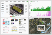
Today, SPH Engineering and AirData UAV have announced a new partnership to offer pilots a seamless and simple way to track and manage their fleets by automatically synchronizing flight data from SPH Engineering’s UgCS to AirData. "Thanks to the new AirData and UgCS integration, our pilots are able to focus on the task at hand knowing the flight logs are being seamlessly monitored and archived. With both AirData and UgCS offering unique capabilities and with a minimal learning curve for our pi...
IntelliCAD Technology Consortium Announces Release of IntelliCAD® 10.1
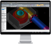
Portland, OR, USA — The IntelliCAD Technology Consortium (ITC) today announced the release of IntelliCAD 10.1. IntelliCAD 10.1 is a major release that includes significant performance improvements and new features. IntelliCAD 10.1 is up to seven times faster when selecting entities and two times faster for grip editing, grip displaying, entity snapping, and drawing regenerating. New features include the ability to insert and work with geographic maps, restore default program settings fr...

3Dconnexion Adds Full Support for Kubotek Interoperability Programs
Norwalk, Conn., August 16, 2021—3Dconnexion is proud to announce their certification of full support for their motion controller devices in the latest releases of the next-generation Kubotek interoperability programs. Kubotek’s K-Compare and K-Display products were developed on top of the company's proprietary Kosmos 3D framework, built for comprehensive data exchange between all the major CAD programs. The four programs in these product families now in use by customers include K-Compare R...

RedTail LiDAR Systems Unveils Innovative LiDAR System for Small Drones
Fairmont, WV - RedTail LiDAR Systems, a leader in microelectromechanical systems (MEMS) mirror-based LiDAR technology, today unveiled the market introduction of the RTL-450 LiDAR sensor. The product will be launched at the XPONENTIAL 2021 Trade Show which is being held in Atlanta, Georgia from August 16-19. The RTL-450 incorporates a lightweight MEMS mirror and a precision navigation system to generate accurate data for the most demanding of aerial surveying missions. The high-resolut...

NV5 Geospatial Debuts Predictive Modeling Platform to Improve Utilities’ Vegetation Management Programs
August 25 Webinar to Highlight How Analysis of Lidar and Historical Data Can Help Electric Utilities Improve Reliability and Reduce Costs by Identifying Areas for Proactive Trimming and Removal HOLLYWOOD, Fla. – NV5 Geospatial, powered by Quantum Spatial, North America's largest geospatial data firm, today announced the launch of Trim Optimization, a predictive modeling platform that enables electric utilities to enhance vegetation management programs with risk-based assessments. Using i...

Tensar Releases Next Generation InterAx Geogrid Product
The new stabilizing geosynthetic grid reduces project costs, improves resiliency and prolongs infrastructure life through optimized geometry and ground-breaking material science. (ATLANTA, GA) August 9, 2021 – Tensar International, a global leader in soil stabilization and reinforcement for construction, announces the release of the next generation in its portfolio of geosynthetic solutions: InterAxTM geogrids. Since Tensar invented geogrids in the 1970s, the products have earned a repu...
CYPE launches version 2022 consolidating the Open BIM workflow and enhancing its architectural solutions
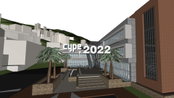
The AEC software company has improved the performance of its cloud-based platform, BIMserver.center, which generates an average of 12,000 new professional projects each month The new version incorporates the free Open BIM Site application that projects buildings by locating them in specific geographic coordinates and also allows users to add maps, topographic surfaces, plots, and buildings As for codes, the software has implemented updates for the Spanish RITE and has added new interna...
Video: New Roundabout Under Construction at McIver and Old Florence Roads in Darlington County

Promenade at The Point

June Issue 2026
.jpg?width=225)