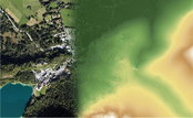
Elevate your performance with UltraMap 5.0
Graz, Austria: Vexcel Imaging announces the release of UltraMap version 5.0, the latest update of its all-in-one aerial photogrammetry software featuring comprehensive DTM generation and full integration of Ortho Production in UltraMap Studio. With the introduction of a completely new Digital Terrain Model (DTM) algorithm based on automatic semantic image segmentation and intelligent filtering, UltraMap 5.0 now generates comprehensive DSMs and DTMs for export at unprecedented quality. Additi...

Eos Positioning Systems announces compatibility of Eos Laser Mapping™ and Eos Locate™ with Esri ArcGIS Field Maps (beta)
The August 2020 release of Eos Tools Pro version 1.89 makes Eos Locate™ for ArcGIS (underground mapping) and Eos Laser Mapping immediately available for use with the Field Maps beta AUGUST 2020, MONTREAL, CANADA — Eos Positioning Systems (Eos), the Canadian manufacturer of the popular high-accuracy Arrow Series® GNSS receivers, has announced today the compatibility of two popular Eos field data-collection solutions with the Esri ArcGIS Field Maps beta. Eos Locate™ for ArcGIS is the world’s...

The PV software archelios™ Pro Silver: manage projects up to 100 kWp
Trace Software International is excited to announce the launch of the newest editions of archelios™ Pro. The software is an excellent tool for the feasibility and bankability study, simulation, 3D design, and sizing of any photovoltaic project. As the solar market becomes more and more complex and challenging, the company has launched a new PV software offering. Trace Software International has used its expertise to create four different PV tools’ proposals, archelios™ Pro Free, archelios™ Pr...

PennDOT Earns Regional America's Transportation Awards for Operations Excellence and Best Use of Technology
Harrisburg, PA – The Pennsylvania Department of Transportation (PennDOT) recently received regional America's Transportation Awards for operational excellence and best use of technology. The department's operational excellence award was for the Automated Work Zone Speed Enforcement ProgramOpens In A New Window and the best use of technology award was for the Shaler Street Bridge ReplacementOpens In A New Window. "Innovation is at the heart of PennDOT initiatives across the state," said Pen...
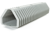
Xylem’s revolutionary Leopold Type 360 underdrain features innovative backwashing capability
New bolt down model increases efficiency RYE BROOK, N.Y., – Xylem now offers the Leopold Type 360 underdrain, a bolt down underdrain system for greenfield projects and water treatment filtration rehabilitation projects. The underdrain system has an innovative design concept where backwash water flows in a 360-degree pattern, increasing efficiency by up to 20%. “The industry challenged us to create an underdrain that combines efficiency, straightforward installation and individually se...

GNSS RTK rover with Visual Positioning increases safety, simplifies surveying
New GS18 I GNSS RTK rover with Visual Positioning can measure what you see (HEERBRUGG, SWITZERLAND, 18, August 2020) – Leica Geosystems, part of Hexagon, unveils the Leica GS18 I (announced by Hexagon yesterday), a versatile, GNSS RTK rover with Visual Positioning. The GS18 I allows users to capture points of interest from a distance and measure points from the images in the field or the office. Visual Positioning technology (sensor fusion combining GNSS, IMU and a camera) allows user...

Milwaukee Tool Integrates One-Key™ with Autodesk BIM 360®
MILWAUKEE, WI - Milwaukee Tool is proud to announce that their One-Key™ digital platform now integrates with Autodesk Construction Cloud™’s BIM 360® construction management software, enabling customers to seamlessly share information between the two solutions and enhance asset tracking, project management, and reporting. As the industry’s largest and most robust asset management platform and tracking network, One-Key™ incorporates industry-leading tool electronics with a custom-built, cloud-b...
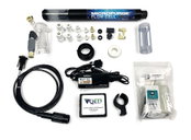
Q.E.D. MicroPurge MP25 Simplifies Low-Flow Groundwater Sampling
Purge stabilization flow cell ensures accuracy and consistency Dexter, MI – Q.E.D. Environmental Systems, Inc., a leading manufacturer of innovative environmental products and subsidiary of Graco Inc., highlights that its MicroPurgeÒ MP25 Purge Stabilization Flow Cell system makes consistent low-flow groundwater sampling easy and accurate. The associated PurgeScanÔ technology monitors purging parameters and performs stabilization automatically, reducing potential for error and inaccuraci...

Geo-localized data collection now made easy with new OnPOZ Collect app for Android
Effigis is proud to announce the worldwide launch of its new OnPOZ Collect and Cloud solution, for efficient geo-localized fieldwork data collection and management. OnPOZ Collect is a powerful GIS mapping app that transforms a phone or tablet into a geospatial data collection tool. You will be ready for the field, whether you are completing an inventory assessment, infrastructure inspections, damage reporting, forestry projects or a variety of other project types. OnPOZ Collect is intuitive a...
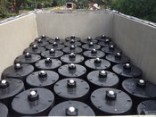
Contech® Stormwater Management StormFilter® Achieves ISO 14034 Environmental Technology Verification (ETV)
West Chester, OH – Contech® Engineered Solutions announced today that the Stormwater Management StormFilter® has been verified in accordance with ISO 14034 Environmental Management - Environmental Technology Verification (ETV). Data from both laboratory and third-party field monitoring studies provided the basis for the StormFilter performance claims. ISO 14034 ETV is an international standard developed with Canadian participation that provides a protocol for third-party verification of tech...
Video: New Roundabout Under Construction at McIver and Old Florence Roads in Darlington County

Promenade at The Point

June Issue 2026
.jpg?width=225)