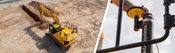
New Factory-Fitted Machine Control Solutions Launched
JCB and Leica Geosystems are joining forces to offer factory-fitted 2D and 3D-ready semi-automated excavator control solutions. (Heerbrugg, Switzerland, 20 03 2024) JCB and Leica Geosystems, part of Hexagon, today announced that they are joining forces to offer factory-fitted 2D and 3D-ready semi-automated excavator control solutions. From March 2024, the solutions - known as INTELLIGRADE - will be available initially on the JCB 220X tracked excavator in the United Kingdom before bein...
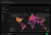
HEAVY.AI Introduces HeavyIQ, Delivering Powerful Conversational Analytics Focused on Location and Time Data
HeavyIQ leverages Natural Language Processing to enable organizations to easily explore their massive data sets and quickly generate advanced visualizations SAN JOSE – March 19, 2024 – HEAVY.AI, innovator in advanced analytics, today announced HeavyIQ. HeavyIQ brings groundbreaking Large Language Model (LLM) capabilities to the GPU-accelerated HEAVY.AI analytics platform, enabling organizations to interact with their data through conversational analytics. Users can easily explore their d...
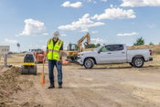
Trimble and Radiodetection Combine Survey-Grade Positioning with Underground Utilities Locating Measurement Workflows
Trimble Catalyst Now Integrates with Radiodetection’s RD Map+ Application and Precision Locators to Bring Survey-Grade Accuracy to Utility Workflows in North America WESTMINSTER, Colo. — Trimble (NASDAQ: TRMB) and Radiodetection announced today a collaboration to improve the technology used in the utility measurement and mapping process. Through the integration of the Trimble® Catalyst™ DA2 GNSS system and Radiodetection’s RD MapTM+ application and precision locator products, the software and...

Trimble Announces TX-RAMP Certification for e-Builder Digital Project Delivery Software and AgileAssets Pavement and Maintenance Management Systems
WESTMINSTER, Colo., March 14, 2024 — Trimble (NASDAQ: TRMB) announced today two of its cloud software solutions that support asset lifecycle management have received a Level 2 Certification based on the security requirements of the Texas Risk and Authorization Management Program (TX-RAMP). The two Trimble solutions are e-Builder Enterprise - Commercial, a digital project delivery software for owners of capital improvement programs, and certain capabilities within AgileAssets, an enterprise asse...
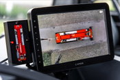
Mammoet implements innovative 360-degree safety system
Mobile crane camera setup alerts drivers to site hazards Mammoet is working with Rietveld, a specialist in fleet management and vehicle and machine safety systems, on a joint project to protect drivers and road users when mobile cranes are moving and maneuvering. The project combines three different safety technologies and was commissioned by Mammoet to support its customers to meet stricter safety regulations. Testing is currently being carried out on one of its new Liebherr LTM 1070-...

The Future of Design Is Here with AI in Vectorworks 2024 Update 4
Latest Vectorworks Update Introduces New Capabilities in AI Visualization, Virtual Reality, BIM Collaboration, and More to Deliver Added Design Freedom and Flexibility. Columbia, MD (March 13, 2024) — Global design and BIM software provider Vectorworks, Inc., part of the Nemetschek Group, has released its fourth update to the Vectorworks 2024 product line, granting customers access to AI and virtual reality (VR) technologies through two brand new tools. Additionally, the latest version u...

Tekla 2024 Structural BIM Software Offers Enhanced User Experience and Connects Workflows Across Projects and Stakeholders
Tekla Structures 2024: Better control over model object properties in the IFC exports - all properties in one place. Tekla 2024 Structural BIM Software Offers Enhanced User Experience and Connects Workflows Across Projects and Stakeholders. Enhancements and Further Open Standards Adoption Boost Collaboration Performance WESTMINSTER, Colo., March 13, 2024 — Trimble (NASDAQ: TRMB) announced today the introduction of 2024 versions of its Tekla® software for constructible Building Informat...

Planera Announces Integration with Autodesk Construction Cloud to Streamline Project Scheduling and Planning in the Construction Industry and Beyond
The new integration connects Autodesk Construction Cloud with Planera’s groundbreaking approach to construction scheduling and planning San Jose, CA – March 7, 2024 — Planera, a construction critical path method (CPM) scheduling and planning solution, today announced an integration with Autodesk Construction CloudÒ, a portfolio of software and services that combines advanced technology, a builders network and predictive insights for construction teams. The new integration combines Planer...

Leica Geosystems unveils Leica TerrainMapper-3, the all-in-one sensor for versatile airborne LiDAR mapping
The new airborne mapping system provides maximum application flexibility by offering an adjustable field of view up to 60 degrees and three scan patterns. Heerbrugg, Switzerland, 29.02.2024) - Leica Geosystems, part of Hexagon, introduces the Leica TerrainMapper-3 airborne LiDAR sensor, featuring new scan pattern configurability to support the widest variety of applications and requirements in a single system. Building upon Leica Geosystems’ legacy of LiDAR efficiency, the TerrainMapper-3...

Looq AI Launches AI-Enabled Digital Twin Platform at Distributech 2024; Secures $2.6M from Top VCs
Distribution pole capture with the Looq Q camera, the imaging component of the Looq platform. High data quality ensures that a single Looq survey can serve to update asset management databases, to complete complex engineering tasks such as pole-load analysis and phase tracing, and to create a trustworthy, survey-certifiable, record for as-built. Image courtesy of Looq AI. Novel Technology Enables True Asset Intelligence of Critical Utilities Infrastructure at Scale [San Francisco, C...
Video: New Roundabout Under Construction at McIver and Old Florence Roads in Darlington County

Promenade at The Point

June Issue 2026
.jpg?width=225)