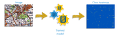
Trimble Introduces New Version of eCognition Software Suite with Powerful New Geospatial Data Analysis Capabilities
BERLIN—Trimble (NASDAQ: TRMB) today announced the release of eCognition Suite 9.3, a software platform for advanced geospatial image analysis for environmental, agriculture, forestry and infrastructure applications. Version 9.3 leverages the latest image feature extraction technology to solve challenging problems faster and more accurately for remote sensing specialists, Geographic Information System (GIS) experts, cartographers, photogrammetry and other geospatial professionals. The ann...
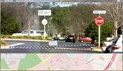
Trimble Expands Field-to-Finish Capabilities for Geospatial Professionals with Enhancements to Software Portfolio
BERLIN—Trimble (NASDAQ: TRMB) announced enhancements to its industry leading portfolio of geospatial office software with a new version of Trimble® Business Center and the introduction of Trimble Clarity, a new cloud-based application that enables geospatial professionals to easily visualize and share three-dimensional point cloud data with clients. The new software versions expand the field-to-finish workflows for survey and mapping professionals, providing a complete solution for the delivery...
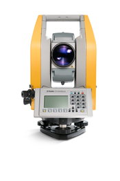
Trimble Enhances Optical Portfolio with the Next-Generation Mechanical Total Stations
BERLIN—Trimble (NASDAQ: TRMB) today announced the release of the Trimble® C5 and Trimble C3, the next generation of mechanical total stations to support land survey professionals with their cadastral survey, topographic survey and stakeout needs. The new Trimble C-Series mechanical total stations enhance the Trimble portfolio with new productivity boosting features that make everyday field work easier and faster. The announcement was made today at INTERGEO 2017, the world’s largest confe...

FARO Announces Innovative Visual Inspect for Inspection and Design
Lake Mary, FL - FARO® (NASDAQ:FARO), the world’s most trusted source for 3D measurement and imaging solutions for factory metrology, construction BIM/CIM, product design, public safety forensics, and 3D solutions applications, announces the availability of the FARO® Visual Inspect™ product family. This innovative platform enables large, complex 3D CAD (computer-aided design) data to be transferred to an iPad and then used for mobile visualization and comparison to real world conditions (https://...

Applanix Releases Updated Version of POS LVX for High-Accuracy Positioning and Orientation for Autonomous Ground Vehicles
Berlin, Germany – Applanix, a Trimble Company, introduced today an updated version of its POS LVX system, which provides high-accuracy positioning and orientation for the operation of autonomous ground vehicles. The POS LVX can be integrated with cameras, Light Detection and Ranging (LiDAR), RAdio Detection and Ranging (RADAR), and other sensors to provide accurate Positioning and Orientation System Estimation (POSE) for localization, perception, and the production of high-precision maps critic...

Trimble Expands Portfolio of OEM Products for High-AccuracyDirect Georeferencing on Unmanned Aerial Vehicles
BERLIN —Trimble (NASDAQ: TRMB) introduced today three new GNSS-Inertial Systems for Direct Georeferencing on Unmanned Aerial Vehicles (UAVs): the Trimble® APX-15-EI UAV, Trimble APX-18 UAV, and Trimble APX-20 UAV. Direct Georeferencing with the systems allows the location of image elements collected by Light Detection and Ranging (LiDAR) and hyperspectral sensors to be accurately computed without extensive networks of ground control points, reducing costs while maintaining accuracy to produce m...

Colorado DOT Crews to Install Monitoring Technology on I-70 in Glenwood Canyon
This fall, said the Colorado Department of Transportation, crews will begin installing interconnected weather and road sensors, cameras, speed-detection devices and variable speed limit signs at 17 locations on the Interstate 70 Glenwood Canyon corridor. It is an example of how state DOTs are increasingly turning to technology projects to improve highway utilization and safety. "This section of I-70 experiences a range of weather conditions throughout the year, causing unsafe conditions f...

First True Tilt Compensation GNSS is Next Evolution of Leica Captivate Experience
(Heerbrugg, Switzerland, 26 September 2017) – Leica Geosystems, industry leader of measurement technology, announced today the Leica GS18 T, the world’s fastest GNSS RTK rover, and the latest versions of Leica Captivate field software and Leica Infinity office software. This latest announcement further expands the Leica Captivate Experience. With the addition of calibration-free GNSS and various upgrades to the Captivate field software and Infinity office software, users continue the immersiv...
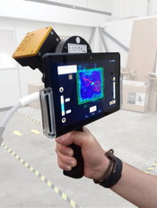
GeoSLAM Launching Enhanced SLAM Software and Next Generation Mobile Scanner at InterGEO 2017
NOTTINGHAMSHIRE, UK, 25 September 2017 – GeoSLAM, the experts in “Go-Anywhere” 3D mobile mapping, will launch the latest version of its award-winning SLAM registration software and unveil the next-generation ZEB-REVO mobile scanner this week at InterGEO 2017 in Berlin. The time-saving and hassle-free solutions developed by GeoSLAM help to ensure that customers are completing jobs 10 times faster than when using traditional survey tools – and slashing up to two-thirds off project costs....

SBG Systems to Launch the “SBG +Services”, a Full Set of Technical Services Around its Inertial Sensors
Carrières-sur-Seine, France – SBG Systems, leading manufacturer of inertial navigation systems, adds to its catalog a full set of technical services called the “SBG +Services”. Dedicated to Surveyors as well as Integrators, these services increase productivity by enhancing utilization efficiency and bringing clever solutions to daily project challenges. Choosing an inertial sensor is more than matching technical specifications. Professionals face other challenges such as training a new employ...
Video: New Roundabout Under Construction at McIver and Old Florence Roads in Darlington County

Promenade at The Point

June Issue 2026
.jpg?width=225)