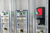
Leica Geosystems Sets New Benchmark for Laser Visibility
(Heerbrugg, Switzerland, 21 February 2018) – Leica Geosystems, industry leader in reality capture technology, announced today the new Lino series of cross and point line lasers, specially created to ensure outstanding laser visibility. The clever power concept with Li-ion rechargeable batteries enables users to work without inconvenient interruptions. Thanks to the ingenious adapter concept with its strong magnets, the laser is also simple and quick to position. "In addition to precision, the...

AirFaas Awarded as the Potential Future European Tech Giant by EU Commissioner
The “DIGITALEUROPE SME AWARD” aims at celebrating and rewarding SMEs which have the potential to become the future European Tech giants. The winner 2018 is AirFaas from Finland, and the award is handed over today in Brussels by Mariya Gabriel, European Commissioner for Digital Economy & Society. AirFaas is an Airbnb for factories, a portal that allows companies to manufacture their machines and components without owning factories, production equipment or having production workers. A win-win f...

Resilience In Action: Get Severe Weather Protection From Closed-Cell Spray Foam Insulation
When people think of disaster mitigation they often think of roof systems, shutters, and impact resistant glass. But what is behind the walls can have an enormous impact on what happens to a home in a weather event. Closed-cell spray polyurethane foam insulation (ccSPF) is the ideal insulation for hurricane and severe weather zones. The product: Adds structural strength Provides wind uplift resistance Offers water resistance Is cost-effective Is easy to install...

Topcon Acquires ClearEdge3D, a Technology Leader in 3D Modeling and Construction Verification Software
TOKYO, Japan – Topcon Corporation, a world leader in positioning instruments for survey and construction, through its American subsidiary, has acquired all the outstanding shares of ClearEdge3D, Inc., a recognized technology leader in the engineering and construction software industry. ClearEdge3D’s EdgeWise software dramatically speeds as-built modeling workflows by utilizing automated feature extraction algorithms and other patented technologies. Its Verity construction verification softw...

USDOT Video: Mid-Block Crosswalk Application
The Federal Highway Administration has led the development of a smartphone based application to increase driver awareness of pedestrians at mid-block crosswalks. A driver using the application within their vehicle will receive an audible and visual alert when a pedestrian using the application has indicated an intent to use a mid-block crosswalk. The application runs on smartphones or tablets and is active when the vehicle and pedestrian are within the designated geofenced areas.

Pitney Bowes Simplifies and Accelerates Data Accessibility with New Software and Data Marketplace
STAMFORD, Conn., Feb. 15, 2018 - Pitney Bowes Inc. (NYSE:PBI), a global technology company that provides innovative products, solutions and data to power commerce, today announced the global availability of its new Software and Data Marketplace, simplifying access to hundreds of data sets across the Retail, Insurance, Real Estate and Financial Services industries. The Software and Data Marketplace is a self-service resource for data users to download Pitney Bowes’ industry-leading data catalo...

New FARO Design ScanArm 2.0 Improves Product Design Workflow
Lake Mary, FL - FARO® (NASDAQ:FARO), the world’s most trusted source for 3D measurement and imaging solutions for factory metrology, product design, construction BIM/CIM, public safety forensics and 3D machine vision applications, introduces the next generation FARO® Design ScanArm® 2.0, specifically designed to address the most demanding challenges and requirements faced by product design and product engineering professionals. It offers an exceptional combination of flexibility, reliability, va...
Leica Geosystems Introduces Latest in Linear Mode LiDAR
Heerbrugg, Switzerland – Leica Geosystems, industry leader in measurement technology, announced today the launch of TerrainMapper, its next generation linear mode LiDAR system. As part of the RealTerrain airborne LiDAR mapping solution, the new sensor builds on Leica Geosystems sensor technology and is supported by the HxMap unified multi-sensor post-processing workflow. TerrainMapper enables users to increase point accuracy, deliver even point density across the swath, and accommodates more...

Leica Geosystems Multipurpose Mobile Mapping Platform Increases Smart City Applications
Heerbrugg, Switzerland – Leica Geosystems, industry leader of measurement technology, released today the new Leica Pegasus:Two Ultimate, an upgrade to its current mobile mapping platform bringing higher quality digital reality capture to the market. Users can service new market segments, including Smart City applications by digitising road and rail infrastructures while expanding into new markets in support of autonomous vehicles, with seamless 360 and higher resolution imagery, and increas...

Esri and Autodesk—What’s Next?
As software leaders, we believe that working together to create direct, faster, and more transparent data flow between our systems will enable our customers to positively impact the way we build things. By streamlining information exchange early in the design phase, we can responsibly consider the natural environment and set achievable goals for sustainability and resiliency. Creating an interface between geographic information systems (GIS) and building information modeling (BIM) will help t...
Video: New Roundabout Under Construction at McIver and Old Florence Roads in Darlington County

Promenade at The Point

June Issue 2026
.jpg?width=225)