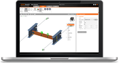
New IDEA StatiCa Version 10.1 is Live
We are happy to announce the brand-new version of IDEA StatiCa 10.1 release. This version brings an exceptional volume of new features and improvements with the focus to enable engineers to work faster, evaluate the requirements of the national code thoroughly and use the optimal amount of material. It does not matter if you focus on steel or concrete structures or if your main goal is a quick and flexible workflow, we have plenty of new enhancements for everybody. The best way to start is...

AECOM to Launch PFAS Solution DE-FLUORO™ at CleanUp 2019 in Adelaide
ADELAIDE — AECOM, a premier, fully integrated global infrastructure firm, announces the launch of DE-FLUORO™, a technology that effectively and permanently removes per- and poly-fluoroalkyl substances (known as ‘PFAS’) at CleanUp 2019. CleanUp, the eighth International Contaminated Site Remediation Conference, will be hosted September 8-12 by CRC CARE in Adelaide. Given the growing demand for an effective way to permanently remove PFAS, a number of AECOM technical specialists will present findin...
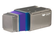
Teledyne Optech Announces the CL-360, a Compact, Long-range, Survey-Grade Lidar Sensor for UAV and Mobile Applications
VAUGHAN, Canada — Teledyne Optech, a Teledyne Technologies [NYSE:TDY] company and global leader in advanced lidar sensors, is pleased to announce the CL-360, the next offering in its new line of compact lidar sensors for UAV and mobile applications. The CL-360 boasts survey-grade data precision that is synonymous with Teledyne Optech lidar sensors and is designed specifically to meet the needs of OEM hardware manufacturers to develop products for mobile, static, UAV or airborne surveying markets...
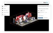
Select and Download Sections of Large Point Clouds Right in Your Browser with NavVis IndoorViewer 2.5
The upcoming release of NavVis IndoorViewer 3D building visualization software will include a new feature to select, crop and download point cloud sections in browser. The beta version of the extended point cloud functionality in NavVis IndoorViewer will be previewed at INTERGEO 2019. Munich, Germany – NavVis, the leading global provider of indoor spatial intelligence technology and enterprise solutions, announces the beta release of NavVis IndoorViewer 2.5. This major software relea...
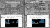
Vectorworks, Inc. Announces 2020 Version of BIM and Design Software
Experience a smoother workflow with improvements to the VGM level of detail. Columbia, MD — Global design and BIM software provider Vectorworks, Inc. announces the 2020 release of Vectorworks Architect, Landmark, Spotlight, Designer and Fundamentals, as well as 2020 versions of Vision and Braceworks. This newest release brings improved software performance, quality enhancements and new data-driven workflows. “Data and usability are the cornerstones of this year’s product line enhancem...

The Wild and Igloo Vision Partner to Bring Real-Time VR/AR Collaboration to Immersive Shared VR Environments
The Wild and Igloo Vision partner to bring real-time VR/AR collaboration to immersive shared VR environments Portland, OR & Shropshire, UK – 10, September 2019 – Today, Igloo Vision and VR/AR collaboration platform The Wild announced their integration, which will open up even greater possibilities for collaboration and experiential design review for teams working in architecture, engineering, and construction (AEC). Igloo Vision designs and develops immersive 360° projection spaces, along...

Road-SIT Survey v. 7.5: The Features that Streamline the Survey Work
10 September, 2019, Bologna Italy – SITECO Infomatica SRL will be attending Intergeo 2019 in Stuttgart, Hall 3, Stand B3.025, showcasing the Road-Scanner family of Mobile Mapping Systems and the NEW software release of Road-SIT Survey. Road-SIT Survey is the mobile mapping data application developed by Siteco, fully compatible with the most widespread mobile mapping systems like the Optech-Lynx, Riegl-VMX, Topcon IPS3 and Leica Pegasus. And of course with the well-known Siteco’s Road-Scanner....

BQE Software Partners with Stripe to Help Firms Get Paid Faster
ePayments will allow BQE Core users to speed up cash flow by sending automated invoices that clients can pay instantly via credit or debit cards. TORRANCE, Calif., Sept. 10, 2019 -- BQE Software Inc. and Stripe have partnered to help professional service firms get paid faster via online payment solution with automated posting to BQE Core accounting. “Businesses all over the world are recognizing the benefits of accepting credit cards, not just to get their invoices paid faster, but also to...

Technology Helping ADOT to Manage Traffic through I-15 Bridge Project
PHOENIX – To enhance safety and manage traffic through the bridge improvement project along Interstate 15 in the Virgin River Gorge, the Arizona Department of Transportation is using a first-of-its-kind alert system to help reduce emergency braking and collisions. With I-15 reduced to one lane in each direction during construction, traffic begins to queue during peak travel times and holidays. A queue warning system that includes portable message boards informs drivers of stop-and-go traffic...
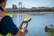
Trimble Announces New Offline Data Transfer and Post-Processing Workflow for Trimble TerraFlex Software
SUNNYVALE, Calif.— Trimble (NASDAQ: TRMB) announced today its Trimble® TerraFlex™ field software now supports the transfer of data between the field and office without the use of Trimble cloud services. The new software workflow—called offline data transfer—is possible through the integration of Trimble TerraFlex and the Trimble Positions™ Desktop add-in for Esri® ArcGIS® Desktop. TerraFlex is a field solution that enables mobile workers to easily collect, manage and edit their geospatial featur...
Video: New Roundabout Under Construction at McIver and Old Florence Roads in Darlington County

Promenade at The Point

June Issue 2026
.jpg?width=225)