
State Governments in the U.S. Using Vexcel Imagery to Aid in COVID-19 Response
United States : The worldwide COVID-19 pandemic has now reached all 50 states in the U.S. In accordance with Federal Government and Center for Disease Control and Prevention (CDC) mandate social distancing is being put in place throughout the nation. As announced on March 17, 2020, state and federal government agencies have been given no-cost or obligation access to high-resolution aerial imagery and related geospatial information captured by Vexcel Imaging to support their responses to the...

Dynamic Infrastructure responds to coronavirus and allows free use of its AI-based bridge maintenance technology
Transportation should keep moving: Dynamic Infrastructure responds to coronavirus pandemic and allows free use of its AI-based bridge maintenance technology by DOTs and PPPs worldwide The New York and Tel Aviv based company Dynamic Infrastructure has decided to open free of charge its AI-based technology to enable Departments of Transportation and Private Public Partnerships (PPP) to continue to remotely manage the critical maintenance of bridges and tunnels during the global emergency r...

Eka Releases Free COVID-19 Risk Monitoring App
Press Release: New York: Eka Software Solutions, the #1 cloud platform for commodity management, announced the release of COVID-19 Risk Monitoring, a free app designed to help customers and prospects quickly gain visibility into supply chain risks to better assess and mitigate risk. The app provides specific insights into the impact of COVID-19 by showing a company’s contract position across countries with reported cases of the virus. Based on company data, the app instantly visualizes contracts...

TerraView Demonstrates Commitment to the Building of the American Drone Industry with Introduction of Second Commercial UAV Model
RangePro X8P (Pixhawk), the follow-up to the RangePro X8, is proudly designed and manufactured in the USA, with U.S.-made flight control system (FCS) components and highly secure radio options Valencia, CA — TerraView, a California-based unmanned aircraft system (UAS) development and manufacturing company, today unveiled the RangePro X8P - Pixhawk, a follow-up model to last year’s RangePro X8, now with system components and options that meet federal government and Department of Defense (DoD)...
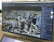
SLA launches 3D Singapore Sandbox at GeoWorks
Nationwide 3D geospatial data available for testing innovative solutions Set up to drive innovation & foster well-connected community of geospatial firms Singapore Land Authority (SLA) has announced the launch of 3D Singapore Sandbox, a first-of-its-kind collaborative environment for technology industry partners and developers. This initiative aims to encourage the use of 3D city models and geospatial data to develop and test new applications and services that can benefit both the publi...

Concept3D Makes Enterprise Level 360° Virtual Tours Available at No Charge
With Global Populations Unable to Travel, Concept3D Aims to Support Continuity With Open Access to its Enterprise Level Virtual Tour System To support higher education, businesses, major event locations and others with Virtual Tours, Concept3D is opening up its Enterprise Level 360° Tour system through June 30, 2020, with clients able to add up to five tour stops and use the advanced features of the Enterprise system at no charge. The 360° Tour System is a fast and effective tool to buil...

HxGN Content Program provides aerial imagery in response to COVID-19
WASHINTON, D.C., USA — Hexagon’s Geosystems division announced today the HxGN Content Program is making its aerial imagery library of the entire United States and Europe freely available to any government agencies and non-profit organizations managing the COVID-19 outbreak. The orthorectified high-resolution aerial imagery can be used by first responders, healthcare departments and GIS professionals to assess the spread of the virus, visualize the scope of affected areas, plan coordination e...

Vectorworks 2020 SP3 Launch Brings Quality and Performance Improvements
Vectorworks Spotlight quality fixes, BIM enhancements and Enscape and NBS Chorus partnerships are a few of the coveted updates Columbia, MD –Global design and BIM software solutions provider Vectorworks, Inc. releases Vectorworks 2020 Service Pack 3 (SP3) with quality and performance improvements as the central theme of this update. As part of the SP3 release, Vectorworks is introducing additional partner integrations with Enscape and NBS Chorus, as well as providing key updates for user...
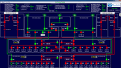
Russelectric, A Siemens Business, Offers Customized SCADA Systems
Enables remote monitoring of all power system functions Hingham, MA – Russelectric, A Siemens Business, a leading manufacturer of power control systems and automatic transfer switches, announces the availability of customized Russelectric® supervisory control and data acquisition (SCADA) systems, enabling users to monitor system operation, acknowledge alarms, and review PLC setpoints and alarm history. All screens are custom-designed for each power control system, providing the most realistic...

Ideate Software Tools Help Lemay Focus on Customers, Communities and Future Generations
Communities and Future Generations San Francisco, CA– Ideate Software, a veteran Autodesk Developer Network member, is pleased to share how Lemay, an award-winning architectural firm, uses Ideate Software tools. Jean-Marc Demeo, Gestionnaire BIM Principal at Lemay said, “Our teams are motivated by design challenges. You can see, hear and feel the energy as they work together to explore options and create solutions.” To help them stay focused on creative thinking, Lemay provides the best...
Video: New Roundabout Under Construction at McIver and Old Florence Roads in Darlington County

Promenade at The Point

June Issue 2026
.jpg?width=225)