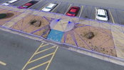
Virtual Surveyor Introduces Curb & Gutter Mapping in New Version of Drone Surveying Software
AARSCHOT, Belgium – Virtual Surveyor has introduced Curb & Gutter mapping functionality in Version 7.6 of its popular drone surveying software. The new capability enables surveyors to create a lightweight CAD model of curbs and gutters along the edges of streets and parking lots from standard orthophotos and elevation models captured by unmanned aerial vehicles (UAVs), or drones. “Accurately mapping the height of curbs and geometry of gutters is critical for modeling the flow of water away fr...

Connected Vehicle Sensors Installed in East Hawaii
HILO – The Hawaii Department of Transportation (HDOT) is pleased to announce the installation of Blyncsy Intersect Connected Vehicle units on the 16 state-owned traffic signals in East Hawaii in cooperation with Elemental Excelerator. These connected vehicle sensors calculate travel times between units by anonymously collecting data from Bluetooth-enabled devices in passing vehicles. HDOT and the County of Hawaii will use data from the units to optimize traffic signal timing. Hawaii Island dr...
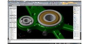
IntelliCAD Technology Consortium Announces Release of IntelliCAD® 10.0a
Portland, OR, USA — The IntelliCAD Technology Consortium (ITC) today announced the release of IntelliCAD 10.0a. IntelliCAD 10.0a is a maintenance release for version 10.0 that was previously issued on July 30, 2020. IntelliCAD maintenance releases concentrate on fixes, but IntelliCAD 10.0a includes minor new features: choose the color of print stamps, determine whether print stamps print upside down, and use the new Show Palettes and Hide Palettes commands. Also included for multiline text are...
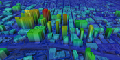
UP42 Partners with Intermap to Bring High-Resolution Elevation Data to UP42’s Geospatial Marketplace
NEXTMap Digital Surface Model (DSM) BERLIN, Germany – UP42 is pleased to announce that the NEXTMap Elevation Data Suite from Intermap Technologies is now offered on the UP42 developer platform for Earth observation data and analytics. The NEXTMap 3D elevation products are available as Digital Surface Models (DSM) and Digital Terrain Models (DTM) at one-, five-, and 10-meter resolution. The addition of NEXTMap datasets to the UP42 marketplace enables users to build even more powerful...
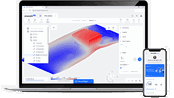
OnScale Introduces OnScale Solve™: The World’s First Cloud Engineering Simulation Platform
Silicon Valley, CA – OnScale today announced the release of the OnScale Solve, the web-based cloud engineering simulation platform bringing to engineers powerful multiphysics solvers and scalable cloud supercomputer resources. “OnScale Solve gives engineers, designers, and analysts access to the powerful cloud-native engineering simulation tools and cloud supercomputer resources they need to innovate, solve complex problems, and efficiently work from any location and device,” says Ian Campbel...

New Swedish technology to support a greener aviation recovery
Flying is like competition sailing: it is all about using good winds and avoiding unfavorable air currents. To allow airlines to fully use the favorable winds there is a new weather optimization service available that shows exactly how the wind blows and where there is bad weather in the atmosphere. With this knowledge airlines can save hundreds of tons of fuel per month which also means less emissions The best feature of the new optimisation service, delivered by AVTECH Sweden, is that airli...

Datumate Announces Autodesk BIM 360 Integration for Improved Construction Site Visualization and Project Management
No-code integration empowers planning and construction teams with essential construction intelligence extracted in near real-time from survey-grade reality captures. YOKNEAM, Israel – Datumate, developer of the DatuBIM Construction Data Analytics platform, is pleased to announce today a productivity-enhancing integration with BIM 360®, a construction management software part of Autodesk Construction CloudTM. Seamless integration enables joint customers to stay informed about on-site construc...

GSSI Updates to StructureScan™ Mini XT GPR Kit and Palm XT Antenna
GSSI, the world’s leading manufacturer of ground penetrating radar (GPR) equipment, announces new updates to the StructureScan™ Mini XT all-in-one GPR concrete inspection system, including a software update and a newly designed survey wheel for the Palm XT Antenna. Rugged, compact, and flexible, the StructureScan Mini XT is ideal for locating rebar, conduits, post-tension cables, and voids. The Mini XT can help identify structural elements, including pan deck and concrete cover, and can also...
Quantum Spatial Completes Data Collection for NOAA's Largest Coastal Mapping Project
Unique Combination of Sensors Used to Gather High Resolution Topographic and Bathymetric Lidar Data Along 12,000 Square Miles of Eastern Seaboard and Gulf Coast Areas Not Surveyed Since Civil War Era HOLLYWOOD, Fla.– Quantum Spatial, Inc., an NV5 company and North America’s largest geospatial data firm, recently completed the collection of topographic and bathymetric lidar and digital imagery for the National Oceanic and Atmospheric Administration’s (NOAA) largest coastal mapping projec...

Digital Twin Consortium Announces Liaison with buildingSMART
The Digital Twin Consortium® and buildingSMART International (bSI) have entered into a liaison agreement to accelerate the development, deployment, and wide-scale adoption of open digital twin technologies. Both have agreed to the following: Collaborating on standards requirements, including open-source standards Realizing interoperability by harmonizing technology components and other elements to enable connected data environments Aligning work in horizontal domains for ad...
Video: New Roundabout Under Construction at McIver and Old Florence Roads in Darlington County

Promenade at The Point

June Issue 2026
.jpg?width=225)