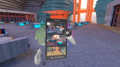
The Wild Releases ‘Tours’ to Facilitate Collaborative Presentations in VR/AR
Portland, OR – Today, VR/AR collaboration software company TheWild announced their biggest release to date, ‘Tours’, to turn creative visions into a shared experience in a collaborative virtual workspace. Tours in The Wild is a compelling new immersive presentation feature to help architecture, design, and enterprise teams frame focused stories through their design spaces. Tours helps prompt meaningful conversation and present smarter to clients and collaborators by guiding them through preci...
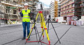
Leica Geosystems Introduces One App for All Terrestrial Laser Scanning Portfolio
All Leica Geosystems’ terrestrial laser scanner users, now including Leica ScanStation P-Series users, can seamlessly capture and document high-quality data and verify registration with a few simple clicks with the Leica Cyclone FIELD 360 mobile-device app. Award-winning mobile-device app, Leica Cyclone FIELD 360 now expands in-field data acquisition and visualisation for all Leica Geosystems 3D terrestrial laser scanners (HEERBRUGG, Switzerland) – Leica Geosystems, part of Hexa...

Q-Free announces Kinetic™ Mobility, blazing a trail to unify local, intercity, and regional traffic operations in a single platform
Cutting-edge platform will dramatically simplify traffic management and bridge the gap between traditionally siloed operations including signal and freeway management CARLSBAD, CA – Q-Free (OSE: QFR), a global leader in mobility solutions for smart city infrastructure, today introduced Kinetic™ Mobility, an integrated traffic management platform delivered in an entirely new way. Changing the existing industry model, Kinetic Mobility enables agencies to collaborate on common mobility goals acr...
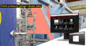
Leica Geosystems announces new Leica Cyclone ENTERPRISE Project Management Hub
Leica Cyclone ENTERPRISE provides a next-generation universal project management hub that supports management, collaboration and deliverable creation in the desktop or on the web, in the office and on the go. New reality capture management and collaboration platform provides a single source of truth for deliverable creation and rapid viewing (HEERBRUGG, Switzerland) – Leica Geosystems, part of Hexagon, announces Leica Cyclone ENTERPRISE, a new, user-managed, enterprise-level real...
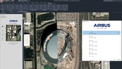
Plexscape and Airbus join forces to offer the best satellite imagery to the AEC industry
Following a partnership between Plexscape and Airbus, engineers using AutoCAD can now have easy and fast access to OneAtlas, the Airbus’ geospatial digital platform delivering the freshest satellite imagery, through the new version of Plex-Earth. By getting access to recent imagery, engineers get a complete understanding of their project sites' conditions from the very beginning of their design workflow, speeding up processes and avoiding the high cost of rework by reducing errors. Conventio...
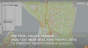
Video: New Machine Learning Tool Tracks Urban Traffic Congestion
A new machine learning algorithm is poised to help urban transportation analysts relieve bottlenecks and chokepoints that routinely snarl city traffic. The tool, called TranSEC, was developed at the U.S. Department of Energy’s Pacific Northwest National Laboratory to help urban traffic engineers get access to actionable information about traffic patterns in their cities. Currently, publicly available traffic information at the street level is sparse and incomplete. Traffic engineers genera...

GSSI Updates to StructureScan™ Mini XT GPR Kit and Palm XT Antenna
GSSI, the world’s leading manufacturer of ground penetrating radar (GPR) equipment, announces new updates to the StructureScan™ Mini XT all-in-one GPR concrete inspection system, including a software update and a newly designed survey wheel for the Palm XT Antenna. Rugged, compact, and flexible, the StructureScan Mini XT is ideal for locating rebar, conduits, post-tension cables, and voids. The Mini XT can help identify structural elements, including pan deck and concrete cover, and can also...
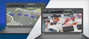
FARO Zone 3D 2021 Software Released for Optimal Forensic Scene Documentation
Lake Mary, Florida – FARO® Technologies, Inc. (NASDAQ: FARO), a global leader for 3D Metrology, AEC (Architecture, Engineering & Construction), and Public Safety Analytics, today announced the release of its new FARO Zone 3D 2021 software for crime, crash, fire and security applications. The latest edition of FARO Zone represents a significant software advancement that empowers public safety professionals with even more tools to diagram, document, share and analyze forensic scenes, and create co...

APTA and the Transit app Partner to Unveil New Ridership Trends Dashboard
The American Public Transportation Association (APTA) and the Transit app today released the APTA Ridership Trends dashboard, a new resource providing up-to-date, week-by-week estimations of public transit ridership for agencies across the United States. The dashboard is available at www.transitapp.com/APTA. During the COVID-19 pandemic, public transit ridership has risen and fallen rapidly in response to public health alerts across the country. These changes make it difficult for public tran...
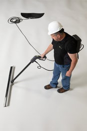
Solmax’s new Leak Location Suite – an advanced approach to preventing geomembrane leaks
Smart technology for cost-effective, high-performance containment Geosynthetics manufacturer Solmax has launched a Leak Location Suite (LLS) that raises the bar on electric liner integrity (ELI) surveys. Solmax’s LLS aims to raise standards with its advanced approach, building repeatable liner testing and remediation into containment design. “Geosynthetics are critical to contain waste — they line the world’s biggest landfills and keep hazardous outputs from mines and industrial processes f...
Video: New Roundabout Under Construction at McIver and Old Florence Roads in Darlington County

Promenade at The Point

June Issue 2026
.jpg?width=225)