Vectorworks, Inc. Announces Unreal Engine Partnership and Service Pack 3 Release
Major updates include a new real-time rendering connection to Twinmotion and Unreal Engine, a direct connection with Solibri plus a new Vectorworks Cloud Services folder sharing feature for project teams Columbia, MD (March 16, 2021)—Global design and BIM software provider Vectorworks, Inc. has released its third service pack for the Vectorworks 2021 product line focusing on key updates for their architecture, landscape architecture and entertainment design customers. Notable highlights...

Breaking The Blueprint
Digital technology allows organizations to collaborate earlier, forming new, more efficient, or safer ways of working. While its implementation is easier for uniform processes in bulk, things get trickier when working at a rarer size and scale. However, technology exists that can make planning a heavy lift project as simple as walking around site – months or years before it even exists. Mammoet World investigates. The role of engineered heavy lifting has always been to support the incredib...

Cityzenith goes high-end with new high-rise Digital Twin deal in the Middle East
Cityzenith is hitting new heights with a pioneering contract to create a multi-purpose Digital Twin for an ultra-luxury residential condominium tower in the Middle East. The Lamina Tower is under construction at the Jeddah Corniche resort on the Red Sea in Saudi Arabia, and with premium 10,000 ft² units revealing unobstructed views of the Red Sea from all rooms, is billed to be one of the most luxurious residential properties in the country. The contract with Cityzenith makes it the first...

New Leica CityMapper-2L configuration enables digital twin creation of cities in complex weather and congested flight operation areas
With a new focal length combination for ultra-high resolution projects or operations when low flying altitude is required, the Leica CityMapper-2 now offers a full product portfolio covering all flying parameters and GSD’s (HEERBRUGG, SWITZERLAND) – Leica Geosystems, part of Hexagon, introduces the new Leica CityMapper-2L configuration specifically designed for airborne urban mapping projects at low altitude operation. Lower flying heights can be required by air traffic control (ATC) restrict...

New ASCE Publication Offers Guidance on Using Remote Sensing Monitoring
Reston, Va. – ASCE’s newest publication, Remote Sensing for Monitoring Embankments, Dams, and Slopes, GSP 322, provides information on selecting and deploying a monitoring network to assess the behavior, geometry, total and differential for embankments, dams, and slopes (EDS) movement, and potential risks of the EDS movement on people and infrastructure. This Geotechnical Special Publication covers general technologies used for EDS monitoring, selection and installation of networked sensors f...
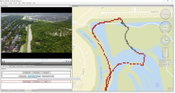
Remote GeoSystems Awarded Patent for Essential Geospatial Full Motion Video “Geo-editing” Technology
FORT COLLINS, Colorado, USA, - Remote GeoSystems, Inc., a global provider of immersive geospatial full motion video and survey data mapping software and recorder solutions, is pleased to announce the award of US Patent Number 10,893,287 on January 12, 2021 for essential elements of “video geo-editing” technology capabilities. The patent covers map-based GPS data and video segment selection, extraction and re-splicing functionality found in products like LineVision Desktop, Video GeoEditor and...

Q-Free launches first multiuse high-speed weigh-in-motion and multimodal classification solution
The versatile, future-proof HI-TRAC® TMU4X was developed in direct response to global demand for a single roadside data solution to help communities address Vision Zero and sustainability goals. NORTH SOMERSET, England, UK – Q-Free (OSE: QFR), a global leader in mobility solutions for smart city infrastructure, announced the formal launch of the HI-TRAC® TMU4X, an advanced multimodal, high-speed weigh-in-motion (WIM) and data collection solution offering automatic vehicle classification...

Autodesk Expands Preconstruction Offering with Global Launch of Autodesk Takeoff
SAN RAFAEL, Calif., March 9, 2021 — Autodesk, Inc. (NASDAQ: ADSK) today announced the worldwide availability of Autodesk Takeoff, a new product that empowers estimators to perform 2D and 3D quantification workflows from a common data environment to increase collaboration, speed and accuracy during the estimation process. Originally announced at Autodesk University in November 2020, Autodesk Takeoff will join Autodesk Build and Autodesk BIM Collaborate as part of the Autodesk Construction Cloud u...

Tensar Unveils Next Generation of the Leading Geosynthetic Design Software
SpectraPave wins 2021 Constructech Top Products Award; launches online and mobile app (Alpharetta, GA) – For years, engineers, contractors and owners around the world have depended on Tensar’s SpectraPave software as a tool to design optimal pavement and gravel sections for a variety of subgrade support conditions. The new generation of this industry-leading software was specially redesigned to accommodate the collaborative, online needs of today’s civil and geosynthetic engineers. Spect...
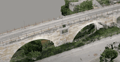
Video: Reimagine Bridge Inspection with Azure Remote Rendering and HoloLens
Discover how Bentley Systems enables remote bridge inspection with Azure Remote Rendering and #Microsoft HoloLens. Learn more about Azure Remote Rendering: https://www.aka.ms/remoterendering
Video: New Roundabout Under Construction at McIver and Old Florence Roads in Darlington County

Promenade at The Point

June Issue 2026
.jpg?width=225)