
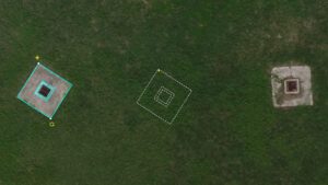
Image: Duplicating a manhole drawing with the Move/Copy tool. Faster Overall Workflow AARSCHOT, Belgium – Virtual Surveyor has enhanced its popular smart drone surveying software with new planimetric survey capabilities. In addition to multiple…
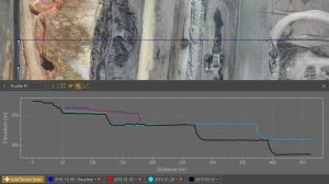
Virtual Surveyor Provides Comprehensive Insights into Drone Survey Data with Addition of Profile View
Excavation progress over four different dates shown through the profile view (Image) AARSCHOT, Belgium – With the goal of giving surveyors…
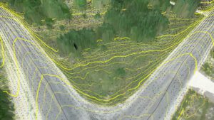
Virtual Surveyor Improves Point Cloud Workflow to Fully Leverage Drone LiDAR Payloads
Contour lines at bare earth from Zenmuse L1 data AARSCHOT, Belgium – Virtual Surveyor has developed an enhanced point cloud workflow for Version…
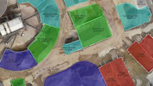
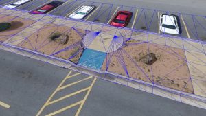
Virtual Surveyor Introduces Enhanced Stockpile Reporting in Drone Surveying Software
Site with aggregates showing different material fractions. AARSCHOT, Belgium, 1 June 2021 – Calculating and reporting stockpile inventories are now easier and faster in the latest version of the Virtual Surveyor drone surveying software. Virtual Surveyor…
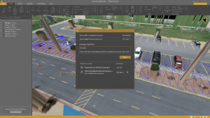
Virtual Surveyor Introduces Dropbox Integration for Easy Collaboration and File Access from Anywhere
Sharing a Virtual Surveyor project externally to a collaborative team space.(Image) AARSCHOT, Belgium, 6 April 2021 – Virtual Surveyor has introduced Dropbox integration in Version 8.0 of its popular drone surveying software. This means Virtual Surveyor…
Virtual Surveyor Introduces Curb & Gutter Mapping in New Version of Drone Surveying Software
AARSCHOT, Belgium – Virtual Surveyor has introduced Curb & Gutter mapping functionality in Version 7.6 of its popular drone surveying software. The new capability enables surveyors to create a lightweight CAD model of curbs and gutters along the edges…
