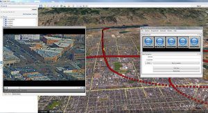
FORT COLLINS, Colorado – Remote GeoSystems, Inc. is pleased to announce the release and availability of the all new LineVision™ Google Earth Extension – commercial software for UAV, airborne & terrestrial mobile inspection and survey projects requiring…

