
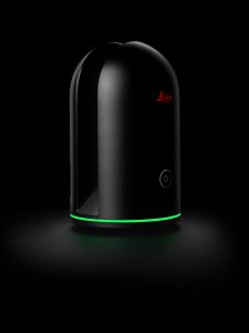
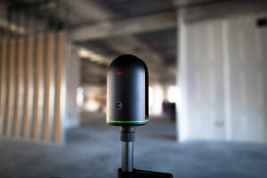
Norcross, Georgia – Leica Geosystems, a leader in the world of measurement and survey for nearly 200 years, has redefined what’s possible in the imaging laser scanner market with the introduction of the BLK360, the world’s smallest 3D imaging laser scanner.…
Leica Geosystems Announces Complete Imaging Solution: Leica BLK360 Imaging Laser Scanner and Autodesk ReCap 360 Pro App
Las Vegas, November 16th, 2016, Leica Geosystems announced the “BLK360,” a revolutionary miniaturized black 3D imaging laser scanner. The product…
