HCSS Unveils the Future of HeavyBid on the Web
HCSS introduces a modern, web-based version of its flagship estimating software. SUGAR LAND, Texas – HCSS, the leading provider of heavy civil construction software, officially announces the launch of its reimagined estimating solution: the web-based HeavyBid. Marking the company’s 40th anniversary, this evolution brings the performance relied upon by tens of thousands of estimators into the modern, mobile environment that today’s contractors require. HCSS will host live demos of the new HeavyBi...

ALLPLAN Powers AI-Enabled BIM Transformation Across Global Architecture, Engineering and Infrastructure Projects
From concept to construction: ALLPLAN integrates AI and BIM to help multidisciplinary teams deliver complex projects with greater speed, precision, and confidence. Project: Heaven & Hell, Copyright: Manuel Kottersteger ALLPLAN, a leading global provider of BIM design-to-build software for the architecture, engineering, and construction (AEC) industry and part of the Nemetschek Group, today announced the growing adoption of its AI-enabled platform across landmark building and infrastructure proje...

Making structural health monitoring scalable: IDS GeoRadar launches MyMO – a portable device for fast, non-contact monitoring
MyMo is a fast, non-contact structural monitoring solution that helps engineers evaluate more assets, more often. Designed to complement traditional inspections and fixed monitoring systems, MyMo supports screening and prioritisation by revealing where deeper investigation or intervention is needed. Easy to transport and deploy by one person in minutes, MyMo makes structural monitoring scalable. (Pisa, Italy, 17 February 2026) – IDS GeoRadar, part of Hexagon, today announced the launch of MyMo,...

Geo Week 2026: Emesent Launches the Emesent GX1, an All-in-One SLAM LiDAR, RTK and 360° Imagery Scanner
Industry first: GX1 delivers independently validated 5-10mm global accuracy, providing surveyors, AEC sector with long-awaited mobile scanning speed and survey-grade accuracy they can prove DENVER ― Today at Geo Week, Emesent, a global leader in autonomous mapping technology, launches the Emesent GX1, the world's most accurate integrated Simultaneous Localization and Mapping (SLAM) and Real-Time Kinematic (RTK) scanner. The product marks a significant breakthrough and industry first, by achievin...

Topcon expands Capture Reality portfolio with introduction of new handheld scanning system
LIVERMORE, Calif. — February 16, 2026 — Topcon Positioning Systems has introduced the CR-S1, a handheld scanning system that combines LiDAR, panoramic cameras, visual SLAM cameras, and a GNSS antenna in a single device. The CR-S1 utilizes Topcon’s Collage mass-data software ecosystem central to a connected workflow. The CR-S1 expands the company’s Capture Reality portfolio as a higher‑performance option alongside the CR‑S2. It offers increased point‑cloud density, extended scanning range, and up...

Esri and Pix4D Launch Real-Time Terrestrial Mapping Workflow
Alliance Brings Seamless Integration of Asset Data into ArcGIS for PIX4Dcatch Users Pix4D joins with Esri to launch new terrestrial scanning workflow for infrastructure-focused organizations. Esri and Pix4D workflow lets field teams capture accurate 3D models and augmented reality using PIX4Dcatch app data integrated directly into ArcGIS Online in real time. New integration enables users to document subsurface assets with seamless precision. Workflow brings high-fidelity, georeferenced documenta...

New Leica MultiMapper brings portability and versatility to airborne mapping operations
A compact, light-weight hybrid imaging and LiDAR system designed for rapid deployment and efficient operations Mounted to a helicopter or fixed-wing aircraft, the flexible solution performs consistently across multiple aerial mapping applications – from city modelling and corridor mapping to infrastructure inspection, and post-event assessment Enables pilot-only operation and reduces operational complexity (Heerbrugg, Switzerland, 16 February 2026) Leica Geosystems, part of Hexagon, today introd...

Heliox, A Siemens Business, Highlights VersiCharge Blue™ 80A for Fleet and Commercial EV Charging
Powerful, Reliable Charging Solution Delivers Industry-Leading Speed, Safety, and Versatility for Electric Vehicle Infrastructure Heliox, A Siemens Business, a leader in EV charging solutions, is proud to highlight its VersiCharge Blue™ 80A, engineered for the most demanding fleet and commercial vehicle charging environments. Designed to deliver up to 80A AC (19.2 kW) power output, the VersiCharge Blue 80A ensures that fleet operators can keep vehicles moving efficiently and reduce operational d...

Aerial Surveys International Teams with Polygon Solutions, Urban Hawk at Geo Week 2026 to Unveil TrinityGeo™ Geospatial Intelligence Product
WATKINS, Colorado, USA– Aerial Surveys International, in partnership with Polygon Solutions and Urban Hawk, will unveil and demonstrate the TrinityGeo 3D infrastructure monitoring product at Geo Week 2026 in Denver. TrinityGeo integrates state-of-the-art aerial data with advanced 3D analysis and AI technologies to deliver actionable spatial insights for critical infrastructure projects. “TrinityGeo provides geospatial intelligence – including precise 3D elevation and structural details – for ass...
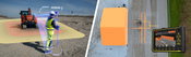
Leica Geosystems releases Leica Xsight360 and advanced Safety Awareness portfolio in North America
ATLANTA, USA: Leica Geosystems, part of Hexagon, today announced the official launch of the Leica Xsight360 safety awareness solution in the United States and Canada. The system complements its comprehensive safety awareness portfolio, including dynamic 3D avoidance technology developed jointly with Xwatch Safety Solutions. Across North America, jobsites are becoming increasingly complex, with tighter schedules, labor shortages, and growing regulatory requirements. Safety professionals and proje...
Video: Crashes Drop Measurably After Rural Road Safety Improvement Project on US 521 in Lancaster County

AdventHealth Weaverville Hospital

June Issue 2026
.jpg?width=225)