
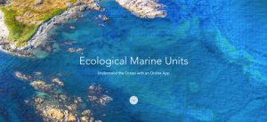
REDLANDS, Calif.- Esri, the world leader in smart mapping technology, announced a whole new way of measuring the ocean on September 15, 2016, at the Oceans Conference in Washington, DC. Ecological Marine Units (EMUs) are Esri’s gift to a world whose final…

Bentley’s AssetWise InspectTech Helps State DOTs and Agencies Achieve Compliance with FHWA MAP-21 Regulations
EXTON, Pa.- Bentley Systems, Incorporated, a leading global provider of comprehensive software solutions for advancing infrastructure, today announced…
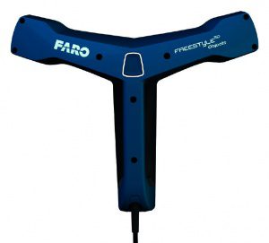
FARO Introduces Freestyle3D Objects, the First Handheld, Color Laser Scanning Solution Through FARO’s Early Adopter (EA) Program Specifically for the Public Safety Forensics and Product Design Markets
Lake Mary - FARO® (NASDAQ: FARO), the world's most trusted source for 3D measurement and imaging solutions for factory metrology, product design, construction…

FARO Releases High-Resolution Array Imager for Factory Metrology and Product Design Applications
Lake Mary, FL - FARO® (NASDAQ:FARO), the world’s most trusted source for 3D measurement and imaging solutions for factory metrology, product design, construction BIM/CIM, public safety forensics and 3D solutions and services applications, announces the…

FARO Releases SCENE Version 6.1, Introducing a Fully Integrated Point Cloud to 3D Mesh Engine for Product Design and Construction BIM-CIM Professionals
LAKE MARY, Fla. - FARO® (NASDAQ: FARO), the world's most trusted source for 3D measurement and imaging solutions for factory metrology, product design, construction BIM/CIM, public safety forensics and 3D solutions and services applications, announces the…
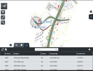
Bringing the Civil Engineering Office to the Field Speeds Approvals and Helps Resolve Issues During Design, Construction, and Operations
Bentley Systems announces OpenRoads Navigator CONNECT Edition, an innovative application that provides civil and transportation professionals an easy-to-use, dynamic product for quick access to civil design information in the field. OpenRoads Navigator supports…

Trimble Connected Mine Provides Spatial Data Visualization Using Trimble and Microsoft Mixed-Reality Technologies
SUNNYVALE, Calif. —Trimble (NASDAQ:TRMB) announced today the release of its Trimble® Connected Mine™ Visual Intelligence module with support for mixed-reality technology including Microsoft HoloLens to provide visual collaboration of mine spatial data.…
Buckeye Mountain and Trimble Partner to Bring Mobile Computing, GPS and AEI Tag to Railways
NIWOT, Colo.- Buckeye Mountain and Trimble have been working together in an effort to provide the railroad industry with products that meet their specific needs for mobile computers, AEI (railcar automatic equipment identification tags) and GPS. Trimble's…

Quickly Produce Conceptual Roadway Designs
Bentley Systems announces OpenRoads ConceptStation, a conceptual modeling application that empowers highway engineering professionals to quickly create conceptual road and bridge models in a matter of hours – not days. OpenRoads ConceptStation enables rapid…
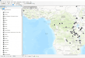
Exprodat Increases Oil & Gas Workflow Integration with Updated Data Assistant
Exprodat, the oil and gas ArcGIS platform specialist, Esri Gold Partner and Getech group company, has released the latest version of its popular Data Assistant software, which simplfies and speeds up the process of importing and exporting common exploration…
