
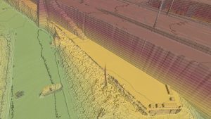
LEUVEN, Belgium – Virtual Surveyor has unveiled Terrain Lenses in Version 6.3 of its popular drone surveying and mapping software. Overlaid on a LiDAR point cloud or orthophoto, the six lenses enhance different aspects of the terrain in 3D to give users…

McCain Inc. to Unveil Transparity® TDX, at the Intelligent Transportation Society of America’s Annual Meeting
VISTA, California – McCain, Inc. announced today that it will formally unveil Transparity® TDX during the Intelligent Transportation Society of America’s…
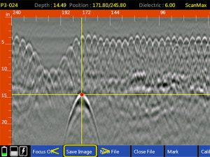
GSSI Releases Improved StructureScan™ Mini XT GPR Concrete Inspection Features with Software Update
GSSI, the world’s leading manufacturer of ground penetrating radar (GPR) equipment, announces the release of a major software update for the StructureScan™…
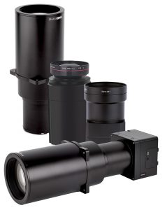
Phase One Industrial Introduces Three High Performance Lenses for High-Altitude Aerial Photography and Long-Range Aerial and Ground Inspection
COPENHAGEN – Phase One Industrial today expanded its RS and RSM lens offering with three new high performance lenses for high-altitude aerial photography and long-range aerial and ground inspection applications. The 300mm AF, 180mm, and 150mm MK II lenses…
Topcon Announces Next Generation Flight Planning Software
LIVERMORE, Calif., U.S./ CAPELLE A/D IJSSEL, the Netherlands – Topcon Positioning Group announces the next generation flight planning system for its rotary-wing aerial UAV offering — Intel® Mission Control Software. The new software…

Topcon Announces Advanced Bentley Integration for Aerial Photogrammetry Processing
LIVERMORE, Calif. & CAPELLE A/D IJSSEL, Netherlands - Topcon Positioning Group announces new cloud-based photogrammetry processing powered by Bentley ContextCapture to its MAGNET Collage Web web-based service for publication, sharing, and analysis of reality…
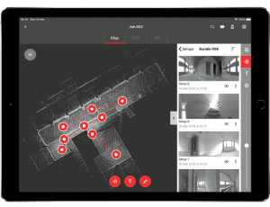
New Complete Ecosystem Created with Smallest Imaging Laser Scanner, Award-Winning Mobile-Device App
(HEERBRUGG, SWITZERLAND, 22 MAY 2019) - Leica Geosystems, part of Hexagon, today announced the Leica Cyclone FIELD 360 laser scanning mobile-device app now works in conjunction with the Leica BLK360 imaging laser scanner to create a laser scanning…

Trimble Releases Next-Generation Integrated Smartphone and GIS Data Collector
SUNNYVALE, Calif.— Trimble (NASDAQ: TRMB) introduced today the Trimble® TDC600 handheld, an ultra-rugged, all-in-one smartphone and Global Navigation Satellite System (GNSS) data collector for Geographic Information System (GIS) and field inspection…

Delair Introduces Open Payload Version of Long-Range UAV to Enable Custom Configuration of Sensing Capabilities
TOULOUSE, France – Delair, a leading supplier of commercial drone solutions, today introduced a new model of its popular long-range UAV, the Delair DT26, which offers an easy-to-integrate architecture for adding user-specified sensors and other…
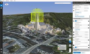
Gaist’s Mapping Solution Could Boost Efficiency for Utilities Market by 10 Per Cent at 0.01% of Project Cost
London, UK – Utilities companies looking to cut the cost and time of their construction works today have a new solution available to them as Gaist revealed its unique infrastructure digital twin has the potential to increase efficiency output by 10 per cent…
