
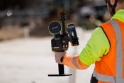
Making structural health monitoring scalable: IDS GeoRadar launches MyMO – a portable device for fast, non-contact monitoring
MyMo is a fast, non-contact structural monitoring solution that helps engineers evaluate more assets, more often. Designed to complement traditional inspections and fixed monitoring systems, MyMo supports screening and prioritisation by revealing where deeper investigation or intervention is needed. Easy to transport and deploy by one person in minutes, MyMo makes structural monitoring scalable. (Pisa, Italy, 17 February 2026) – IDS GeoRadar, part of Hexagon, today announced the launch of MyMo,...

Geo Week 2026: Emesent Launches the Emesent GX1, an All-in-One SLAM LiDAR, RTK and 360° Imagery Scanner
Industry first: GX1 delivers independently validated 5-10mm global accuracy, providing surveyors, AEC sector with long-awaited mobile scanning speed and survey-grade accuracy they can prove DENVER ― Today at Geo Week, Emesent, a global leader in autonomous mapping technology, launches the Emesent GX1, the world's most accurate integrated Simultaneous Localization and Mapping (SLAM) and Real-Time Kinematic (RTK) scanner. The product marks a significant breakthrough and industry first, by achievin...

MBH Architects Announces Promotion of Joe Irwin and Hillary Thompson to Principal
Joe Irwin and Hillary Thompson Leadership appointments strengthen innovation, design technology, and brand strategy across the firm MBH Architects, an award-winning architecture and design firm, has announced the promotion of Joe Irwin and Hillary Thompson to Principal, recognizing their leadership, technical expertise, and lasting contributions to the firm’s growth, innovation, and design excellence. Ryan McNulty, President and Principal said: “Joe and Hillary exemplify the curiosity, rigor, an...
Topcon expands Capture Reality portfolio with introduction of new handheld scanning system
LIVERMORE, Calif. — February 16, 2026 — Topcon Positioning Systems has introduced the CR-S1, a handheld scanning system that combines LiDAR, panoramic cameras, visual SLAM cameras, and a GNSS antenna in a single device. The CR-S1 utilizes Topcon’s Collage mass-data software ecosystem central to a connected workflow. The CR-S1 expands the company’s Capture Reality portfolio as a higher‑performance option alongside the CR‑S2. It offers increased point‑cloud density, extended scanning range, and up...

EasyMining and Ragn-Sells awarded 2026 Wastewater & Circularity Prize
The 2026 Wastewater & Circularity Prize goes to EasyMining and Ragn‑Sells for the development and commercialization of technology and products for phosphorus recovery from sewage sludge ash. The prize will be awarded at the “Water Wastewater Circularity” Conference (Vatten Avlopp Kretslopp) in Karlstad on 12 March 2026, where Sara Stiernström, Head of Product Development at EasyMining and Pär Larshans, Chief Sustainability Officer at Ragn‑Sells will receive the award. Each year, the Swedish VA‑g...

Eight Standout Steel Bridges--and One Exceptional DOT--You Should Know for 2026
CHICAGO - Innovation spans the steel bridge industry, but eight recent bridges rise above the rest. The American Institute of Steel Construction and the National Steel Bridge Alliance are recognizing eight bridges with 2026 Prize Bridge Awards--the structural steel industry’s highest design honor for bridges. “People across the country rely on steel bridges to connect them to the communities where they live, work, and play--and it takes a specialized group of experts to create those bridges,” sa...

Topcon and Fixposition announce collaboration agreement
LIVERMORE, Calif. — February 16, 2026 — Topcon Positioning Systems and Fixposition have entered an agreement to collaborate on integrated technology for future product offerings. “Topcon provides high-precision GNSS (global navigation satellite system) positioning technologies for geomatics, construction, and agriculture applications worldwide. Working with companies such as Fixposition — specialists in Visual RTK (real-time kinematic) and visual-aided positioning — helps create added value for...

HDR Selected to Lead Program Management Services for Lexington’s Blue Grass Airport
HDR has been selected by the Lexington-Fayette Urban County Airport Board to provide program management services for Blue Grass Airport’s next decade of capital improvements. This milestone sets the stage for transformative enhancements that will strengthen connectivity, improve passenger experience, and support Central Kentucky’s economic growth. The multiyear program will advance critical projects identified in the airport’s master plan, including terminal development, landside access improvem...

Topcon secures early access to Xona’s Pulsar satellite navigation service
LIVERMORE, Calif —Topcon Positioning Systems has signed a commercial agreement with Xona to secure early-adopter access to Pulsar, Xona’s low Earth orbit (LEO) satellite navigation constellation. This agreement positions Topcon among Xona’s first commercial customers preparing to integrate Pulsar into future high-precision positioning workflows. “The letter of agreement reinforces Topcon’s long-standing commitment to innovation and customer-driven technology leadership,” said Ron Oberlander, hea...

Esri and Pix4D Launch Real-Time Terrestrial Mapping Workflow
Alliance Brings Seamless Integration of Asset Data into ArcGIS for PIX4Dcatch Users Pix4D joins with Esri to launch new terrestrial scanning workflow for infrastructure-focused organizations. Esri and Pix4D workflow lets field teams capture accurate 3D models and augmented reality using PIX4Dcatch app data integrated directly into ArcGIS Online in real time. New integration enables users to document subsurface assets with seamless precision. Workflow brings high-fidelity, georeferenced documenta...
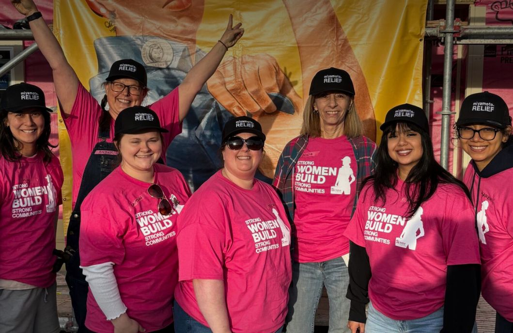
Video: Habitat for Humanity - Women Build Event in Sacramento
AdventHealth Weaverville Hospital

June Issue 2026
.jpg?width=225)