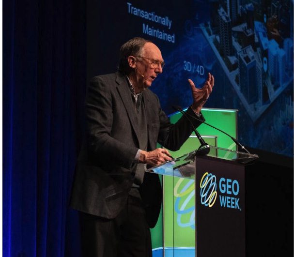
In February 2023, Informed Infrastructure Editorial Director Todd Danielson went to the GeoWeek conference in Denver where he interviewed Jack Dangermond, Esri founder and president.
The full video interview can be viewed at bit.ly/41kfgvh but we also wanted to include some excerpts in this issue of the print magazine.
Danielson: You just delivered the keynote address at GeoWeek. Can you provide a summary of some highlights?
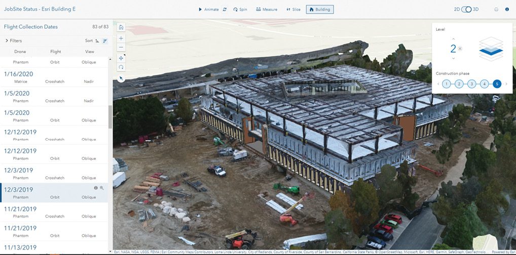
Dangermond: People in the geospatial world are making footprints all over the planet; they’re changing the nature of what’s going on. I talked about something called the geographic approach, which is a framework for bringing geographic knowledge or geographic intelligence into their workflows. GIS is building a kind of digital twin of the planet, caching all this information together so engineers and planners and designers or people who make decisions can have a more-informed platform for doing work.
One of the big things that’s occurring in our field is this notion of living digital twins, where data is brought in from many different sources: IoT transactions, updating a GIS, the weather, traffic movement. All these geographic phenomena are being wired up, and they’re able to be fused into a virtual digital twin. Applications in engineering and design and environmental management and transportation are being configured in such a way that they can take these streams of living digital twin information off the web as web services and mash it up and then make better decisions.
I also want people in this field to realize they’re part of a digital ecosystem; some people like to call it a “nervous system of the planet.” They’re all participating, they’re measuring things, they’re analyzing relationships, they’re designing things, they’re taking action. This community of geospatial people, with all these individual players, is becoming interconnected and fueled by shared information.
Engineering companies are beginning to embrace GIS technology for maintaining their work and integrating their work, bringing in outside maps and services dynamically, fusing them to do their own project work. As a result, they’re building 3D living cities through BIM transactions or other engineering transactions of all types.
Danielson: The last time I interviewed you was November 2019, right before COVID hit, and we talked quite a bit about digital twins. Since then, how has the technology and definition of a digital twin changed?
Dangermond: The big change is that people are constructing reality—both the natural world and the built environment—in dynamic real-time digital twins. That means the digital twin is becoming virtual, not a static set of files. It’s a virtualized digital twin that’s dynamically brought together on view or at the beginning of some analytics or the beginning of some interpretation or application of the digital twins.
So that’s a big shift, and it’s co-evolving with our wiring up of the planet. Everything that moves and changes is observed sometimes through imagery, sometimes through other types of sensing. And my colleagues in other companies across the whole spectrum are getting conscious of this; they want the work their customers do to be interconnected and made available as services. And we can have technology that fuses all those measurement environments and brings them together so participants of geographic information are being fueled by a GIS.
Last time we were together, we talked about Esri’s relationship with Autodesk Corporation—that just gets better and better. And I’m quite shocked that so many large engineering companies are embracing geography and this living digital twin of geographic information as part of their workflows. And they’re definitely doubling down on other aspects of geospatial work and their design-construction-engineering-build work, but they’re empowering it with geographic knowledge so their work gets better. It’s more enlightened by bringing together social factors and environmental factors and economic factors as foundational information to be able to do design and engineering and construction. The technology’s fueling more direct work by the very people that read your magazine.
Danielson: We also talked about the merger of GIS and AEC worlds, particularly with BIM technology. How do you feel that’s progressed? Are you pleased with where it is now, and how much further do you think it needs to continue?
Dangermond: We have many partners, as you know, across the industry, and they have continued to open up their datasets for integration into GIS. And we, in turn, are integrating the services and map information into their workflows and specific products. But we’ve also been at the same time working with the whole world of open standards. Being able to dynamically bring in any standards-based BIM models into our GIS desktops or servers has been really refreshing and interesting to see. We have an open platform with open APIs, an open architecture that people can extend by bringing our technology into other systems.
One of the fastest-growing areas for Esri is the adoption of these large AEC and small AEC companies of this geographic approach to expanding and considering all the factors in their practices. And we’re talking about very large companies embracing GIS not simply for use in their own workflows, but they’re embracing GIS now as a kind of professional practice.
AEC companies are unique, because they know how to do project management. GIS people really know the technology, they know the science, but they often don’t have this idea of managing a project. AEC companies really have it in their DNA. So it’s fueling more involvement, it’s expanding the practices of AEC companies to get involved in what has traditionally been a separate activity. And where that goes is intriguing to me, because it means we’re linking fundamentally into geography.
We have a chance to create a more-sustainable future considering all the factors—social, economic, engineering and environmental—bringing it all together using geography as a framework. That excites me a lot.
Danielson: Are there other things engineers should be doing in the future?
Dangermond: Increasingly, AEC firms are hiring GIS people that come from outside their world, and that interdisciplinary workflow is the outcome. The technology evolves—like connecting engineering workflows to science workflows and GIS workflows—and then the methods they use change. And as the methods change, technology evolves to support those new methods, so there’s a co-evolution between tech and applications or workflows.
Danielson: We talked about the needed collaboration between people in the GIS world and the AEC industries. How must that collaboration continue to everyone’s benefit?
Dangermond: People around architecture, engineering, design and construction are learning new capabilities and understandings about using geographic knowledge to amplify and enhance the way they do engineering. My background is in landscape architecture and urban design, and I think as a designer. So, am I a designer? Am I a landscape architect? Am I a GIS? No, I don’t want to think that way. I’m empowering practices of design with geographic knowledge—that’s the ultimate fusion. Sometimes these segmentations of “I’m a this” and “I’m a that” get in the way.
The basic concept of geography is looking at things holistically, bringing it all together, being able to integrate all the information into layers of understanding that can support applications of many types. As the profession of engineering and designing and planning and construction evolve, it’ll increasingly involve context for the design work. Some people are beginning to call that “geodesign” as a way to bring science into the workflows of design.
An example: I want to design a new town. Is this the right location, or is that the right location? I want to build a new building. Is this the right location, or is that the right location? That requires context. And who does the work for them? It’s engineers and designers and planners who are increasingly empowered with geographic intelligence.
It’s natural that this would occur instead of doing design and then doing an environmental impact statement to see if it’s okay. No, let’s bring in all that information in the first place. Bring in issues about social equity and environmental impact right into the design efforts people carry out. That to me is empowering the disciplines, not keeping separate disciplines. It’s enlarging the workflows. And if we’re going to survive as a human species, this has to happen. We have to all buy into this notion of holistic approaches to the way we create the future.
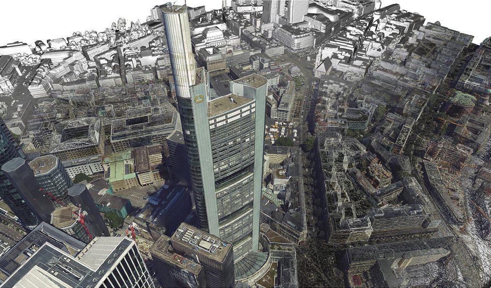
Danielson: Esri just introduced ArcGIS Reality. Can you tell me a little bit about this new product, why it was developed, and who is the intended audience?
Dangermond: It was developed in Stuttgart by a group of students that left the university and started this company a number of years ago. They invented some of the best technology to be able to take imagery of all types—aerial imagery, drone imagery, now satellite imagery—and process it in such a way that they can create very accurate digital products that can support the world.
When we acquired them, the job was to look at how we bring that technique and set of technologies into what traditional GIS users have been doing, automating the link between imaging and creating GIS products directly. So this reality-capture technology has now been re-engineered into ArcGIS Pro or ArcGIS Enterprise support, so people can do this reality capture and use the outputs directly. Whether it’s from a drone or aircraft or satellites right into information products that update and change the digital twin of reality. It completely automates the process and results in products that are directly usable, and it’s scalable. This is very cool, and I think it’s going to transform the mapping business. It’ll transform the way people act.
Danielson: I’ve been watching you do this for more than 20 years now. What drives you to keep doing this, to keep going, to have so much passion?
Dangermond: I was very lucky, because in university I found something that really got me excited: this idea of integrating everything using geography as a common science. As a designer and landscape architect or urban planner, this thrilled me because I could see that my life could actually matter. People hunt for purpose in life; I found it as a kid.
I think most people like to have a purposeful life, and they do it in their family or in their job, or they do it in being a person of faith or whatever it is. I just lucked out, because I found something I really like. The idea of connecting innovation and science to the way people behaved, that just turned me on.
When I talk to young people, they want to do that. And once you find ways that you can actually do it, there’s no sleeping. And people who I’ve met that really matter, they find a passion in their life.
Todd, you are making a difference by being able to try to figure out and listen and understand and project this information from the people you listen to outwards. You must see, or you wouldn’t keep doing it. In all my interactions with people of all types in all countries and cultures, when people really see they could make a difference with their life, they search out what that is.
Todd Danielson
Todd Danielson has been in trade technology media for more than 20 years, now the editorial director for V1 Media and all of its publications: Informed Infrastructure, Earth Imaging Journal, Sensors & Systems and Asian Surveying & Mapping.
Video: New Roundabout Under Construction at McIver and Old Florence Roads in Darlington County

Bridge Replacement at Amsterdam Centraal Station

June Issue 2026
.jpg?width=225)