
Hexagon and Vansteelandt partner to capture aerial data of Belgium and Luxemburg for the HxGN Content Program
The nationwide data sets will be collected by Vansteelandt, processed by Hexagon and made available via the HxDR Data Store
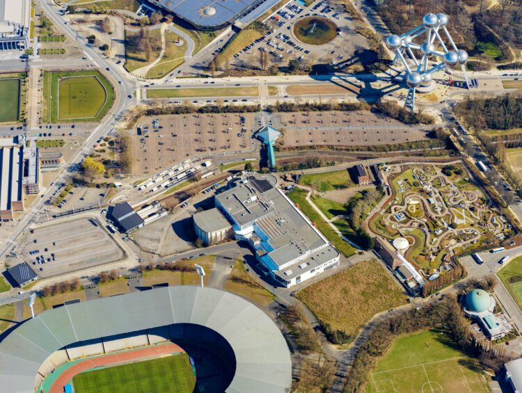
(Heerbrugg, Switzerland, October 19, 2022) Hexagon’s Geosystems division announced today that Hexagon is partnering with Vansteelandt BV, a Belgium-based mapping and survey services provider, to collect aerial imagery and LiDAR data of Belgium and Luxemburg for the HxGN Content Program. Vansteelandt will, as part of its Plan3D products, capture the data starting in early 2023 and complete two refreshes over four years using the Leica CityMapper-2, the world’s only hybrid oblique imaging and LiDAR airborne sensor.
The Belgium and Luxemburg data sets will be processed by Hexagon and offered globally through the HxGN Content Program’s Metro HD city data offering, an off-the-shelf solution of ultra-high-resolution 2D aerial data and 3D digital twins of major cities. Vansteelandt will also provide the data sets through its local Plan3D network in Belgium, Luxemburg and the Netherlands. Hexagon Digital Reality (HxDR), Hexagon’s cloud-based visualisation and collaboration platform for geospatial data, will host the nationwide data sets for both organisations.
“Today’s digital twin market requires more accurate and detailed geospatial data spanning larger areas. Collaborating with Hexagon enables us to meet the market’s demand and achieve operational efficiencies,” says Tom Vansteelandt, CEO at Vansteelandt BV. “By leveraging Hexagon’s latest technological innovations, including the Leica CityMapper-2 and HxDR platform, we support our customers and local partners with high-quality geospatial data.”
“The HxGN Content Program continuously grows to create value by combining the local knowledge of our partners with our global footprint to deliver exceptional experiences and solutions to our shared customers,” says John Welter, President, Geospatial Content Solutions, at Hexagon. “Our partnership with Vansteelandt underscores our commitment to democratising geospatial data, making it easier for professionals to gather reliable, real-world insights that foster innovations in the industry and community.”
About Hexagon
Hexagon is a global leader in digital reality solutions, combining sensor, software and autonomous technologies. We are putting data to work to boost efficiency, productivity, quality and safety across industrial, manufacturing, infrastructure, public sector, and mobility applications.
Our technologies are shaping production and people-related ecosystems to become increasingly connected and autonomous – ensuring a scalable, sustainable future.
Hexagon’s Geosystems division provides a comprehensive portfolio of digital solutions that capture, measure, and visualise the physical world and enable data-driven transformation across industry ecosystems.
Hexagon (Nasdaq Stockholm: HEXA B) has approximately 23,000 employees in 50 countries and net sales of approximately 4.3bn EUR. Learn more at hexagon.com and follow us @HexagonAB.
About Vansteelandt
Headquartered in Deinze and founded as a traditional topographic survey service provider in 1994, Vansteelandt has put its focus on developing smart innovative, and more productive, ways of working. This as alternative to traditional methods but always with keeping the specs and quality of the end products in mind.
At present they offer GIS mapping, topographic services and licenced products based on its own aerial Plan3D image and 3D data content. Special aerial services for high detailed data collection, advanced processing and deep learning to generate products have become their core business.
