
Emesent launches three time saving products for geospatial professionals
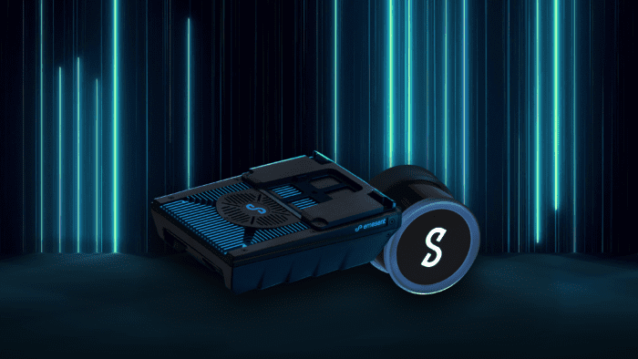
Hovermap ST-X, the newest edition of Emesent’s award-winning Hovermap autonomy and mapping device, captures detailed, accurate data over a greater area in less time.
Hovermap ST-X, Long Range Radio, and Emesent’s Aura software platform were launched at INTERGEO, providing a versatile combination to scan large areas and complex assets in less time and visualize the results in full detail.
Emesent, World leader in drone autonomy, LiDAR mapping, and data analytics today launched three new products at INTERGEO, which will help geospatial professionals save time while capturing accurate data for digital twins and BIM applications.
The products include Hovermap ST-X, a new Hovermap variant with a sensing range of 300 meters and improved accuracy, a Long Range Radio add-on which increases the communication range with Hovermap up to 20 times further, and Emesent’s Aura platform which offers an integrated SLAM processing and point cloud visualization environment for Hovermap users.
“We’re excited to launch these products, which together will allow our customers to capture dense, accurate 3D data in large, complex areas in less time and view the results in exquisite detail to derive new insights,” said Emesent CEO and Cofounder Dr Stefan Hrabar.
Extending the reach of autonomous LiDAR scanning while capturing denser, more accurate point clouds
Hovermap ST-X is the newest edition of Emesent’s award-winning Hovermap autonomy and mapping device. It incorporates the latest in LiDAR sensing technology to offer high density point clouds with increased coverage and improved accuracy. Featuring a sensing range of 300 meters, triple returns, and more than a million points per second, it captures detailed, accurate data over a greater area in less time. Customers scanning large areas for mining, construction, and forestry will benefit from these features, providing faster time to insight.
The improved LiDAR sensor accuracy, award-winning Wildcat SLAM algorithm, and optional Automated Ground Control Points deliver results with sub-centimeter accuracy.
The improved accuracy and density also benefit close-range indoor scans of buildings, industrial plants and other assets for floor plans and scan-to-BIM applications.
As with previous variants, Hovermap ST-X provides advanced drone autonomy to scan inaccessible GPS-denied areas or can be used for handheld, backpack, or vehicle-mounted scans. The weather sealed IP65 rated design allows it to be used in wet or dusty conditions.
“Hovermap ST-X is sure to be a valuable tool for geospatial and asset inspection professionals,” said Andre Broodryk, VP of Product at Emesent.
“It provides them with a versatile scanning solution for capturing large outdoor areas or complex indoor spaces.”
Fast-tracking inspections and surveying with continuous scanning over longer distances
Emesent’s Long Range Radio accessory attaches to Hovermap to increase the connectivity range up to 20 times further (up to one kilometer for above ground line of site flight applications).
“Our Long Range Radio allows operators to reap the full benefits of Hovermap ST-X’s autonomy and mapping capabilities and extend the range of its applications,” said Andre.
“It’s also compatible with Hovermap ST, so existing customers will benefit too”.
The Long Range Radio saves operators time in the field with the ability to scan large, complex environments in a single flight while retaining the communication link to update waypoints and preview the point cloud coverage during flight. This removes the need to scan from multiple locations or merge datasets in post-processing.
Simplifying 3D laser scanning workflows from capture to insight
Aura, Emesent’s integrated processing, visualization, and analytics platform provides a streamlined workflow for Hovermap users to process their data, view the results, clean datasets, and take measurements to derive insights and make decisions.
Aura’s visualization engine has been optimized for the dense, detailed point clouds produced by Hovermap ST and ST-X. Users can view point clouds with more than a billion points at full resolution to ensure crucial details and insights are not missed.
“Aura delivers a solution that makes users’ workflow seamless and hassle free no matter how large or numerous the datasets, dense the point clouds, or complex the 3D structures,” said Andre.
“Aura also lays the foundation for future point cloud analytics modules that we’re developing.”
Emesent chose INTERGEO to announce the new products because of its scale, relevance, and reputation in the geospatial industry.
“We saw INTERGEO as the perfect launch platform for our exciting new products,” said Stefan.
“Together, they will take SLAM-based LiDAR mapping to new heights, and INTERGEO is the best place to tell the industry about this. We’re looking forward to showcasing these solutions to customers at our booth and hearing how they can benefit from them.”
To be one of the first to see the new products, visit Emesent at Hall 3, booth A3.024, during INTERGEO, being held in Essen, Germany, from October 18 to 20, or visit the Emesent website.
About Emesent
Founded in 2018 as a spin-out from CSIRO, Emesent is a world leader in drone autonomy, LiDAR mapping, and data analytics. Their vision is to be the world leaders in the autonomous digitalization of the most challenging and seemingly unreachable places on Earth and beyond. Headquartered in Australia, with a global reach through their network of over 45 resellers and regional offices in the US, UK, and Germany. Emesent has built a reputation for delivering high quality data capture solutions in the mining, infrastructure, survey, and mapping industries. Their team of roboticists, engineers, and business development experts work side by side to deliver revolutionary efficiency, safety, and operational insights for their customers.
LinkedIn: https://www.linkedin.com/company/emesent
Twitter: @emesent
