With 5G-connected drones and edge computing, dozens of towers can be inspected simultaneously.
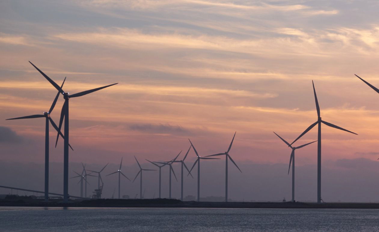
There are more than 52,000 utility-scale wind turbines across the nation that require ongoing maintenance, and total wind power capacity is expected to grow 62 percent by 2024. With the cost of a new wind turbine blade running nearly $1 million, it’s imperative to keep turbines functioning at peak capacity to maximize their lifespan.
GE Renewable Energy’s “Stay Ashore!” program aims to reduce risky, manual, offshore work as well as levelized cost of energy (LCOE) with new robotic and digital technology. The project’s new offshore wind turbine, the Haliade-X, is the most powerful offshore wind turbine in the world, offering a 63-percent capacity factor and an ability to generate green electricity that puts it in a class of its own.
With this tremendous potential comes the possibility of loss of revenue in situations requiring repair or maintenance. This is where drones come in, playing a vital role in the preventive maintenance of vertical structures, including wind turbines, transmission towers and more. The Stay Ashore! program, for example, uses robotics for planned maintenance events, particularly repetitive tasks, inspections and jobs in hard-to-reach areas. Drones have the potential to perform many of these repetitive events and inspections at a fraction of the cost.
Looking Ahead to Wireless Connectivity
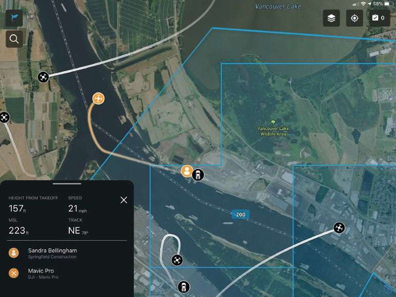
In a typical modern turbine inspection, a field team heads to a wind farm to deploy a drone equipped with high-resolution photography, LiDAR (light detection and ranging) and infrared thermal instruments. During the inspection flight, the drone captures high-resolution images that can measure erosion on blade edges. The infrared camera looks for hidden damage inside the equipment, seeing up to 15 centimeters deep, and the LiDAR sensor captures point clouds of up to 500 points per square meter within an accuracy of 3 centimeters that will later be turned into a detailed 3D model of the structure. This entire inspection takes about 45 minutes.
The data collected usually is saved onto a Secure Digital (SD) card, downloaded to a laptop and uploaded to the office via the internet later that day for analysis. The images then can be analyzed by an artificial intelligence (AI) program that compares them with previous inspection findings. A technician evaluates any changes that could cause concern, and servicing is scheduled for needed repairs, heading off larger, more-expensive problems in the future. Although faster than traditional methods, this data processing and manual review takes considerable time and leaves room for further automation.
Taking it a step further, let’s imagine dozens of drones staged near a wind farm. They could be programmed to do routine inspections on a frequent schedule. They also could be at the ready for any unscheduled flights, such as helping to identify equipment damage after weather events.
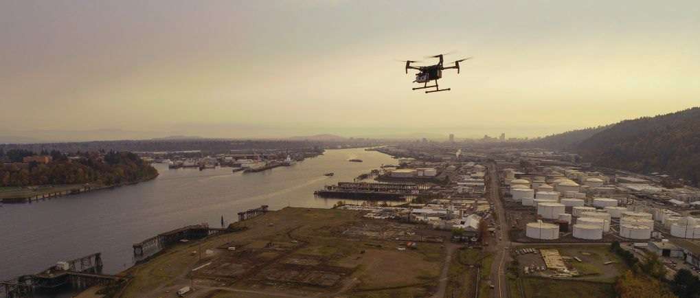
Remotely deployed drones likely would be connected to the 4G LTE wireless network—or, in the future, the high-speed, ultra-low-latency 5G wireless network—through small communication nodes placed on structures in the field. 4G enables the drone to stream data directly to the office and makes it possible to remotely command and control the drone from nearly anywhere in the world with an internet connection.
5G unlocks even more potential, such as the ability to gain near-real-time insights from AI. With high volumes of data streaming from the drone, 3D maps can be created while the drone is in flight for live insights into the state of the structure.
These aerial robots could be programmed with computer vision that lets them understand and react to the environment around them. This could help the drone autonomously avoid obstacles, identify damage or structural anomalies, and complete a mission—all without a human at the controls.
Further, edge computing will allow much of these data to be processed without sending them back and forth between distant servers located far away from the office. This results in an ultra-low-latency automated process that generates richer data and alerts repair crews to potential faults and risks ahead of time.
These autonomous, connected drone flights lay the foundation for tomorrow’s inspections and data gathering. Connecting drones to the wireless network will enable long-distance drone flights, and flying beyond visual line of sight (BVLOS) will introduce new opportunities for many drone operations.
Let’s explore three attributes of next-generation wireless networks that are especially relevant for connected drones:
1. Very Low Latency: Think of latency as how fast a piece of data moves from one part of a network to another. 5G will cut data transit speed to many times less than the blink of an eye—eventually less than 10 milliseconds end-to-end. This reduced latency should create a near-real-time experience for drone and sensor operators in terms of sensor response, drone control, and delivery of the media and data collected. Lower latency should allow remote crews flying a drone from hundreds of miles away to fine-tune sensor movements and drone position to get the perfect angle for a sensor reading without experiencing meaningful control lag.
2. Energy Efficiency: 5G is expected to have up to 90 percent lower energy requirements than 4G. And with 5G edge computing, complex functions can take place within the network near the end user. The drone shouldn’t need as much onboard processing capability, leading to less energy consumption and longer flight times. And with drones already offering a greener alternative to traditional crewed aviation, organizations may be able to reduce their carbon emissions even further with more energy-efficient drone technologies.
3. Reliability: Drone aviation requires very high levels of reliability. New 5G networks are being built with a focus on reliability, providing the confidence necessary for drones to operate over the network. This is especially valuable for engineering and infrastructure inspection applications that demand low-risk, high-reliability solutions for potentially hazardous work, such as damage assessment after a natural disaster.
Developing a Drone Program in Energy and Utilities
With all the new advancements in connected drones, you may be evaluating drone adoption. Now is a great time to get started so your company can be on the leading edge of drone connectivity—not playing catchup later. But you’ll need to demonstrate how the technology will add business value for your organization. The following are three important considerations for launching a drone program:
1. Establish use cases built around company objectives.
Most drone programs start with a few use cases that quickly show the value and potential for the technology. Be clear about your goals and the benefits to the organization. Do they save time or money? Do they reduce risk? How do they help the business? You need to prove your drones are delivering value to build support for the program.
Begin by identifying use cases that directly align with larger company objectives. Also, look for how drones could improve on existing processes and systems. For example, Southern Company, one of the nation’s largest electric and gas utilities, became interested in drones as a way to decrease helicopter use and reduce risks to personnel.
Southern Company’s starting point was improving worker safety during inspections; they soon saw that drone technology could do a lot more. Drones could greatly improve grid reliability by collecting better inspection data a lot faster. Southern Company also began using drones to pull rope for conductor wire after storms, restoring power to rural areas in weeks instead of months.
Your first use cases should align with the priorities of your company’s stakeholders and executives. This will help get buy-in from the people who are enabling your flight operations.
2. Calculate ROI and use it as rationale to scale your drone program.
To grow your drone program, you need to be able to prove to your executives that drones are worth the financial investment. Usually, they’ll want to see dollar savings, so it will be worthwhile to have a cost analysis prepared.
In the cost column, your budget will include drone hardware, equipment and pilots as well as software to process data, build models and manage operations. On the savings side, account for operational efficiencies, better worker safety, major incidents averted and other benefits. These often outweigh the cost of operations.
For example, the oil and gas industry spends $37 billion a year monitoring above- and below-ground pipes to detect leaks. Contamination from leaks of produced water kills vegetation and can ruin crops in places where pipelines run by farmland. Remediation can cost hundreds of thousands of dollars. Drone inspections can swiftly survey hundreds of miles of pipeline, producing aerial imagery that shows landscape changes that indicate pipeline leaks. They also can be equipped with methane sensors that use lasers and infrared data to detect methane in the air from up to 30 meters away. This can help companies rapidly pinpoint and repair leaks.
Drones also can reduce the need for bucket trucks, an expensive field tool that typically requires a crew of at least two running an enormous piece of hardware and working in hazardous conditions. One power-utility company serving 10 million people across Florida, for example, indicated that drones allow their crews to assess damage faster in hard-hit areas inaccessible to bucket trucks and traditional repair crews.
Launching drones to conduct utility-pole inspections can slash labor and hardware costs. Reducing your fleet by even one truck can result in $80,000 to $100,000 savings when compared to the cost of a single drone. Further, this doesn’t include the harder-to-calculate savings from keeping your workforce on the ground and out of harm’s way.
3. Centralize and streamline your documentation.
Keeping close track of flight operations is crucial—and not just for the people on your aviation team. Documenting all parts of your program allows executives to have visibility into the aspects that relate to their departments: safety, compliance, leadership and others. Everyone should be able to review your mission records; track your safety; and know where, how and when you’re flying.
The best way to do this is through a drone-management platform. With various resources available today, look for one that enables drone pilots and managers to do the following:
• Check airspace and get access to controlled areas.
• Plan, fly and log missions.
• Track all the drones, batteries and personnel in your fleet.
• View historical data for every flight logged.
• Record all this information in a digital system for easy reporting.
• Provide access to anyone in the organization who needs it.
As your program grows, you’ll have more aircraft, more people, more use cases and perhaps new airspace rules to track. To stay on top of all program activity, you’ll need to automate as much documentation and reporting as possible, especially in organizations that are nationwide or international.
Securing buy-in from your team is the first step to launching a successful drone program for your organization. Although drones already are proving the profound impact they can have by improving everyday tasks for energy and utility professionals, ongoing developments will continue to introduce new use cases that are unheard of today. This will be strengthened by connected drone technology, enabling advanced insights and remote deployments. Start considering how you can rely on drones to speed up your operations, improve efficiency, and lower expenses for today and tomorrow.

Donavon Graves
Donavon Graves is director of business development and strategic planning at Skyward, a Verizon company; email: [email protected].
Video: New Roundabout Under Construction at McIver and Old Florence Roads in Darlington County

Bridge Replacement at Amsterdam Centraal Station

June Issue 2026
.jpg?width=225)