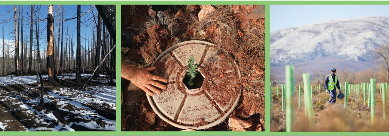
Imagine planting enough new trees to cover a plot of land the size of Switzerland. Now do it again and again, nearly 500 times, until you’ve covered 2 billion hectares. It’s a huge, seemingly overwhelming effort. Yet a Dutch company is using advanced geospatial technologies to make it happen.
From its base in Amsterdam, Land Life Company works to restore lands degraded by natural or human activities such as wildfire, desertification, agriculture and urbanization. It’s one of a small handful of companies capable of large-scale tree-planting services needed to reestablish forests and create productive landscapes. With projects in 25 countries on five continents, Land Life clients include governments and corporations seeking to reinvigorate damaged land and soils or to offset carbon released by commercial activities. Since its founding in 2013, Land Life has planted nearly 1.3 million trees.
Successful tree planting comes in bunches. At each project location, new trees are planted in groups to provide protection against the wind. The young trees spread naturally to fill in and enlarge the new forest. Eventually the soil improves to support new plant life and further aid in carbon capture.
But it’s difficult to plant trees successfully on a large scale, and Land Life plants trees by the thousands. Logistics are complex; and costs for sapling trees, supplies, labor and equipment add up quickly. To optimize the cost-to-benefit ratio, Land Life needs to achieve a high rate of success for the trees it plants; the young trees need to grow and remain healthy to produce long-term benefits.
Foraging the Forests
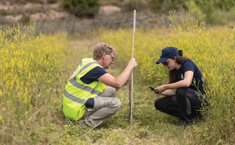
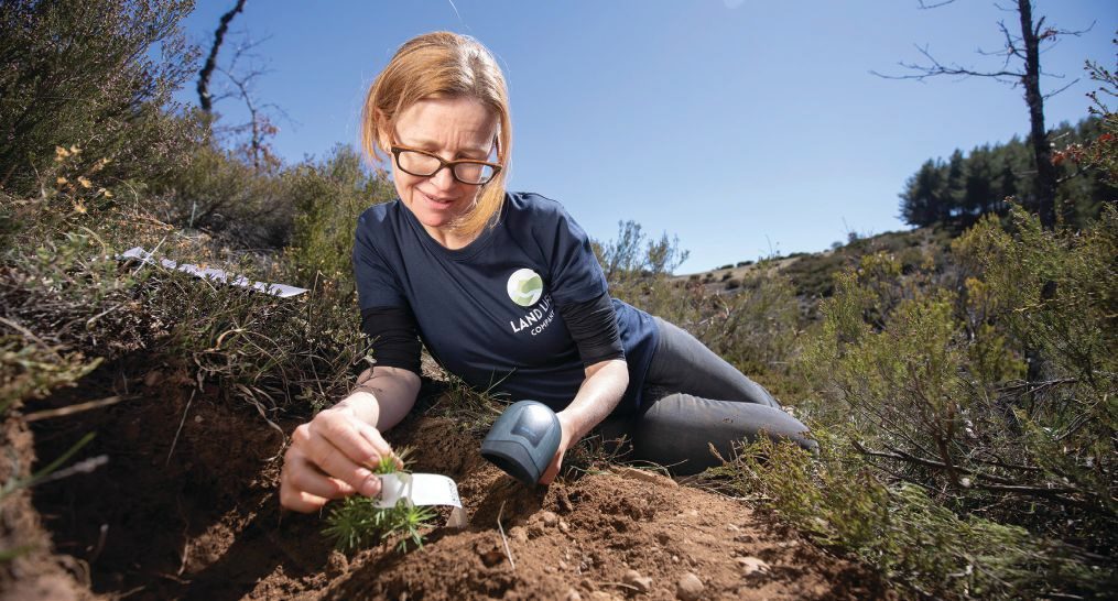
To reach and maintain success, Land Life monitors the new trees through periodic visits to measure parameters such as height and health. Combined with information on the tree species, location, soils and environmental conditions, the data support informed decisions in planning the next round of planting and enable Land Life to adjust variables such as soil amendments and watering approaches.
“We are gathering as much data as we can,” says Tom Janmaat, a data scientist at Land Life. “We’re shaving costs in the operations and using our knowledge to optimize performance. The next steps will be ecological gains: making sure you plant the right trees in the right spot at the right time. Scientific knowledge is available, and we think we can get even better. We can help improve our knowledge base by gathering data on how our trees grow: Learning what works and what doesn’t.”
Janmaat explains that Land Life records as much data as possible on factors that could influence the trees’ growth and survival rates, then analyzes how the various parameters influence each other. Thanks to its rigorous statistical practices, Land Life needs to monitor only a fraction of its trees. On a planting of a hundred-thousand trees, they typically monitor a few thousand to produce a good sample of every combination of tree species and treatments in a given field.
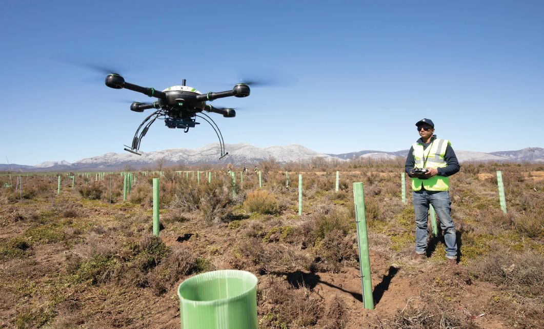
Monitoring tree performance is a labor-intensive process. To control costs, the company is working to improve productivity in its monitoring efforts. For example, it developed an inhouse smartphone app to guide users through the capture of information on a tree’s species, height and health. In order for the information to be useful, field teams must be sure they visit the same tree every time. When dealing with thousands of nearly identical trees, it’s not a simple task. That’s where GNSS comes in.
For years, Land Life attached small paper tags with unique QR codes to the trees selected for monitoring. Although the codes ensured accurate identification of specific trees, they required monitoring personnel to carry a separate QR reader and crawl on the ground to reach and scan the tag. The method was further compromised by the fact that some QR tags were torn off and lost each year. So Land Life turned to satellite positioning using the GPS receivers built into team members’ smartphones. That decision led to a new challenge: accuracy.
In open fields and with access to a cellular network, a smartphone’s built-in GPS can provide positions accurate to roughly 3 meters. The accuracy is worse when working in treed areas or locations where cellular signals are not available—conditions where Land Life does much of its work. With trees spaced 3 to 4 meters apart, the smartphone GPS can’t provide the accuracy needed to confidently identify and return to the same tree repeatedly. Land Life needed the ability to measure within 1 meter.
Meeting the Needs
Professional-grade GPS or GNSS (Global Navigation Satellite System) receivers could easily meet the submeter requirements, but Land Life was concerned about the cost and complexity of those solutions. It had already invested in writing software for data collection, and its field teams were familiar and efficient with those inhouse apps. Land Life needed a way to blend higher-accuracy positioning into its existing workflows and Bring-Your-Own-Device (BYOD) approach to locating and monitoring the trees.
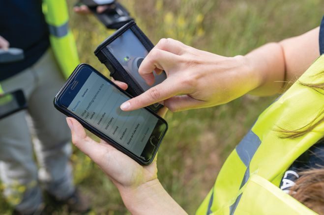
Land Life selected the Trimble R1 GNSS receiver: a device roughly the size of a pack of playing cards that can provide real-time positioning with submeter accuracy. Using a Bluetooth connection, the R1 can stream position data to apps running on iOS or Android smartphones, making it easy for field workers to carry and use. Land Life software developers incorporated the high-accuracy positions into their inhouse monitoring apps. With the position data in their familiar apps, workers could use existing workflows and smartphones; they needed very little training on the new device.
Land Life also can mount an R1 onto its tree-planting machines, enabling field teams to capture the location of each new tree when it’s planted. For monitoring, the app then can guide users to specific trees.
“When you have that submeter accuracy, it’s easy to find your way back to a tree,” notes Janmaat. “You walk toward the tree, you look on your phone and say, ‘Oh, yeah. I see the dot of my location on my screen next to the tree that I’m looking for.’ It works quite well.”
Building on its experience with the R1, Land Life also is using Trimble Catalyst, which combines a small GNSS antenna with software running on an Android-based tablet or smartphone. By turning the smartphone into a GNSS system that can produce up to centimeter accuracy, the Catalyst technology further reduces the cost and complexity of accurate positioning. Like the R1, the Catalyst solution uses GNSS correction data from the Trimble RTX service to produce the needed submeter accuracy positions.
According to Jasper Schurr, the commercial manager for Geometius, a Trimble distributor in the Netherlands, receiving correction data is essential. “The RTX service is important for users like Land Life,” he says. “Many GNSS correction services provide corrections using cellular phone connections. With RTX, cellular coverage isn’t needed. The correction data can be delivered via both phone and communications satellites, so users can get accurate performance 24/7, even in remote locations.”
Maintaining Control
Land Life already is reaping the benefits of the accurate GNSS systems for monitoring. Janmaat describes a project in Spain where they could compare the new and old approaches. “Two of us were there for two full days doing close to 20 hours of work each to monitor a thousand trees. With the Trimble system, you can do a thousand trees by yourself in one day, which has sped up monitoring by at least a factor of four.”
As the forests grow, monitoring will transition from ground-based measurements to using drones to capture data over larger areas. By using accurate GNSS to locate trees during planting and maintain tight georeferencing for drone flights, Land Life will be able to identify and monitor individual trees from aerial drone images.
Janmaat used data plots from a planting project in Texas to illustrate the contribution of accurate positioning to Land Life’s data-driven methods. Trees planted using accurate GNSS appear in neat rows, while those planted using only a phone GPS are uneven and more scattered.
The accurate positioning also enabled direct comparison of different treatments and watering methods to specific trees through time, including use of an automated watering solution in dry areas. The data enable Land Life to improve performance and survival rates, effectively reducing the cost per successful tree.
Looking forward, Land Life expects to use its GNSS capabilities to assist operators in guiding the planting machines, ensuring consistency and proper placement of trees. But monitoring will remain a core effort and a driver for increasing productivity and tree success rates.
Janmaat is keen to share his enthusiasm and knowledge gained about technology in forestry and agriculture in general. He believes it provides an interesting and exciting challenge for young professionals to implement technology that enables a for-profit company to contribute to society and the Earth, while having a positive effect on our environment.
“We are doing technologically challenging stuff that we apply toward a sustainable goal,” he says. “We are confident this will reduce costs in the future and make us more effective in planting trees. Apart from the cost aspect, it also enables us to reforest parts of the Earth that would otherwise be more difficult to recover. By developing our knowledge, we have greater understanding on which trees grow well in the various conditions. It enables us to work in areas where other companies might not succeed.”

John Stenmark
John Stenmark is a writer and consultant working in the geospatial, AEC and associated industries; email: [email protected].
Video: New Roundabout Under Construction at McIver and Old Florence Roads in Darlington County

Bridge Replacement at Amsterdam Centraal Station

June Issue 2026
.jpg?width=225)