Specification Section: 2021 AEC Technology, Services and Design Software, Services Guide
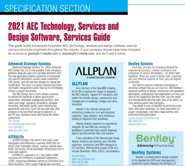
This guide briefly showcases innovative AEC technology, services and design software used by civil and structural engineers throughout the industry. If your company should have been included, let us know at [email protected] or [email protected], and we’ll add it online.
ALLPLAN

As a member of the OpenBIM initiative, ALLPLAN is leading the charge to digitalize the AEC industry, support IFC standards, and enable the holistic design, construction and management of buildings, bridges and other structures.
Allplan is the ultimate design and reinforcing solution for civil and structural engineers, rebar detailers, and contractors looking to digitalize their workflows.
Allplan enables engineers to seamlessly integrate 3D and BIM into existing 2D workflows to generate high-quality drawings, reports and documents from one solution.
A key subsidiary of the Nemetschek Group, Allplan solutions are used by over 240,000 engineers, contractors and BIM managers in 52 countries. (Nemetschek brands in the U.S. include Bluebeam, RISA, SDS/2, Vectorworks.)
Donnie Henry
844-4ALLPLAN
Bentley Systems

Bentley Systems (Nasdaq: BSY) is the infrastructure engineering software company. We provide innovative software to advance the world’s infrastructure – sustaining both the global economy and environment. Our industry-leading software solutions are used by professionals, and organizations of every size, for the design, construction, and operations of roads and bridges, rail and transit, water and wastewater, public works and utilities, buildings and campuses, mining, and industrial facilities. Our offerings include MicroStation-based applications for modeling and simulation, ProjectWise for project delivery, AssetWise for asset and network performance, Seequent’s leading geoprofessional software portfolio, and the iTwin platform for infrastructure digital twins. Bentley Systems employs more than 4,500 colleagues and generates annual revenues of approximately $1 billion in 186 countries.
1-800-BENTLEY
www.Bentley.com/going-digital-roads
CivilGEO

CivilGEO develops civil engineering and stormwater software that greatly speeds up an engineer’s work when performing water resource model studies. Flood studies, bridge design, dam failure, detention pond design, urban drainage and more can be analyzed and designed. Users typically save at least 50% of their engineering time using the advanced automation that the software provides. The software tightly integrates with Autodesk Civil 3D and Bentley MicroStation as well as ESRI’s ArcGIS and ArcMap. Free demonstration versions are available for trial.
Sara Presta
[email protected]
800-488-4110
www.civilgeo.com
BQE
Founded in 1995, BQE is a leading cloud-based software provider to professional service firms worldwide. Our flagship product – BQE CORE Engineer – is a comprehensive, cloud-native, business management platform that streamlines the billing and accounting process, while improving operational efficiency. Named as one of the best business software solutions for invoicing and billing by PCMag, CORE Engineer is recognized for its intuitive features that simplify and automate operations for business owners and their teams – especially those in service-based businesses such as engineering.
866-945-1595
Contech Engineered Solutions

Contech Engineered Solutions is a leading provider of site solutions for the civil engineering industry. Contech is the only company that can provide bridge, drainage, erosion control, retaining wall, sanitary, soil stabilization and stormwater solutions on a national scale. Our product offering includes corrugated metal and plastic pipe; steel truss, metal plate and concrete arch bridges and structures; hard armor and retaining wall systems; and stormwater detention/retention, filtration and treatment systems.
Contech makes it easy for you to “Design Your Own Project” with our convenient DYO Project tools. These interactive tools allow you to quickly and easily prepare designs and supporting documents for estimates/project meetings and be more efficient with your time. https://www.conteches.com/start-a-project/online-design-tools.
800-338-1122
Esri

Esri is the global leader in cloud-based and desktop geographic information systems (GIS) software and location intelligence. Esri’s GIS solutions deliver unique and powerful technology for applying location-based analytics to building and infrastructure industry projects.
Architects, engineers, construction professionals and environmental consultants benefit from adding geographic context to their engineering and design projects. ArcGIS, the flagship product, delivers spatial data to plan, design, build and operate the built and natural world. With ArcGIS and partner offerings that extend its capabilities, Esri enables digital transformation in AEC and environmental management firms of all sizes working on projects of all types.
Esri technology is geo-enabling the industry through improved workflows, better collaboration between stakeholders, and strategic solutions to build smart communities and assets for the future.
Marc Goldman
909-793-2853 x6460
Keystone Retaining Wall Systems
Throughout our 35-year history, Keystone Retaining Wall Systems has become the world’s leading source of retaining wall and landscape solutions. Keystone’s products and services provide soil retention, erosion control and inventive landscape answers for commercial, municipal, transportation, residential and industrial applications. We offer pinned, lipped and lugged segmental retaining wall options. Our interlocking pinned units use Keystone pultruded fiberglass pins with 6,400 psi shear strengths for time-saving designs and construction options. Two of our Keystone structural wall systems have been widely approved for use across the country by state departments of transportation.
KeyWallPRO, our industry-leading engineering wall design software, is an advanced, professional-level software for the design of Keystone’s mechanically stabilized earth walls. For more information or to purchase this software, go to http://www.keystonewalls.com/softwareresources.
John Schramm
952-897-1040
New Millennium Building Systems
Specification Tools for Joist & Deck
Our steel joist and deck BIM models are downloadable from ARCAT and MasterSpec. You also have access to updated steel joist and deck load tables and catalogs featuring convenient, interactive PDF formats. And our new online tools help to simplify right specification based on your application. Visit: https://tools.newmill.com
Have you also heard? Long-span composite floor systems are engineered to improve multi-story building design and construction. Three types of “thin-slab” floor systems represent the category: Composite Joists, Deep-Ribbed Composite, and Dovetail Composite. We can help you select the right system based on floor span, depth, loads, fire, vibration, acoustic ratings and overall aesthetics. Visit: www.newmill.com/longspan
Together, let’s build it better.
Rich Madden
Newforma
Newforma pioneered the Project Information Management (PIM) category in 2004 and has been revolutionizing it ever since. There are many companies that have attempted to match our robust set of PIM features, but we remain the industry standard. Newforma brings disparate applications and teams together on one unified project dashboard that allows you to view and interact with all project information including RFIs, submittals, emails, drawings, and field management tools. Our connector strategy continues to grow, enabling automated information exchange from the most widely used applications in the AEC industry into your Newforma dashboard.
Kyla Natali
877-875-8252
Nucor, Vulcraft/Verco
Vulcraft/Verco’s online design tools provide architects, engineers and design professionals 24/7 access to critical design information for buildings of today. Our online tools make it easier to specify our products, help increase project performance and reduce project costs. Customizable, intuitive and interactive, our suite of online design tools includes deck diaphragm shear design, composite strength, joist vibration analysis and much more. Whether working at the office, remotely from home or on the road, our online design tools are always at your fingertips.
For a trial run, check out one of our Vulcraft/Verco links below:
www.vercodeck.com/design-tools
www.vulcraft.com/canadian-design-tools
Dave Bjork
330-682-6274
Propex
Propex GeoSolutions is a global leader in innovating patented geosynthetic and erosion control products that are tested, proven and trusted. We don’t just manufacture and market these innovative products, we also have an experienced team of professional engineers to support you through the design process including creating a unique design for your project that meets specifications. We’ll also support your installation efforts through our certified installer program.
Interested? Try out EC Design, our web-based erosion control modeling application that uses Hydraulic Engineering Circular No. 15 (HEC-No25) and Revised Universal Soil Loss Equation (RUSLE) to help you choose the best solution for your project.
423-553-2465
PRESTO GEOSYSTEMS

Presto’s GEOWEB 3D soil-confinement system offers flexible solutions for challenging soil-stabilization problems. The 3D system strengthens and transforms fill material, improving performance in a variety of applications.
For controlling erosion, the GEOWEB system’s 3D cellular structure stabilizes the upper soil layer on slopes to resist sliding and prevent surface runoff erosion. In channel designs, the system controls stormwater and replaces expensive riprap and reinforced concrete with vegetation and poured-in-place concrete.
Vegetated gravity and reinforced GEOWEB retaining walls are designed for natural aesthetics and to meet green initiatives. Using the GEOWEB system to build roads with onsite, low-quality fill reduces cost and installation time.
Presto offers free project evaluations, fast and easy specification tools, and engineering consultation.
HDPE GEOWEB. Strength and Flexibility Perfected.
Katie Bocskor
800-548-3424
Advanced Drainage Systems
Advanced Drainage Systems, Inc. (ADS) enhanced ADS Design Tool 2.0 is now available at the company’s websites: www.ads-pipe.com and www.stormtech.com. The new application enables customers to incorporate site-specific information, quickly create customized CAD layouts, and edit and save designs for review and modification. The result is a custom-tailored StormTech stormwater management system that can be immediately utilized in project documents.
The ADS Design Tool 2.0 also allows customers to evaluate the feasibility of above-ground pond replacement, alternative underground products, land values and usage, regulatory compliance, rainwater harvesting, stormwater quality, green infrastructure applications and more. Users can also add other ADS products to the StormTech design including N-12 and HP pipe, Nyloplast basins and Inserta-Tee lateral connections.
Tori Durliat
419-424-8275
ASTRALiTe
ASTRALiTe Edge is the world’s first small-scale topographic and bathymetric scanning LiDAR that can detect small underwater objects, measure shallow water depth, and survey critical underwater infrastructure from a small UAV platform.
ASTRALiTe’s patented 2-in-1 topo-bathy LiDAR overcomes the limitations of traditional bathymetric LiDAR, measuring underwater features at centimeter-level depth resolution. From coastal mapping and surveying to infrastructure inspection and military logistics, the applications of our LiDAR are numerous and widespread.
Edge provides high-definition measurements both above and below the water surface and accurately measures the transition from land to water. Additionally, we provide simultaneous water- and bottom-surface detection at sub-centimeter accuracy and precision from shore through shallow waters—an industry first.
303-993-8039 ext. 705
Aurigo
Aurigo builds software that helps build the world. Aurigo provides modern, cloud-based solutions for capital infrastructure and private owners to help them plan with confidence, build with quality, and maintain their assets efficiently. With more than $300 billion of capital programs under management, Aurigo’s solutions are trusted by over 300 customers in transportation, water and utilities, healthcare, higher education, and government on over 40,000 projects across North America. Founded in 2003, Aurigo is a privately held U.S. corporation headquartered in Austin, Texas, with global offices in Canada and India.
512-212-4999
Autodesk
Infrastructure projects can be complex and involve teams from multiple disciplines. Autodesk helps civil design and engineering professionals work more efficiently, have deeper insights on their designs to make better decisions, collaborate more seamlessly, and deliver more sustainable and resilient transportation, site, and water infrastructure.
The Autodesk Architecture, Engineering & Construction Collection delivers integrated BIM and CAD tools, and a common data environment, so you can adopt more integrated workflows and coordinate from design to construction.
Make better design decisions, streamline team coordination and keep constructability top of mind with Autodesk.
Federico Contarini
Bentley Systems
Each day, you face an increasing demand for engineering accuracy, contract compliance and production of various deliverables—all within tight deadlines. When you need to deliver safe, compliant and cost-effective projects on time, you can depend on Bentley.
Our team of engineers dedicates themselves to delivering software that you can count on. With Bentley’s expansive portfolio of design, construction and operations applications, professionals and organizations of every size have all the capabilities that they need, plus the speed and interoperability that they want. Best of all, there’s no more worrying about risky oversights.
Stay ahead of your competition by delivering more, faster, with better workflows. For more information on project collaboration, visit https://www.bentley.com/products/brands/projectwise.
800-BENTLEY
CUES
GraniteNet WebInspect
CUES is proud to introduce GraniteNet WebInspect, a browser-based inspection app designed to perform inspections and collect information about municipal assets such as manholes, including MACP v7 Level 1, hydrants, lift stations, grease traps, light poles, signage, etc.
Perform and track tasks such as valve turning, smoke tests, brush cutting, snow plowing, etc. Collect GPS points, water-quality samples, flow tests, assess sewer backups, etc. Virtually any type of asset assessment or task can be quickly deployed for your organization using WebInspect, with or without your existing GIS maps.
All that’s needed is an internet connection and virtually any device with a browser, such as a mobile phone or a tablet. There’s no software to install on any user devices to use GraniteNet WebInspect.
800-327-7791
DatuBIM
Construction Data Analytics Platform
DatuBIM is a non-intrusive, end-to-end project management platform that delivers automated construction data analytics and engineering reports within hours of drone-based data capture. As-built digital twins and automated analytics deliver valuable insights for optimizing, controlling and documenting processes, quality and budget.
DatuBIM allows for comparison against design plans, remote monitoring of execution progress, digital inspection, volume delta calculations, and much more.
DatuBIM is a secure, cloud-based software, so you have all your project data and analytics when and where you need it. Easily share insights across teams to improve collaboration and solve problems more efficiently and faster.
Designed for infrastructure construction projects, DatuBIM offers value to project owners, managers and contractors, and the full range of construction industry professionals.
888-765-2903
Digital Construction Works
Digital Construction Works, Inc. (DCW) is a leading industry application and technology integration solution and services company. We help owner-operators and constructors accelerate the adoption and use of digital workflows, incorporate digital twins of assets, implement best practices, and, if needed, include the right combination of fit-for-purpose third-party technology to improve construction planning, design-build, operations and project outcomes. We can take your current disparate applications and integrate them, so they all work together, and you can manage them in a single, secure, integrated platform with project insights.
The future of construction is digital.
Let’s go there together.
610-458-2799
www.digitalconstructionworks.com
Dlubal
Dlubal offers powerful programs for structural and dynamic analysis for multiple materials, including steel, concrete, timber, cross-laminated timber (CLT), aluminum, glass, and fabric/form-finding per the American, Canadian and other International Standards.
RFEM is a nonlinear FEA program for analyzing member, plate, wall, shell and solid elements. It is one of the most highly sophisticated yet user-friendly programs, especially suitable for new users with its intuitive modeling workflow.
Due to a wide range of interfaces, RFEM also provides seamless integration between CAD and structural-analysis programs in Building Information Modeling (BIM). Bidirectional data exchange between RFEM and programs such as Tekla Structures, Autodesk Revit and AutoCAD are possible.
See why more than 5,000 engineering offices, construction companies and universities across the world trust in Dlubal Software.
Amy Heilig, P.E.
267-702-2815
EagleView
EagleView is a leader in aerial imagery, machine-learning-derived data analytics and software, helping customers in different industries use property insights for smarter planning, building and living. With 200-plus patents, EagleView pioneered the field of aerial property measurements and has the largest multi-modal image database in history, covering 98 percent of the U.S. population. With over 9.5 million linear miles flown every year, EagleView’s coverage is the most extensive and up to date, enabling local government and business customers to use the most accurate data to make timely and informed decisions.
585-486-0093
East Coast Erosion Control
ECDesigner is a free web and mobile app to help you evaluate your site-specific rolled erosion control needs. Available on iPhone and Android devices. ECDesigner calculates site conditions for slope and channel situations, plan site takeoff, and produces comprehensive outputs for easy design and submittals. Developed by engineers, the app evaluates soil types, flow rates and vegetation to create the ability to analyze the complexities of slopes, channels or spillways in a free app. Our new camera feature allows slope calculations to occur with the snap of a picture.
Diane Smith
800-582-4005
ENERCALC
ENERCALC’s Structural Engineering Library (SEL) provides practicing engineers with an easy-to-use toolkit for designing the elements of structures.
Our fill-in-the-blanks calculation software provides the ability to develop sets of project engineering calculations that contain external images, documents and other project information.
SEL includes over 40 structural engineering design, analysis and governing code validation modules. Small projects of five stories or less dominate our clients’ workload. This is where our software excels.
RetainPro’s earth-retention structure calculation modules and ENERCALC 3D’s FEM capabilities are now included in SEL.
SEL runs on Windows programs and on any HTML5 browser. One license covers both platforms, including a secure means of sharing data.
ENERCALC has provided calculation tools for structural engineers since 1983.
800-424-2252 ext. 1
e-PlanSoft
e-PlanSoft develops industry-leading cloud-based electronic document review software that assists governmental agencies, construction and manufacturing industries, developers, and owners with their plan review, design review, product review, construction, and asset review management in real-time.
Architects and engineers have their own special needs when it comes to designing and coordinating project review and approval. For these professionals, e-PlanREVIEW provides a powerful web-based collaborative review tool. Architects, engineers, and project managers can easily access and manage design and review projects from start to finish, from any device. Users can upload and view the latest plans, add mark-ups, insert, and respond to comments, and compare drawings using overlay and side-by-side comparison tools. EPR’s backend database ensures all comments and markups are tracked guaranteeing each project can get done quickly.
Brandy Parslow
[email protected]
887-654-EPLAN (3752)
www.eplansoft.com
Epson
Moverio BT-40 and BT-40S Augmented Reality (AR) Smart Glasses
Epson announced the Moverio BT-40 and BT-40S augmented reality (AR) smart glasses, designed to deliver a high-quality AR viewing experience with maximum comfort. The new solutions offer a number of advances for engineers, including a wider field of view (FOV), Full HD 1080p display resolution, high contrast, improved connectivity, and a more comfortable, adjustable and easy-to-wear design. With a wide 34-degree FOV at a comfortable position for the eyes, the Moverio BT-40 and BT-40S deliver a unique heads-up, hands-free experience with higher resolution equivalent to viewing a 120-inch screen from a distance of 15 feet. The Moverio BT-40S also includes the option of an Intelligent Controller running Android 9.0 that supports Google Mobile Services (GMS) for custom software integration.
www.epson.com/moverio-augmented-reality
Epson
SureColor T-Series Wide-format Printers
Epson recently expanded its SureColor T-Series printer line with two new wireless multifunction printers: the 24-inch SureColor T3170M and 36-inch SureColor T5170M. Both models incorporate a 600 dpi high-detail scanner with simple top-loading functionality for accurately scanning blueprints and line drawings, making large copies, and sharing high-quality technical documents. Featuring an industrial-grade Epson PrecisionCore MicroTFP printhead for ultra-fast print speeds, and UltraChrome XD2 pigment ink technology, the SureColor T3170 and SureColor T5170 create output with brilliant color and crisp lines; and that’s smudge and water-resistant, ideal for unpredictable job sites. With a sleek design and compact footprint, the printers fit into modern work from home, small and temporary office environments, allowing for seamless team collaboration across CAD, architecture, engineering and corporate graphics workflows.
www.epson.com/surecolor-t-series-plotters
European Space Imaging
European Space Imaging is the leading premium supplier of global very-high-resolution (VHR) satellite imagery in Europe. Utilising their multi-mission ground-station at the German Aerospace Center, their team of geospatial experts bring together unique partnerships, innovative techniques and tailored services to achieve results for any project. VHR satellite imagery offers a unique view of what lays in, on and around AEC sites. It provides a cost-effective and simple method of monitoring wide areas both locally and globally, and is an indispensable tool for managing all phases of the AEC process.
From this data, you can gain insights into building typologies, transport networks, vegetation encroachment, development site suitability, asset management and more. Contact us today to learn more.
Benjamin Lieberknecht
FARO Technologies
FARO manufactures 3D reality capture solutions to integrate into the industry’s most widely used BIM workflows allowing stakeholders to make informed decisions and improve project collaboration. Specifically, for the construction industry, FARO’s 3D laser scanning solutions allow users to put Building Information Modeling (BIM) into practice during the design, construction and operation phases to improve productivity, sustainability and quality as well as reduce cost, risk and waste. Project data gathered can be processed and extracted into 3D deliverables used to analyze, collaborate and execute better decisions to improve and maintain the overall project quality.
800-736-0234
Foundation Software
Foundation Software is known for helping contractors successfully run the back office side of their construction business, allowing them to stay focused on job performance. They do this by delivering America’s No. 1 software products and services; including job-cost accounting and project-management software, mobile field/timekeeping solutions and payroll processing services niched to the needs of construction. Active in the industry since 1985, Foundation Software values friendly and personal service, which is showcased by quick support response, receptionists who answer every call and seasoned professionals who understand construction. A recipient of multiple local and national awards, Foundation continues to remain focused on offering best-of-breed products for the construction industry.
800-246-0800
HeadLight
Designed for infrastructure construction professionals, HeadLight is a photo-based inspection technology that allows them to capture, interpret and act on data from the jobsite in real-time, offering the visual source of truth they need to confidently deliver a comprehensive and accurate picture of their work from day one.
Leveraging mobile tablets and a cloud-based infrastructure, HeadLight users can efficiently create updates on the jobsite, reducing the time spent transcribing reports as well as minimizing human error. With visuals of each part of the construction process supported by the context created through rich metadata, our customers have a fact-based recreation of the entire construction process that helps mitigate risk and build trust.
Tara Kelly
[email protected]
206-428-3094 ext. 703
HydroCAD Software Solutions
HydroCAD Stormwater Modeling provides easy TR-20, TR-55, SBUH and Rational hydrology, plus TC calculations, pond storage, outlet hydraulics, pump routing, underground storage, pollutant loading and more. Version 10.1 adds many new features including multi-level undo, sloped grates, channel outlets, computer-controlled outlet devices, automatic pond overflow, rainfall trimming, enhanced reporting and a constantly expanding chamber library. Interactive graphical environment is fast and intuitive, producing better results in less time on every project. For details, visit www.hydrocad.net.
Robyn Piper
800-927-7246
IDEA StatiCa
IDEA StatiCa is an engineering software dedicated to structural design and code-check of joints, cross-sections, beams, and other details in structures. We develop it for structural engineers, fabricators, detailers and all others who perform or use structural analysis.
IDEA StatiCa enables engineers to work faster, evaluate requirements of the national code thoroughly and use the optimal amount of material. For us, creating software is a way to contribute to making every new construction around the world safer and cheaper.
IDEA StatiCa can help you to design steel joints and connections as well as concrete details and structures of any topology and loaded in all directions. It keeps the whole analysis-design-check process in minutes.
[email protected]
347-809-6647
IES
If you analyze and design structures, you could benefit from IES tools. Try our proven, practical and affordable structural software free. Solve your next problem on us. See why thousands of engineers leverage VisualAnalysis, ShapeBuilder and our other tools every day.
Terry Kubat
800-707-0816
InEight
InEight combines proven technology with a unified vision, delivering actionable insights and project certainty to 300,000 active users in more than 750 companies. Built on a history of construction and engineering excellence, InEight’s integrated project controls platform helps companies visualize, estimate, manage, control and connect all aspects of capital and maintenance projects. With configurable and field-tested software, InEight customers have the visibility and predictability required for on-budget and on-time project completion.
Based in Scottsdale, Ariz., InEight is an ISO 27001-registered company and a subsidiary of Kiewit Corporation (Kiewit). Kiewit, through its subsidiaries, is one of North America’s largest and most respected construction and engineering organizations. For more information, please visit ineight.com.
Shane Gerlach
[email protected]
866-225-9570
Infotech
Infotech provides software solutions for construction administration and inspection, secure online bidding, and paperless contracting. As the official contractor for AASHTOWare Project, Infotech is uniquely positioned to work with state, local and private entities on streamlining outdated processes and introducing new efficiencies. Interested in working with us? We offer the following solutions:
• Appia: Designed for project owners and their consultants, Appia helps construction teams track quantities, change orders, reports and more.
• Bid Express: Created for public agencies and counties, Bid Express provides a secure, online platform for all your construction bidding or procurement needs.
• Doc Express: Included with Appia, Doc Express enables teams to handle contracts and other documents electronically.
Contact us today for a demo with your project data!
Joshua Garland
352-381-4400
KISTERS North America
KISTERS’ water information system (WISKI) and web services give consulting engineers highly flexible options for data aggregation, validation, editing, estimation and prediction. Efficiently manage myriad data sources and test model inputs for consistency to generate high-accuracy forecasts. Leverage KISTERS’ Array Storage and APIs for cost-effective management and analysis of increasingly common raster/satellite datasets. With 30-plus years of expertise in water, energy and air-quality data management, KISTERS technologies integrate with Esri innovations to provide the most advanced temporal and spatial IT solutions. Discover why federal, state and local agencies collaborate with KISTERS to ease data-intensive and collaborative challenges such as forecast informed reservoir operations, hydropower generation optimization, coordinated flood forecasting and emergency warning, and the EPA water security initiative.
Jens Proche
[email protected]
916-723-1441
www.kisters.net
LUSAS
For more than 35 years, LUSAS has helped its clients analyze, design and rate all types of infrastructure projects. Proven on some of the world’s most iconic structures, our innovative, flexible and trusted software solution can satisfy the increasingly complex and demanding needs of clients. Our technical support is regularly cited as “best in class,” and our consultancy services offer advanced technology capability through partnership.
Building on the renowned capabilities of our software in modelling and analysis, we continue our commitment to improving workflow into design by supporting a wide range of codes of practice. With our current release V19, we have further enhanced true soil modelling and soil-structure interaction, and released new automation, design and reporting facilities for 3D curved girder bridges.
Terry Cakebread
646-732-7774
Microdesk
At Microdesk, we utilize innovative technologies and methodologies to ensure you are meeting macro demands in an innovative and intelligent way. Our goal is to reduce the environmental impact of urbanization by helping the AECO industry to design, construct and operate better projects more sustainably by leveraging the full potential of BIM, VDC and Asset Management.
Using software from industry leaders such as Autodesk and IBM, combined with our vision and passion for sustainably meeting the demands of urbanization, our team of industry experts is redefining project delivery and digital transformation.
We’re committed to helping companies build economically, environmentally and socially responsible with innovative technologies, methodologies and workflows.
800-336-3375
Milwaukee Tool
Milwaukee Tool’s ONE-KEY is the first digital platform for tools and equipment. It integrates industry-leading tool electronics with a custom-built cloud-based program.
Every ONE-KEY compatible tool comes standard with community Bluetooth tracking and geofencing, which are backed by the largest tracking and security network in the industry. This means users get more daily updates than any other similar service, increasing visibility across jobsites, limiting downtime and boosting productivity. Plus, users will see real-time alerts when missing items are found, saving them time and money. As the most robust asset-management solution in the industry, ONE-KEY also helps increase productivity and profitability by eliminating jobsite inefficiencies associated with asset location, utilization and deployment.
800-SAWDUST
Nasuni
Nasuni is a file-storage platform built for the cloud, powered by the world’s only global file system. Nasuni consolidates Network Attached Storage (NAS) and file-server silos in cloud storage, delivering infinite scale, built-in backup, multi-site file synchronization, and local file server performance, all at half the cost of traditional file infrastructures. For engineering and architectural firms frustrated by the cost and inefficiencies of traditional NAS infrastructures, Nasuni offers a file-services platform built for the cloud optimized for sharing files from popular tools like CAD 3D and Revit across offices.
857-444-8500
Nearmap
Nearmap is a pioneering technology and innovation company whose cloud-based geospatial information services and aerial surveys provide certainty to an ever-changing world. We promise our customers the truth in the detail of the world we live in, offering instant access to high-resolution aerial imagery, city-scale 3D datasets and integrated geospatial tools. Nearmap frequently updates this high-volume data with industry-disrupting efficiency—made possible by our patented camera sensors and the most advanced imagery processing pipelines in the world. Esri named Nearmap “Best New Content Provider” in 2017 and an Esri Gold Partner in 2019. In March 2020, Fast Company named Nearmap one of the World’s 10 Most Innovative Enterprise Companies.
ourlinQ
Does anyone love your bonus program? It’s probably a pain to manage, your employees expect it regardless … and it doesn’t move the needle.
Turn your bonus program into something they love! Clearly reward those who are making a difference, and motivate everyone to do more. Put your bonus dollars to work! Download our 5 steps to build a better bonus program: https://info.ourlinq.com/5-steps-iit
Increased Profitability Starts Here
• Connect Decision-Making to Profitability—Link the importance of individual decisions and performance to project and company profitability. Empower employees with the ability to see the connection between their actions and their incentives and future.
• Enhance Transparency—Promote behaviors that drive collaboration, encourage action, and lead to desired results. Add objectivity and meaningful feedback into performance evaluations.
Ryan Jolley, P.E.
435-979-0403
Phase One
As leading experts in the field, Phase One’s medium-format cameras and systems (50MP to 880MP, RGB, Achromatic and NIR) offer exceptional accuracy, image quality and coverage that rival most.
In manned and unmanned platforms, in existing or new settings, these solutions are diverse. Used on UAVs for surveying and inspecting, in Oblique configuration for 3D cities applications or in a 4-Band setting for agriculture and environmental monitoring, the products and solutions are designed to answer the needs of the most demanding projects.
Solutions available to fit whatever imaging job you may have coming up. Choosing the right tool is important for efficiency, productivity, return on investment and ultimately your business.
303-469-6657
Plexscape
Plexscape is a software company committed to changing the way engineers work on Architectural, Engineering and Construction (AEC) projects by developing innovative solutions that bridge the gap between design and the real world.
Our award-winning team (and Autodesk Authorized Developer since 2010) is proud to have created Plex-Earth, a full-blown platform that brings the world’s largest aerial and satellite imagery providers like Maxar, Airbus, Nearmap and Hexagon under a single umbrella.
By getting easy access to recent and high-quality imagery inside AutoCAD and BricsCAD, AEC designers get a complete understanding of their project sites’ conditions from the very beginning of their workflow, speed up processes and avoid the high cost of rework by reducing errors. Join the future of imagery today at www.plexearth.com.
Nick Chanakoulas
Procore
Procore manages your projects, resources and financials from project planning to closeout. Our platform connects every project contributor to solutions we’ve built specifically for this industry—for the owner, for the GC, and for the specialty contractor. The Procore App Marketplace has over 300 partner solutions that integrate seamlessly with our platform, giving you the freedom to connect with what works best for you, even if we don’t build it. The ability to easily communicate across disparate teams makes it easier to work together by eliminating silos and establishing a single source of truth. It’s how Procore gives your team access to everything they need to know to get their job done.
888-406-5261
PROFILE Products
Based in Buffalo Grove, Ill., PROFILE Products manufactures and distributes proven solutions that help you thrive in a competitive environment while enhancing the natural environment. As the world’s largest manufacturer of hydraulically applied erosion control products, it’s our mission to elevate the excellence of the erosion control industry through advanced technologies, on-site consultation, educational seminars and online tools and resources.
The latest in online resources from Profile, ErosionControlSpecs.com is a powerful new tool for erosion control and reclamation professionals. This free and easy-to-use specification-drafting website delivers the most up-to-date CSI-formatted specifications in minutes. With simple step-by-step instructions and the ability to customize specs for your needs, ErosionControlSpecs.com gives you quick, comprehensive specifications in an editable document delivered right to your inbox.
Adam Dibble
847-215-1144
ProSoft
Since 1985, ProSoft has been nationally recognized as an Autodesk premier solutions provider for the Architectural, Engineering and Construction industry. ProSoft’s primary goal is to help their clients leverage their design technology investments by delivering products and services designed to increase their productivity, quality, and control.
ProSoft products and services include:
• Gold-level Reseller for Autodesk AEC, Civil and Infrastructure solutions
• ESRI Partner Network Reseller (AEC Solutions)
• Onsite project mentoring services
• Virtual and onsite instructor-led training classes
• CAD management consulting services
• Custom hardware specifically manufactured for demanding design needs
ProSoft has made a successful business model focused specifically on industry solutions. With these solutions and over 50 years of combined experience, it’s no wonder that ProSoft is second to none elevating their customers’ people, performance and profits.
Shawn Herring
888-263-0393
Qnect
Qnect, an intelligent, cloud-based connection service gives fabricators, detailers and engineers fast and flexible connections with significant cost and schedule savings. In minutes, users can connect most steel buildings without capital cost and with minimal initial training. Two important benefits of Qnect include: Preference Optimization and Bolt Optimization.
Optimization provides multiple, extremely quick runs that compare different connections and bolt options, and then prioritizes all within AISC requirements. A 20-50% reduction in bolt count, bolt holes, time for bolting, machine use, skilled laborers needed and erection time is common. Result: Your team confidently wins more business, while reducing your costs and increasing per-project profits.
Christian Erickson
512-814-5611
RISA
RISA’s suite of products offers a variety of solutions for structural steel design. RISAFloor provides complete building design, including composite steel beams, steel joists, camber and deflection optimization, and much more. RISA-3D is a general-purpose design software that can be used for building and non-building structures. RISA-3D’s steel design not only includes static and dynamic analysis and design per the latest codes, but also allows you to check moment frames and braced frames for the special seismic-specific provisions of the AISC Seismic Design Manual. RISAConnection offers steel connection design for a wide variety of shear, moment, brace, splice and base plate connections. Connection design can be done to U.S. or Canadian codes, and the special seismic provisions of AISC 341/358 also can be considered.
949-951-5815
Simpson Strong-Tie
Yield-Link Moment Connection Plugin Tools
For more than 60 years, Simpson Strong-Tie has made it our mission to create structural solutions that help people build safer, stronger homes and buildings. Our Strong Frame Yield-Link moment connection is precision-made to meet the complex challenges and increased loads of structural steel construction. The state-of-the-art Yield-Link design provides a reliable yet economical structural connection that saves everyone—from building owners to engineers, contractors and fabricators—critical labor hours and dollars. The Yield-Link software from Simpson Strong-Tie makes it easier for specifiers and fabricators to quickly plan, model, detail and document structural-steel structures. From plugins to full integration, our broad range of software solutions help you design and build smarter, faster and easier than ever.
Tim Ellis
925-560-9177
SimScale GmbH
SimScale GmbH is a cloud simulation platform accessible via a web browser. SimScale has built the world’s first fully native cloud engineering simulation platform, now used by over 200,000 users globally. SimScale is a pioneer of GPU-accelerated simulation for architects, engineers and the construction industry, enabling a new generation of CFD solvers to significantly add value to buildings and cities. SimScale will enable a future where engineers can optimize their designs better and faster. The company aims to be the destination for designers across the globe by providing a cloud-based simulation tool, educational hub and collaborative community of innovators. To see how SimScale can add value to your projects and design teams, contact us for a demonstration.
Dr. Naghman Khan
+44 (0)7594766916
Sixense
Sixense provides a distinct spread of tools that improve knowledge of infrastructure condition through asset-management software, sensor technology and instrumentation as well as nondestructive testing. Our integrated solutions unify inspections and monitoring data to optimize infrastructure management and decision processes. BeyondAsset is our software that optimizes bridge and asset inspections as well as management of any infrastructure. EverSense systems are turnkey instrumentation deliveries used for monitoring anything from a single bridge or tunnel to large infrastructure networks. EverScan is a unique portfolio of nondestructive measurement methods focusing on cable and post-tensioned structures.
703-798-0474
SkyCiv
SkyCiv offers a range of easy-to-use, powerful structural analysis and design software. Our core product, SkyCiv Structural 3D is used by engineers in more than 160 countries worldwide, offering features such as:
• Powerful linear, non-linear, buckling, frequency, response spectrum analysis
• In-built steel, wood, cold-formed and concrete member design modules including AISC, NDS, AISI, Eurocode, CSA and more
• Beams, cables, plates, custom sections
• Reporting and detailed design calculations
• Integrated Section Builder—custom shapes, library of sections, built-up shapes and import DXFs
How are we different?
• Easy to learn
• Flexible monthly subscriptions
• 100% cloud-based, no download or installation, access directly from browser
• Fast support via live chat
• Save time—our users save up to 20 hours per month
Get started with a free 14-day trial via www.skyciv.com/free-trial
Trevor Solie
612-356-2448
STRUCTUREPOINT
Formerly the software development team of the Portland Cement Association (PCA), StructurePoint recently developed our new spLearn Education & Training Service and spConsult Specialty Engineering Service. Designed to provide continued PDH-accredited education and personalized support to complement your existing StructurePoint software subscription or as a one-time service. These services include personalized webinars, onsite training and pre-scheduled webinars, along with our vast library of technical articles, design examples, case studies and video tutorials. Our core offering remains the suite of concrete analysis and design software programs: spColumn, spSlab, spMats, spWall and spBeam. We continue to upgrade the SP software as the only tool entirely dedicated to concrete design methods, standards and code provisions relevant for every infrastructure project today.
847-966-4357
Tensar Corporation
For years, engineers, contractors and owners around the world have depended on Tensar’s SpectraPave software as a tool to design optimal pavement and gravel sections for a variety of subgrade support conditions. The new generation of this industry-leading software was specially redesigned to accommodate the collaborative, online needs of today’s civil and geosynthetic engineers.
SpectraPave has become even more powerful with its migration to the cloud, giving customers more convenient access to this valuable tool across multiple devices (mobile app, desktop and web). The free, browser-based SpectraPave software incorporates the benefits of Tensar geogrids into industry-accepted design methodologies based on rigorous full-scale testing. The new SpectraPave app remains the only geosynthetic pavement design software to have undergone a comprehensive, third-party review by pavement engineering experts.
800-TENSAR-1
www.info.tensarcorp.com/tensar-spectrapave
Topcon
Topcon Positioning Group—always one step ahead in technology and customer benefits—is an industry leading designer, manufacturer and distributor of precision measurement and workflow solutions for the global construction and geospatial markets. Topcon has a mission to provide superior end-to-end business solutions by integrating high-precision measurement technology, software and data. Its vision is to improve productivity and workflow to meet global demand for sustainable agriculture and infrastructure. Topcon provides construction, surveying and engineering professionals with the advantages and know-how to be at the forefront of technological innovation to maximize efficiency.
Solutions such as the Topcon GTL-1000—a compact scanner integrated with a fully featured robotic total station—are enabling operators to accelerate construction verification productivity and minimize mistakes, re-work and cost overruns.
925-245-8300
Transoft Solutions
Transoft Solutions develops productivity-enhancing software and intelligent transportation solutions to help AEC professionals with their civil and infrastructure design and planning projects. Our portfolio of planning, simulation, modeling, and design solutions are used in over 130 countries serving more than 50,000 customers.
AutoTURN Pro: The most advanced and comprehensive swept path software available to check your site and road designs. Enhanced review, presentation and reporting features help you get projects approved and expand the value of your work.
TORUS Roundabouts: The most comprehensive solution for roundabout design & analysis.
GuideSIGN Plus: Create and design highway and roadway signs, plan the installation of traffic signs and easily add in pavement markings.
AQCESSRAMP: Plan, retrofit, design and 3D model curb ramps to compliance in minutes.
Visit us at: www.transoftsolutions.com
Patrick Sutherland
888-244-8387
Trimble – Tekla
Tekla software from Trimble provides a complete construction solution for any steel structure. From industrial and commercial buildings to large sports stadiums, Tekla 3D BIM Models are the most productive way to manage your structural analysis and design, high-quality construction documentation, steel detailing, fabrication, and erection. Built with reliable and constructible information, the Tekla software environment facilitates an accurate flow of information to avoid detailing mistakes, reduce human errors in drawings and optimize the fabrication process with integrated CNC information.
Jodi Hendrixson
678-737-7379
U.S. CAD
U.S. CAD is the leading provider of architecture, engineering, and construction (AEC) technology and consulting services. Founded in 1999, U.S. CAD is an Autodesk and Bluebeam Platinum Partner delivering BIM and AEC software, training, support, production and scanning services, and virtual and augmented reality solutions designed for organizations of all sizes for better project outcomes from conception through construction. Our mission is to help clients win more, produce more, and achieve more. Our products and services are ideal for those who design, engineer and build the world around us. Visit www.uscad.com.
877-648-7223
Vexcel Imaging
Vexcel Imaging, a leader in the geospatial industry, develops cutting-edge aerial cameras and photogrammetry software with innovative approaches placing an emphasis on continuing product upgrades and world-class support. The broad UltraCam camera portfolio covers all applications in airborne photogrammetry—from nadir to oblique to wide-area data collection.
UltraCam data is processed with the UltraMap software suite, providing an end-to-end processing workflow for highly automated, quality data products, including point clouds, digital surface and terrain models, orthophotos, and 3DTINs.
In addition, Vexcel launched the Vexcel Data Program (VDP), a cloud-based imagery service that offers an unprecedented, highly detailed image collection covering entire states and countries.
+43 316 8490660
Viewpoint
Construction projects are complex and getting more complicated by the day. That’s why thousands of contractors worldwide turn to Viewpoint, a Trimble company, which offers an array of construction management software solutions through its connected, cloud-based ViewpointOne suite. With ViewpointOne, contractors can better manage their projects, processes and people by connecting their operations across the office, team and field through a single set of unified construction data. Connected data can improve project workflows and productivity, mitigate risks, increase profitability and help contractors better plan future projects and smartly scale construction business operations. ViewpointOne solutions also leverage the cloud to provide anywhere, anytime access to real-time construction data and workflows through intuitive web/mobile applications that are easy for anyone to use.
Woolpert
Woolpert is the premier architecture, engineering, geospatial (AEG) and strategic consulting firm, working to become one of the best companies in the world. We innovate within and across markets to effectively serve public, private and government clients worldwide. Our expansive and integrated AEG capabilities support multiple services, including design technology management, smart building, building design, BIM, mechanical systems, asset management, IoT platforms, enterprise GIS, etc. This holistic view of buildings and assets enables us to integrate the appropriate data and systems. Woolpert is an ENR Top 150 Global Design Firm; recently earned its fifth-straight Great Place to Work certification; and actively nurtures a culture of growth, inclusion, diversity and respect. Woolpert has over 1,100 employees and 42 offices in three countries. For more, visit woolpert.com.
Jill Kelley
937-531-1258
Xylem
Sensus, a Xylem brand, provides remotely managed products and solutions that deliver the right data at the right time for investor-owned utilities, cooperatives and municipalities.
The Sensus ally water meter provides utilities with more distribution visibility and control of service connections with advanced pressure and temperature monitoring as well as remote shutoff capabilities. The integrated, stainless-steel three-state valve allows utilities to turn service on, off or reduce flow to minimize lost revenue and control water consumption remotely. Proven magnetic measurement technology supports smart alarms, including empty pipe, tamper, high flow, reverse flow, leak, and both high/low pressure and temperature. The meter is available in sizes 5/8” – 1”.
With ally, utilities can:
• Monitor pressure and temperature at service connections
• Control water flow remotely (on, off, reduced)
• Detect leaks to save money and conserve water
Kim Genardo
919-417-2760


