
Eos Positioning Systems announces compatibility of Eos Locate™ for ArcGIS with Subsite® Electronics Products
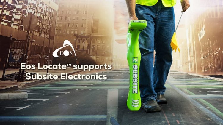
The expansion makes the Eos Locate™ for ArcGIS, an underground asset-mapping solution, compatible with Bluetooth-enabled Subsite UtiliGuard® and UtiliGuard 2 model utility locators, and introduces the ability to use Eos Locate for horizontal directional drilling with the Subsite TK® Recon HDD guidance system
SEPTEMBER 2020, MONTREAL, CANADA — Eos Positioning Systems (Eos), the Canadian manufacturer of the popular high-accuracy Arrow Series® GNSS receivers, has announced today the compatibility of its Eos Locate™ for ArcGIS underground-mapping solution with three Subsite Electronics products.
“We are extremely excited to expand this popular underground-mapping solution to Subsite Electronics customers,” Eos Chief Technology Officer Jean-Yves Lauture said. “Utilities have been asking us to add compatibility, and we are pleased to announce that this integration is now available today, for no extra cost, to our existing customers.”
First introduced in 2019, Eos Locate™ is the world’s first real-time, survey-grade solution for mapping underground utilities with ArcGIS field apps. The solution requires an Arrow GNSS receiver, Esri licensing, an iOS device, and a compatible locator. This expansion adds compatibility for two new utility locator models and one HDD guidance system: the UtiliGuard (with Bluetooth option enabled), UtiliGuard 2, and TK Recon.
“At Subsite, we are constantly listening to customer needs and providing solutions accordingly,” Subsite Electronics Senior Product Manager Christopher Thompson said. “We have a lot of customers who perform this type of work, and by partnering with Eos, we are able to provide a solution today to continue providing our customers with the tools and technology for total underground awareness.”
Thanks to the TK Recon integration, it is now possible for the first time ever to map horizontal directional drilling operations in real-time with Eos Locate™, for both performing as-built reports and monitoring.
To use Eos Locate™ with Subsite devices, customers must download Eos Tools Pro (version 1.89 and higher) from the App Store for free. Eos Locate™ is compatible with both Esri ArcGIS Collector and ArcGIS Field Maps. Follow this manual or these video tutorials to get started.
About Eos Positioning Systems, Inc. (Eos)
Eos Positioning Systems® is an award-winning Esri partner and the Canadian manufacturer of the popular Arrow Series® GNSS receivers. Arrow GNSS (GPS) receivers are specifically designed to bring state-of-the-art GPS technology to GIS-enabled field crews via any iOS, Android or Windows tablet, smartphone or computer. Arrow receivers include GPS, RTK, and full GNSS multi-constellation models for submeter, subfoot or centimeter options. All models are rugged, waterproof, dustproof and equipped with all-day, field-replaceable batteries.
Arrow receivers are designed to work seamlessly with Esri mobile apps (ArcGIS Collector, ArcGIS Survey123, ArcGIS QuickCapture, and ArcGIS Field Maps). In addition, Eos offers three free solutions exclusively for ArcGIS users, including Eos Locate for real-time underground asset mapping with centimeter precision, on-the-fly orthometric heights (geoid model conversions) for elevations, and laser offsets to map features located in GNSS-impaired or physically unsafe environments (e.g., a manhole in a street). Learn more at www.eos-gnss.com.
