
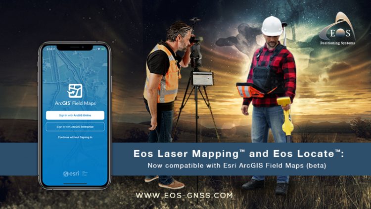
Eos Positioning Systems announces compatibility of Eos Laser Mapping™ and Eos Locate™ with Esri ArcGIS Field Maps (beta)
The August 2020 release of Eos Tools Pro version 1.89 makes Eos Locate™ for ArcGIS (underground mapping) and Eos Laser Mapping immediately available for use with the Field Maps beta
AUGUST 2020, MONTREAL, CANADA — Eos Positioning Systems (Eos), the Canadian manufacturer of the popular high-accuracy Arrow Series® GNSS receivers, has announced today the compatibility of two popular Eos field data-collection solutions with the Esri ArcGIS Field Maps beta.
Eos Locate™ for ArcGIS is the world’s first real-time, survey-grade solution for mapping underground utilities with ArcGIS field apps.
Eos Laser Mapping™ for ArcGIS is the world’s first laser-offset solution for mapping assets from afar with high accuracy, without having to physically occupy them.
“When Esri released the ArcGIS Field Maps beta, we saw the future of geospatial field data collection,” Eos Chief Technology Officer Jean-Yves Lauture said. “Customers currently using these two solutions with ArcGIS Collector may now choose to use them with Field Maps, without any extra work or cost.”
Customers transitioning to Field Maps from Collector will be able to take advantage of additional capabilities (e.g., smart forms, markups) without having to deploy new training or workflows, according to Esri Program Manager Doug Morgenthaler.
“It’s a seamless transition for folks who are using these workflows in Collector,” Morgenthaler said. “That to me is compelling. You can just install another app, enable the workflow, and go — just as you did with Collector.”
To use the solutions, customers must download the latest version of Eos Tools Pro (1.89 or higher) and join Esri’s Field Maps beta program.
About Eos Positioning Systems, Inc. (Eos)
Eos Positioning Systems® is an award-winning Esri partner and the Canadian manufacturer of the popular Arrow Series® GNSS receivers. Arrow GNSS (GPS) receivers are specifically designed to bring state-of-the-art GPS technology to GIS-enabled field crews via any iOS, Android or Windows tablet, smartphone or computer. Arrow receivers include GPS, RTK, and full GNSS multi-constellation models for submeter, subfoot or centimeter options. All models are rugged, waterproof, dustproof and equipped with all-day, field-replaceable batteries.
Arrow receivers are designed to work seamlessly with Esri mobile apps (ArcGIS Collector, ArcGIS Survey123, ArcGIS QuickCapture, and ArcGIS Field Maps). In addition, Eos offers three free solutions exclusively for ArcGIS users, including Eos Locate for real-time underground asset mapping with centimeter precision, on-the-fly orthometric heights (geoid model conversions) for elevations, and laser offsets to map features located in GNSS-impaired or physically unsafe environments (e.g., a manhole in a street). Learn more at www.eos-gnss.com
