
NavVis IndoorViewer 2.4: New Features Automatically Generate Highly Detailed Floorplans and Extend Routing Function
Munich, Germany – NavVis, the leading global provider of indoor spatial intelligence technology and solutions for enterprises, announces the release of NavVis IndoorViewer 2.4. This major software release includes an option to automatically generate highly detailed floorplans, enhanced routing capabilities, a new way to customize and view content and enterprise-ready security features.
NavVis IndoorViewer is a web-based application that combines realistic 3D visualization of buildings with a user-friendly interface and advanced functionality that lets users interact with and enrich scan data. Building scan data is displayed as fully immersive 360° images, point clouds and maps. The 360° image and point cloud views let users move through scanned spaces in 3D, while the map view provides a 2D overview of the scanned structure and its surroundings.
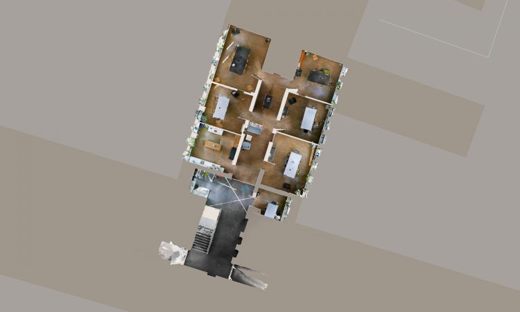
A previously released customization feature lets users upload floorplans that have been created using photo editing or CAD software to the 2D map view. With this latest release, it is now even faster and easier to create visually appealing digital floorplans. A new option in the map generation feature lets users automatically generate highly detailed, colored floorplans in just a few clicks.
“Our 3D visualization software, NavVis IndoorViewer, is disrupting the way indoor spatial intelligence is delivered by making the valuable data captured by 3D laser scanners available to every building stakeholder,” said Felix Reinshagen, NavVis CEO. “With this latest software release, we have updated features to make it even easier for laser scanning professionals to deliver a cutting-edge solution with every building scan project. One of the most exciting new features makes it possible for NavVis IndoorViewer users to automatically generate beautiful, highly detailed floorplans in just a few clicks.”
The routing function in NavVis IndoorViewer, which enables detailed, searchable routing between objects and locations within scanned structures, has also been enhanced. The addition of a path drawing tool enables users to draw routing paths anywhere within the 2D map view, including the unscanned areas surrounding the building datasets that appear on the map.
The release of NavVis IndoorViewer 2.4 includes many additional updates, including an option to set the default image for geo-tagged content and the introduction of enterprise-ready authentication and privacy features.
Find out more: https://www.navvis.com/blog/190606_product_update_indoorviewer_2.4
For a 30-day free trial, visit: www.navvis.com/indoorviewer
Video: Video: The routing function in NavVis IndoorViewer, including the new path drawing tool https://youtu.be/KvNssxk7_3o
About NavVis:
NavVis is the leading global provider of indoor spatial intelligence technology and solutions for enterprises, trusted by top companies including BMW, Daimler, Allianz, Lenovo and Deutsche Telekom.
NavVis helps enterprises drive efficiencies and optimize business performance through its powerful digital twin platform for the indoors that enables accurate mapping at unprecedented speed and scale, immersive 3D visualization designed for collaboration and location-based apps that pioneer AI-powered positioning technology.
Founded in 2013, NavVis is headquartered in Munich and has offices in New York and Shanghai. For more information, visit www.navvis.com.
