WinCan’s ESRI ArcGIS Integration Brings Enhanced GIS Capabilities to Sewer Inspection

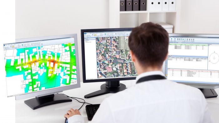
PITTSBURGH, PA —When integrated with ESRI’s ArcGIS platform, WinCan VX sewer assessment software allows users to navigate and analyze inspection data using a rich GIS (geographic information system) interface. With it, users can click map features to link to section and defect information, or they can click a tabular record in an inspection to jump immediately to its mapped location. With this bidirectional link between GIS and WinCan, inspections can be pre-populated with data residing in GIS (eliminating manual data entry) and GIS data can be updated with results once an inspection is complete. Beyond simply mapping data, the ArcGIS integration allows users to filter results, create reports, browse media and build heat maps according to defect type or severity. It also assists with workflow by allowing you to select regions, assign them to specific inspection crews and then monitor per-crew progress graphically with color-coded indication.
Although WinCan VX is available with its own native GIS implementation, most municipal customers in the U.S. have standardized on ArcGIS and seek to leverage that platform. In either case, users can navigate, annotate and edit maps using common tools; show/hide map layers; and export map data to a variety of common formats.
“Pipe inspection professionals want an effortless way to correlate inspection data with map locations,” says Mike Russin, Business Manager for WinCan in the Americas. “The ArcGIS integration offers a full-featured GIS front-end that makes navigating data simple and intuitive. Being able to visualize data in this way is essential to smart, efficient decision-making.”
WinCan is an ESRI Silver Business Partner and has ESRI experts on staff that can support both ESRI and WinCan.
About WinCan.
WinCan™ was the original pipe inspection and asset management software when it entered the market in 1990. Today, it’s the most trusted pipeline software brand worldwide thanks to continuous innovation and exceptional support. WinCan™ transforms raw inspection data into the intelligence municipalities and contractors need to make critical maintenance decisions. The software’s measurement tools help quantify defects, and sophisticated search capabilities filter observations by any combination of criteria. Its report generator automatically summarizes inspection findings using a standard or user-defined template. Native support for GIS mapping, side-scanning and 3D are among WinCan’s™ most innovative features.
WinCan™ pipe inspection and asset management software is supported and distributed in the Americas exclusively by WinCan LLC. As the only WinCan™-certified software consultancy, WinCan LLC is uniquely positioned to deliver support, training, customization and integration with all common municipal databases and mapping software programs. WinCan LLC works directly with end users, and also with inspection equipment manufacturers, helping them deliver integrated hardware/software solutions that allow their customers to document, analyze and report pipeline condition.


