
By Dustin Price, L.S.
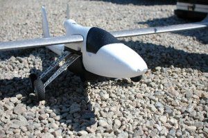
A successful development project begins with an accurate land survey, which is why it’s critical for organizations to capitalize on the latest in surveying technology. Unmanned aerial vehicles (UAVs), or drones, are one example of a new technology that’s delivering better results for land surveyors worldwide. Read on to learn the specific ways that adopting UAV surveying can help.
Cut Costs and Improve Efficiency
Traditional land-surveying methods take a lot of time and effort to achieve results. If a project covers a large area or includes rough terrain that surveyors would find difficult to traverse on land, then the situation is exacerbated.
A slow, time-consuming land-surveying process is much more than mere inconvenience. When an organization has to wait for surveying to finish before it can proceed with the actual project work, then timelines for the project to become a profitable investment get pushed back. In addition, more hours worked by a surveyor equals more money coming out of the developer’s pockets.
With these thoughts in mind, it’s no wonder so many developers are looking for a better way. With UAV surveying, companies can save money and time by completing survey work faster. UAVs can cover large areas of terrain in a relatively short period of time, and because they operate in the air, they can cover all terrain in the same amount of time, no matter how dense or difficult for humans to traverse. As a result, companies get the surveying data they need, turned around quickly, so the project can proceed with fewer interruptions.
Increase Accuracy and Provide Better Forecasting Models
The speed at which UAV surveying can be completed is important, but it’s the combination of speed with extreme accuracy that makes UAVs such a transformational technology.
Modern UAVs can be equipped with the latest in data-capturing technology, such as high-definition cameras that can create images with a resolution up to 1 centimeter per pixel. Such accuracy helps project managers make informed decisions they can feel confident about, lessening the potential for costly rework later in the project.
In addition, data captured by UAVs can help create highly accurate 3D models of the land in question. Today’s 3D modeling software gives project managers a risk-free way to test ideas and fully understand the potential consequences of decisions before they’re even made. Prior to construction, project managers can come up with a concrete plan that will maximize the potential for success.
Simplify the Monitoring Process
It’s important to remember that land isn’t static, particularly during a development project. Although the surveying work that occurs before a project starts certainly is important, developers also need to perform ongoing monitoring after the project begins to ensure complete visibility over the changes occurring on a worksite through time. This ensures that all project work is proceeding according to plan, and there are no complications that may interfere with the project’s safe and successful completion.
Traditional land-surveying methods often are unsatisfactory when it comes to monitoring. For example, they’re often disruptive to the work occurring on the ground, which makes them a source of delay and inefficiency. In turn, organizations may not conduct monitoring as often as they should.
On the other hand, because UAV surveying is quick and undisruptive, it represents an excellent choice for project managers who need to stay up to date on what’s happening on the ground

Dustin Price
Dustin Price is a licensed land surveyor and the Operations Manager at Landpoint. He leads the companies' technical approach to delivering professional surveying services by providing tailored solutions using UAV technology. To learn more about Landpoint, visit http://www.landpoint.net/.
Video: Crashes Drop Measurably After Rural Road Safety Improvement Project on US 521 in Lancaster County

AdventHealth Weaverville Hospital

June Issue 2026
.jpg?width=225)