
DRCOG Makes Infrastructure Data Free for Public Download
The Denver Regional Council of Governments (DRCOG) partnered with Denver Water, the Regional Transportation District and 21 cities and towns in Colorado to embark on an unprecedented and ambitious project to acquire detailed infrastructure information for the region. That data is now available for free, public download from DRCOG’s Regional Data Catalog.
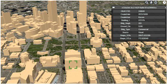
This specialty data (known collectively as “planimetric data”) consists of building outlines, sidewalks, parking lots and pavement information drawn through the interpretation of aerial imagery. Immediate uses include development of emergency response plans, pedestrian routing and sidewalk quality studies, developing building inventories, and impervious surface analysis. The data is crucial for urban planning professionals and those providing public services.
“We recently used the planimetric sidewalk data to identify which bus stops lacked pedestrian connectivity,” said Pat McLaughlin, formerly of the Regional Transportation District. “This data may play a big role in helping Denver address how and where to invest in sidewalk infrastructure.”
The planimetric data is valued at more than $750,000, which would be cost prohibitive for most of the region’s jurisdictions to acquire and maintain. Before DRCOG and its partners purchased the data, most planners used outdated information or none at all. DRCOG, through its aerial photography program, has more than a decade of leading regional collaboration to make big data projects happen — so in 2015, its data consortium decided to find a solution.
Not only was the planimetrics project successful in providing local governments with the data they need, but DRCOG and its partners shared the data in the public domain, inviting innovators and entrepreneurs to tap the resource. The data is already being used by the entrepreneurs behind Eyebot, Foodcaster and Regulation Explorer, mobile apps to aid the visually impaired, provide business intelligence for local restaurants and help locate oil and gas opportunities with the least negative effects to communities, respectively. Other emerging uses include 3D modeling, urban development scenario planning, and special district mapping.
“We have benefited greatly from the planimetrics sidewalk GIS data by providing our clients in the Denver metro region with more accurate walkshed information,” said Drew Parker, a transportation planner for HDR Inc., a local architecture and engineering consulting firm. “This is particularly important for the new RTD FasTracks stations because some are located in previously industrial or undeveloped areas.”
DRCOG would like to continue maintaining these datasets with help from community partners. Organizations interested in supporting this effort should contact DRCOG’s Information Systems Manager Ashley Summers at at 303-480-6746 or [email protected].
