The dynamic duo of AutoCAD Civil 3D and InfraWorks 360 are a powerful combination for improving workflow efficiency for civil infrastructure design. The editorial team at Informed Infrastructure recently completed a detailed benchmark study (www.v1-education.com) of the use of these tools in tandem, showing the time savings and workflows that several independent reviewers achieved on sample projects. Following is a summary of the top-five takeaways of improved workflow and insight when combining the tools from preliminary design phase through final project documentation.
1. Design in Context
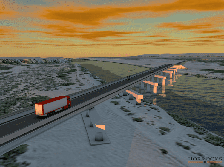
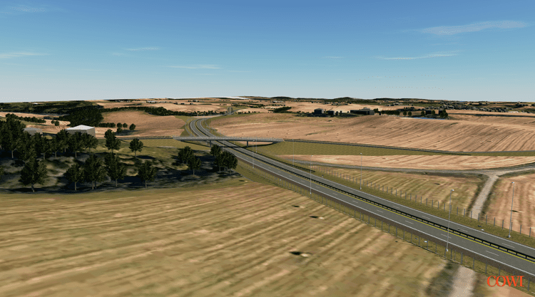
The InfraWorks 360 Model Builder provides quick connections to real-world data to help verify conditions and present projects in their context. This data repository greatly speeds the data-gathering phase to inform the design with real-world conditions from the outset.
The 3D view within the context of the project space proves an influential input for owners to more effectively communicate design intent and obtain initial approvals from key project stakeholders and the public. Using this rapid visualization capability during meetings helps keep progress moving forward as it speeds the time it takes to reach design consensus.
Designing in context from the start, and ending with a detailed model that can be shared, disrupts the prior workflows of starting in 2D design and then (if there was the budget) porting that design to other 3D software and often hiring 3D visualization experts for renderings and animations. Instead, the process is always 3D in InfraWorks 360, and the data can be shared back and forth with Civil 3D for its detailed design capability.
“Everything is changing with 3D modeling, the increasing power of our computers and the ability to have the models on our mobile devices,” says Chris Herrera, president and BIM strategist, Galt Design Group. “Having the ability to see something that’s in the model in context onsite is incredibly powerful.”
2. Time Savings
When combined with AutoCAD Civil 3D, InfraWorks 360 delivered significant time savings in planning, conceptual design and detailed design processes. Reviewers were able to quickly produce design models of the project’s existing conditions as well as high-quality visuals of the design in the context of the project’s real-world surroundings.
“Using InfraWorks 360 cut my preliminary design time almost in half,” says Heidi Boutwell, infrastructure content manager, CADLearning. “On top of that, I got an awesome 3D video I can show the client to sell them on this project.”
With AutoCAD Civil 3D, users have infinite control of such things as 3D road geometry where they can fine tune the profile, add detail to the cross section template, and provide additional grading at key drainage points along the road. Thanks to all the relationships that adjust on the fly, fine tuning can occur without having to go back and recreate the model for different design scenarios.
Using InfraWorks 360 in tandem with Civil 3D allows for quick conceptualization that can be fine tuned and enhanced as the design progresses.
3. Advanced Workflows
One key to the successful integration of these products is interoperable workflows between them. The ability to work on a design project, easily transitioning between the two products, ensures that each design benefits from the respective strengths of the two packages and is accessible to the whole team in their preferred design environment.
InfraWorks 360 provides many quick and accurate design capabilities along with great 3D graphics, but it’s not a documentation tool. InfraWorks 360 will save time and money in the preliminary stage of a project design, but to get that design to a city or county for review, users will need to bring that preliminary work into AutoCAD Civil 3D for detailed design. Civil 3D is the place to create plans and fine-tune design.
Keeping team members and stakeholders informed and involved throughout the design process is a key capability of InfraWorks 360. Earlier involvement and interaction with a model can yield significant project cost savings by speeding consensus and reducing change orders while also streamlining time to project approval.
4. Improved Communications
Capitalizing on the newest technologies can help to better understand and more efficiently construct infrastructure without having to abandon traditional processes. We now have the means to model, simulate and analyze to improve a design, and we can take those same models into the field to communicate the design in context. The model also can drive GPS-guided machine control, which ensures accuracy and reduces time and labor costs. Some are even using augmented reality and virtual-reality headsets to extend the ability to better understand how designs might be experienced after they are built.
As the industry embraces model-based design and BIM workflows for civil infrastructure, there will be a time of transition. The legacy paper-based processes impede innovative design workflows. Further advancements will require a complete break from these old workflows. AutoCAD Civil 3D provides a bridge to navigate BIM workflows by allowing users to work in both 2D and 3D.
5. Improved Project Outcomes
InfraWorks 360 includes rules-based design with integrated analytics to aid the design process for civil infrastructure, enabling teams to evaluate more options. More-automated tools for analysis and simulation is a paradigm shift that introduces a completely new approach to designing civil infrastructure that streamlines, automates or reinvents traditional design processes. New capabilities that harness the cloud for processing power, storage and sharing are aiding this shift.
InfraWorks 360 adds the ability to access data about the project site and explore or assess design alternatives early in the process. InfraWorks 360 includes tools for roadway, drainage and bridge design that incorporate standards that drive design and streamline the preliminary engineering process.
“It’s great to have all the standards built into InfraWorks 360,” adds Herrera. “As you’re developing a roadway, you’re developing it per the AASHTO standard or some other standard that you can adjust. You can do the layout, get some preliminary earthwork, length and basic information on the road, and start working with it immediately with the people who are going to be involved.”
The combination of easier 3D modeling with standards-based design gets the industry much closer to the promise of true BIM workflows.
Read the full benchmark at v1-education.com for one AIA-accredited PDH credit. Join us us for a live webcast on the combined toolset on July 27 at 1 p.m. EDT for another PDH credit. Learn more about InfraWorks 360 at www.autodesk.com/infraworks.

Todd Danielson
Todd Danielson has been in trade technology media for more than 20 years, now the editorial director for V1 Media and all of its publications: Informed Infrastructure, Earth Imaging Journal, Sensors & Systems and Asian Surveying & Mapping.
Video: New Roundabout Under Construction at McIver and Old Florence Roads in Darlington County

K2b Cantonal Highway
June Issue 2026
.jpg?width=225)