
Reality Computing Goes Underground with Ground Penetrating Radar
Ground penetrating radar (GPR) is a non-destructive method for locating and mapping underground objects by transmitting high-frequency radio signals into the ground that bounce back when they hit a buried object or a boundary between different material types. GPR surveys were first used in 1929 to measure the depth of a glacier in Austria and, in the following decades, likewise used to map the thickness of ice sheets and glaciers. In the 1970s, people started to use GPR for applications not involving ice.
Today, GPR is used for a wide variety of underground applications. These include studying groundwater, bedrock, and soils. Mapping remediation sites, archaeological features, and cemeteries. Detecting mines and unexploded ordnance. Locating buried evidence. Even prospecting for gold and diamonds! For all of these applications, Reality Computing plays a part—helping teams using GPR to capture existing conditions underground and developing a digital map of that underground area.
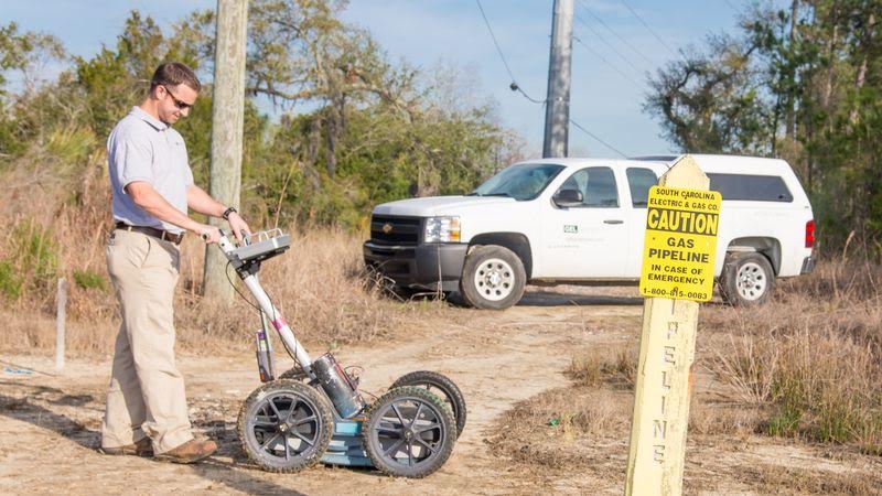
Another very common use of GPR today is the location of underground utilities. Unlike less expensive electromagnetic (EM) tools that can only detect metallic utilities, GPR can detect commonly used, non-metallic materials such as plastic conduits and concrete storm & sanitary sewers.
For example, South Carolina-based GEL Geophysics used GPR and Reality Computing last year to carry out underground utility surveys in preparation for two separate construction projects planned for the downtown Charleston area: the expansion of the Gaillard Municipal Auditorium and drainage improvements adjacent to the central energy plant for Medical University of South Carolina (MUSC).
Construction in historic Charleston is always challenging due to underground infrastructure congestion, and the fact that some utilities in this area were developed over 200 years ago. GEL’s subsurface utility engineering investigation for these projects provided reliable data on the exact location of underground utilities—helping its clients coordinate new designs with existing infrastructure and avoid unexpected issues during construction. Final deliverables included detailed 2D drawings and 3D project visualizations of all detectable buried infrastructure and obstructions in the area.
Gaillard Municipal Auditorium: The city is improving this auditorium complex by renovating the existing exhibition hall, adding a new banquet hall and performance hall, and constructing a new building for municipal offices. The project site encompasses an entire city block and requires infrastructure upgrades to and around the site, including the underground utilities beneath Alexander Street, one of the streets bounding the project.
MUSC plant: Greater Charleston’s water utility is planning some drainage improvements adjacent to the MUSC’s central energy plant (on Bee Street), including the design of a drop shaft for storm water distribution to the utility’s storm water drainage tunnel.
To support design efforts on both of these projects, GEL used GPR technology, Reality Computing, and Autodesk software to map the buried infrastructure.
During the investigations, the firm used GPR systems as well as EM pipe and cable locators to capture and record depths along the utilities at specific intervals. This reality-captured data was imported into Civil 3D software to create 3D models of the underground features, as well as conventional 2D drawings. In addition, the firm used InfraWorks to create 3D visualizations and animations exposing all the utilities buried under the streets in the context of the surrounding cityscape, complete with correct depths and pipe sizes. These visualizations helped some project stakeholders, who may have found it difficult to get a complete visual picture of the situation from 2D plans and sections, get a better understanding of expected construction challenges posed by the existing infrastructure.
GEL’s underground surveys help its utility clients and their contractors better plan trenching and construction efforts. By virtually exposing previously unknown utility conflicts, Reality Computing and GPR help projects to be completed without costly relocation of existing utilities or unexpected field delays.
See this video for an animation of underground infrastructure using Autodesk InfraWorks:
Reality Computing using GPR technology is frequently used for subsurface utility engineering.
Image courtesy of GEL Geophysics.
