
Kindle Collaboration via LiDAR-Based 3-D Smart City Models
A smart city model allows many important stakeholders, including government officials, citizens and the private sector, to easily access critical infrastructure information. But most city departments, agencies and utilities have separate processes in place for long-term planning, updates and expansion as well as to support economic development–from permitting to call-before-you-dig to environmental programs and more.
Each entity has different types of information that need to be available or considered; systems where data are stored; and methodologies for gathering, storing or accessing such data. And each likely has its own redundant processes to gather and store data. This creates duplication of effort as well as duplicate information.
Each group has to gather and use different bits of information (e.g., GPS, LiDAR, asset information, etc.). From emergency response to transportation departments to facilities managers to utilities and more–they’re likely not working in tandem. Each gathers different bits of information at different times throughout the year to support individual needs, and each has information that wouldn’t align 100 percent to the other groups.
But it’s important for these groups to collaborate and communicate–in times of crisis as well as throughout the year.
Tackling the Transformation
Imagine a group of agencies that need a better way to collaborate via a model that’s intelligent and accessible by many groups, and used for many purposes. Components of this intelligent model can be used to communicate with citizens as well as the private sector. Not all data need to be accessible by everyone, but existing mechanisms should allow the least-technical end user to understand and collaborate.
Collecting data is one of the first steps in building an intelligent “Smart City” model, and they’re acquired in several different ways and formats (e.g., conventional surveying, cadastral, GPS, LiDAR, aerial, drone, etc.). This article focuses on different types of LiDAR that can be used for modeling and supporting building information modeling (BIM) and civil information modeling (CIM) workflows that add value to client projects–whether a city, other government agency or the private sector. You’ll want to help clients maintain a strong, sustainable lifecycle for LiDAR data as well as the resulting models.
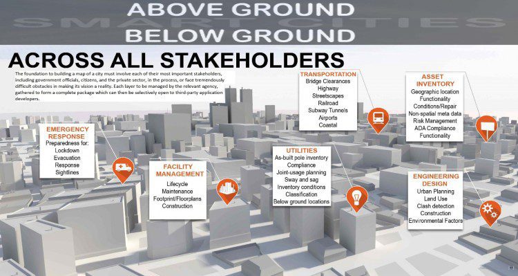
It’s critical to understand above- and below-ground data and their associated data owners. Building a city map must involve each of the important stakeholders, with each layer managed by the relevant agency and then compiled into a complete package that can be made available to third-party application developers. CREDIT: Terrametrix
Reality Capture
An obvious reason to use reality capture is the current state of infrastructure: North America’s grade from the American Society of Civil Engineers (ASCE) for the last 5-10 years is a “D.”
According to the ASCE Report Card for America’s Infrastructure for Roads, “Forty-two percent of America’s major urban highways remain congested, costing the economy an estimated $101 billion in wasted time and fuel annually. While the conditions have improved in the near term, and federal, state, and local capital investments increased to $91 billion annually, that level of investment is insufficient and still projected to result in a decline in conditions and performance in the long term. Currently, the Federal Highway Administration estimates that $170 billion in capital investment would be needed on an annual basis to significantly improve conditions and performance.”
And that comment is just about roads and bridges. The current state for the rest of our infrastructure also is a “D.” So capturing existing conditions is the first step in understanding what you have (i.e., the asset’s current state), what needs to change and what are the effects of that change on the surrounding environment.
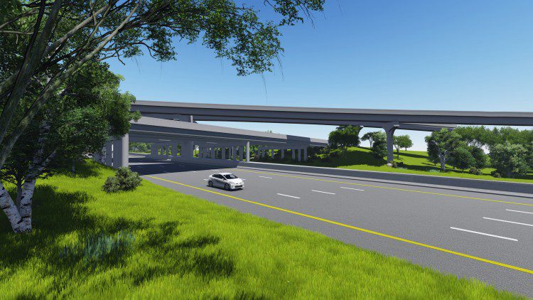
Terrestrial Mobile LiDAR Scanning (TMLS) is a data-collection method to achieve a topographic survey about the land’s natural and man-made features as well as its elevations to prepare a 3-D map. TMLS can cut the processing time that would traditionally take weeks down to just minutes at survey-grade accuracy. This includes the following:
- Establishing horizontal and vertical control to serve as the survey framework.
- Determining horizontal location and elevation of ground points.
- Locating natural and man-made features.
- Computing distances, angles and elevations.
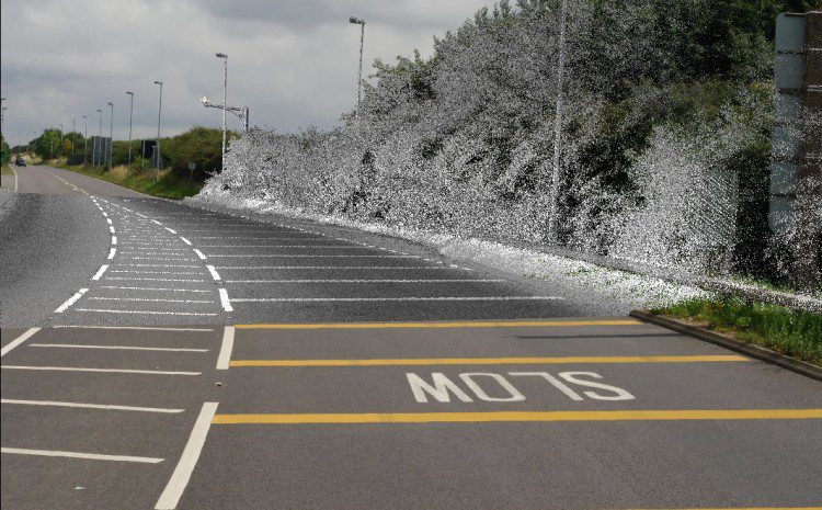
TMLS is used to capture existing roadway conditions and create 3-D maps. CREDIT: CALTROP
Collecting TMLS is a cost-effective and safe way for surveyors and engineers to receive survey/engineering-grade as-built data collection of roadways, railroads, airports and streetscapes. The accompanying images show field data collected of the I-35 Olathe and TranSystems in Kansas as well as 3-D mobile LiDAR data acquisition to provide a complete topographic survey. The project scope was more than 14.8 miles of I-35, K10 and I-435; 13 miles of ramps; and 8.25 miles of side streets.
The 2.4-mile section of I-35 is one of the most congested in Johnston County, Kan., with more than 112,000 vehicles per day. Using mobile LiDAR scanning, traffic can flow at its natural pace with no lane closures.
After the field LiDAR data are collected and processed to bring the data into Autodesk ReCap Pro, they then were registered for use to build planimetrics and create a 3-D model of all roadway features and the cityscape with a much greater level of accuracy.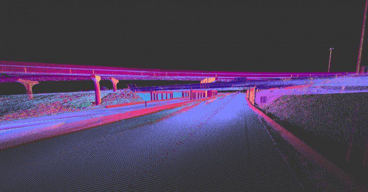
LiDAR scan data (above) provide the input for 3-D modeling and rendering, which was created in Autodesk InfraWorks. Credit: CALTROP
Reality capture also allows people to view a site in real time and space to examine the constitution or structure methodically and in detail for explanation and interpretation. The environment and site conditions are brought to the office so the design team can work more efficiently in the proper context. A small project can be LiDAR scanned in a couple hours in the field, and then downloaded and registered in the office for myriad uses (depending on the end deliverable based on client need) in less than two days.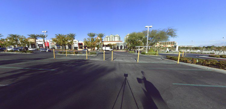
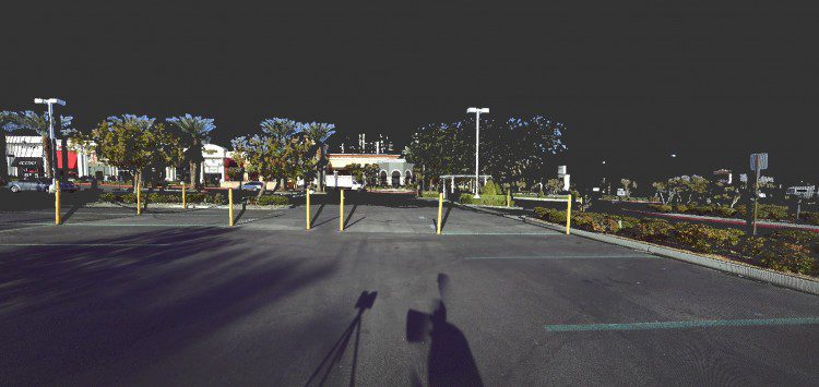
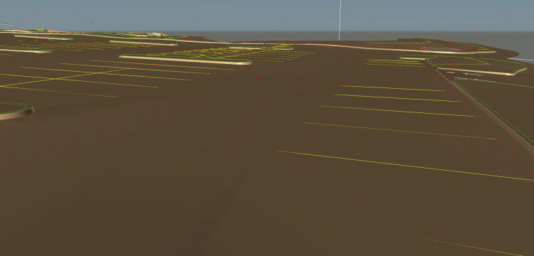
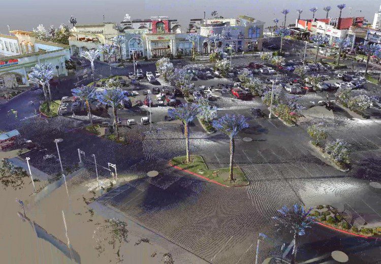
Each project requires data capture, ranging from a real-world photograph of the Boca Park Fashion Village in Las Vegas (top) to a LiDAR point-cloud scan with RGB values (middle) to a 3-D as-built site survey for civil engineering design (bottom). Credit: CALTROP
Piecing the Puzzle Together
Creating a LiDAR model is like connecting the pieces of a very complex puzzle, including all the existing conditions, data formats and systems to process. A 3-D LiDAR scan is a robust survey instrument that collects millions of points, and then groups them into a point cloud. Every one of the points is assigned an X, Y and Z value, which allows for precise measurements between points.
The most important element of data collection is providing a useful source of sustainable data that can be updated and reused multiple times. The benefit of LiDAR point-cloud scanning over traditional surveying methods is the massive amount of detail collected in a short period of time with a high degree of accuracy.
Using LiDAR for data collection helps create a more-intelligent model that can be shared with additional stakeholders. Also, if a client has additional projects in the same area, they can save time and/or money, because they don’t need to scan the same area again. They can use existing-conditions information, and share it with other city departments and agencies to support improved collaboration.
A smarter model can provide advanced technologies for modeling and collaboration, greater accuracy, minimized risk, accelerated schedules or activities, and mutual benefit to multiple parties.
https://youtu.be/U1imQxa2A80
About Keith Warren
Keith Warren is senior program manager at CALTROP, with 28 years’ experience with a variety of AEC projects that include Subsurface Utility Engineering (SUE), SMART City Modeling, Civil Engineering Modeling (CIM), public works, virtual design and construction.
