

Berlin, Germany - Pix4D is pleased to announce that it has been awarded a competitive tender for Deutsche Bahn to provide solutions and services for upcoming railway infrastructure projects through the analysis and visualization of drone images. Pix4D will…
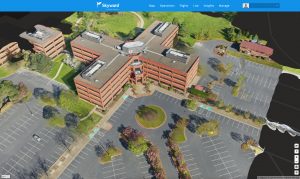
Skyward, A Verizon company introduces mapping and modeling powered by Pix4D
Skyward Mapping & Modeling, powered by Pix4D, enables customers to create, view, measure, and export 2D orthomosaic maps and 3D photogrammetric models…

Pix4D launches new ground image capture app for 3D modeling with the iPad Pro and iPhone 12 Pro
Lausanne, Switzerland, [November 10, 2020]: Pix4D, the photogrammetry industry leader, announces today the release of a new app product for ground images…

A Novel Solution for 3D Mapping Construction Sites: Put a Camera on a Crane
After making its name on the drone photogrammetry market, Pix4D is working its way into solutions designed specifically for construction–and some of those solutions are very creative. First, some background: Pix4D offers a BIM solution built on existing…
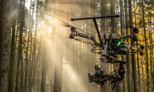
Vertical Images: From Film Making to Inspection, and Why the Future of Drones Doesn’t Lie in Flying
Successful drone entrepreneur Petr Lněnička went from award-winning filmmaker to drone inspection leader in his native Czech Republic. Here he lays out 3 pieces of advice and explains why for him, the transition seemed logical, and why he believes the future…
