

Cupix Expands BIM/VDC Leadership by Integrating with Autodesk, Autodesk’s PlanGrid and Hires Industry Veteran as Head of BIM/VDC Strategy Cupix, the fast-growth pioneer of cutting-edge 3D digital twin solutions for the architecture, engineering and…
Sprayroq Defines Infrastructure Rehabilitation Strength in Recent Academic Study
BIRMINGHAM, AL. July 27, 2021 Spraywall, the only proven and structural high-build polyurethane lining on the market, developed and manufactured by Sprayroq,…

SPH Engineering announces the update of UgCS for UAV-based LIDAR mapping
Riga, Latvia - SPH Engineering announces the release of UgCS update, introducing LIDAR toolset to unlock the full potential of LIDARs making remote sensing…

PERI Formwork Systems, Inc., Upgrades QuickSolve, Empowers Contractors with Even More Powerful Online Planning Tool
Enhanced Web-Based Platform Streamlines Data Capture, Provides Greater Functionality ELKRIDGE, MD (July 20, 2021) – PERI Formwork Systems, Inc., one of the leading manufacturers and suppliers of formwork and scaffolding systems for today’s construction…

HDR Expands Capabilities of its Proprietary Zero Emissions Fleet Optimization and Feasibility Modeling Tool
OMAHA, Neb. — HDR has upgraded its proprietary Zero+ Fleet Optimization and Feasibility Modeling Tool to evaluate all manner of fleets more precisely. The upgraded tool will better serve fleet owners making zero emissions transitions, with detailed analysis…
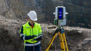
Maptek consolidates on field benefits for high accuracy survey-grade sensors
A new dual-window scanner that halves data capture time headlines the latest Maptek mine measurement improvements. The exciting new Maptek XR3-D mkII laser scanner with dual window arrangement cuts scan acquisition time in half. Conventional terrestrial laser…
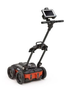
GSSI to Highlight UtilityScan® Compact Unit at Underground Construction Technology 2021
GSSI, the world’s leading manufacturer of ground penetrating radar (GPR) equipment, will be showcasing its compact UtilityScan® GPR system at Underground Construction Technology International Conference & Exhibition (UCT) 2021, to be held July 13-15,…
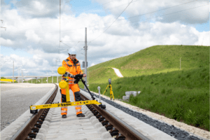
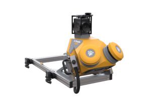
New Trimble GEDO GX50 Laser Scanning System Introduced for Clearance Analysis and Asset Data Collection for Railway Applications
Innovative and Flexible Laser Scanning Solution Designed to Assist Railway Track Surveying Professionals SUNNYVALE, Calif. — Trimble (NASDAQ: TRMB) introduced today the Trimble® GEDO GX50, a flexible laser scanning system designed to operate with Trimble…
Trimble MX50 LiDAR System Expands Mobile Mapping Portfolio
Vehicle-Mounted System Enables Data Capture for Road Agencies and Local Governments SUNNYVALE, Calif.— Trimble (NASDAQ: TRMB) introduced today the Trimble® MX50 mobile mapping system for asset management and mapping—a new addition to its established…

CompassCom releases CompassTrac v7.8 and becomes an approved Esri ArcGIS Marketplace provider
DENVER, CO – July 13, 2021 – CompassCom Software Corp., a leading provider of real-time fleet tracking and management solutions is pleased to announce the immediate availability of version 7.8 of CompassTrac® as well as becoming an approved Esri ArcGIS…
