
ITD Enhances Maps to Ramp up ADA Program
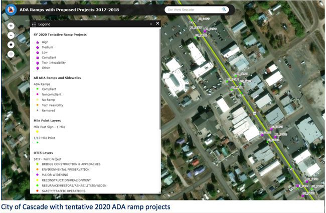
The Idaho Transportation Department recently enhanced the mapping tools used for the Americans with Disability Act (ADA) Curb and Ramp Program, allowing communities in Idaho to more accurately and quickly apply for funds to enhance the mobility of disabled citizens. The new tools also help ITD track program compliance among program participants.
Here’s a link to the new tool: http://iplan.maps.arcgis.com/apps/webappviewer/index.html?id=8aa8b21f61d5421a812c46d25f1b5407
“We started by listening…we needed to have a greater understanding of how local project sponsors are using this program and we wanted our local project sponsors to have greater understanding of how to be successful using the ADA grant program,” explained ITD ADA Curb and Ramp program manager Ryan McDaniel. “We designed a model where users within ITD and within the organizations seeking the grants, can see the exact location, the exact same way, with relevant attributes, within three mouse clicks.”
The result is a significant customer-service improvement. For example, when on the phone discussing a specific project, both ITD and local project sponsors can see the site from the same point of view and use advanced tools to review alternatives when scoping the project. The map simply offers more tools to project sponsors and districts.
